
Yesterday’s Weather
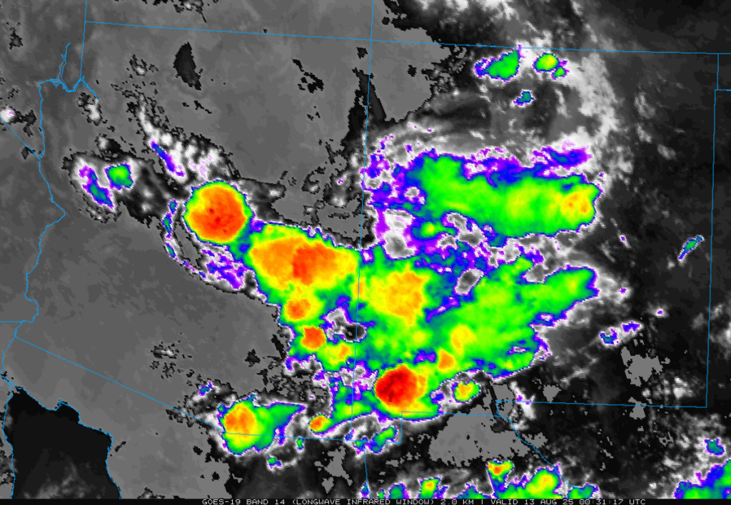
Yet another impressively large Mesoscale Convective Complex (MCC) developed last night in Sonora; a little further south than the one on Monday night.
Otherwise only isolated storms were across the sky islands of southeast Arizona and western New Mexico and some storms were along the Mogollon Rim extending west to south of Kingman and Prescott. The stronger storm south of Prescott weakened and moved southwest near Wickenburg and almost making it to I-10 halfway between Phoenix and the Arizona/California border this morning.
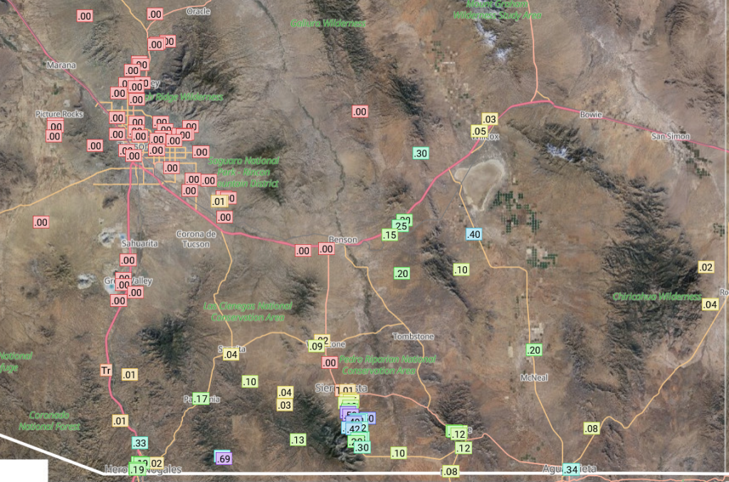
The HRRR-UA WRF 12Z forecast from yesterday missed some of the 0.5″ totals in Gila/Coconino/Graham counties, though complex terrain is where the radar data going into MRMS has the greatest reduction in accuracy. The spatial pattern was generally correct thought, especially in New Mexico.

Rainlog data for yesterday had water in the rain buckets in Cochise County as well as the Nogales area. Tucson remained dry.
Analysis
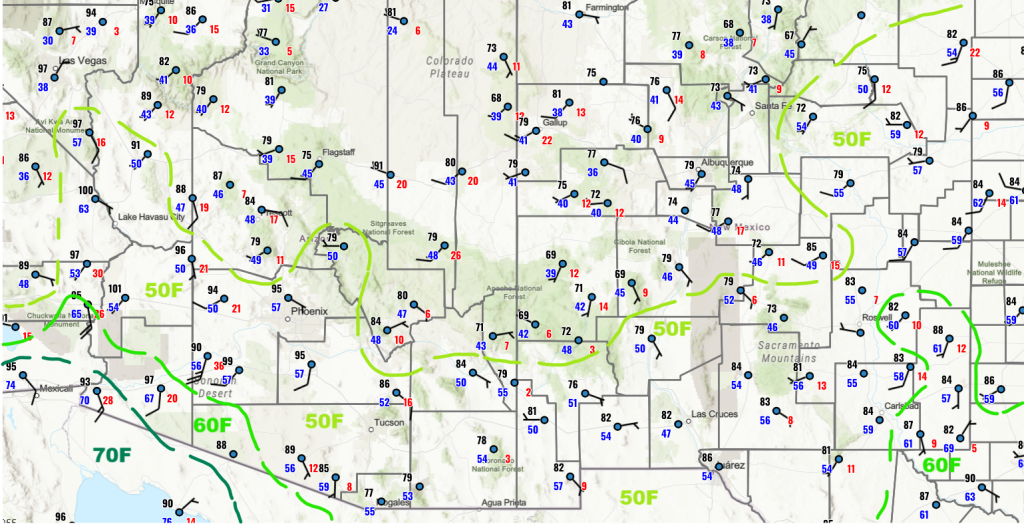
The surface observations below show the 50°F dewpoint temperature line has not changed much since yesterday. A minor surge is along the Colorado River from Yuma up to Blythe and this is most likely from the thunderstorm complex in Mexico last night.
The observed sounding for Phoenix at 5am has westerlies above 300mb with a northeast to east flow down to the boundary layer with light westerly winds below that. Precipitable water is up just a tad from yesterday and the layer between 750mb and 575mb shows a moisture increase. Convective inhibition (CIN) has increased due to some warming aloft.

The position of the tropical upper tropospheric troughs (TUTT) and the trough axis are shown below.

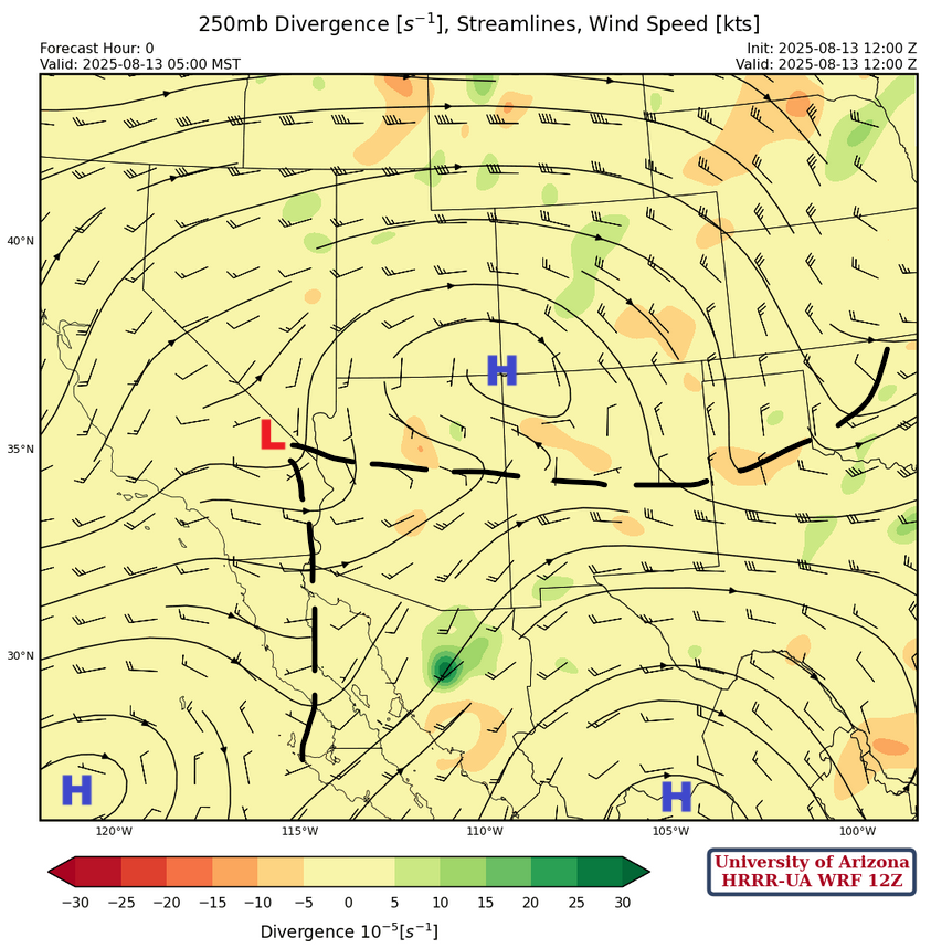
There’s quite a complicated pattern at 250mb with three high pressure ridge centers and a couple of trough axis between them as indicated on the forecast initialization below.
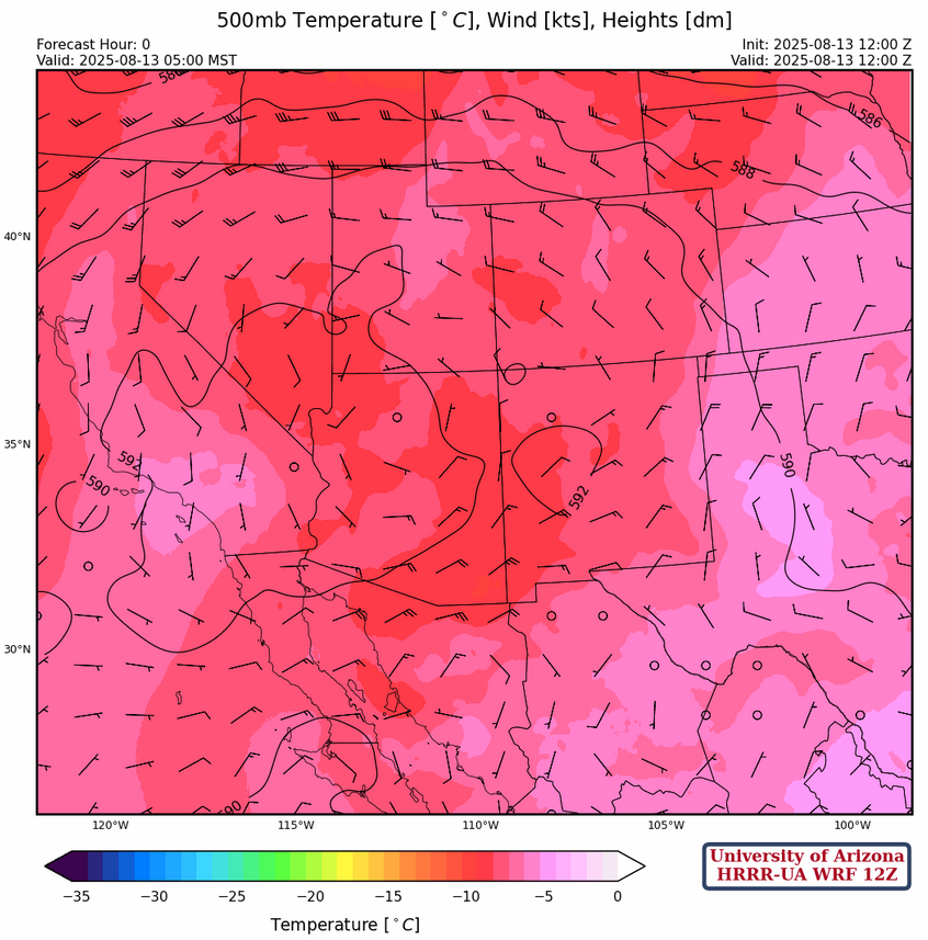
At 500mb, winds across southeast Arizona are light and variable and increasing from the south at 10 to 15 mph in northern Arizona. The center of the 500mb ridge is over the Colorado/New Mexico border with southeast flow across New Mexico. Temperatures were –9°C at both Flagstaff and Phoenix this morning which is colder than normal, and a good convective environment.
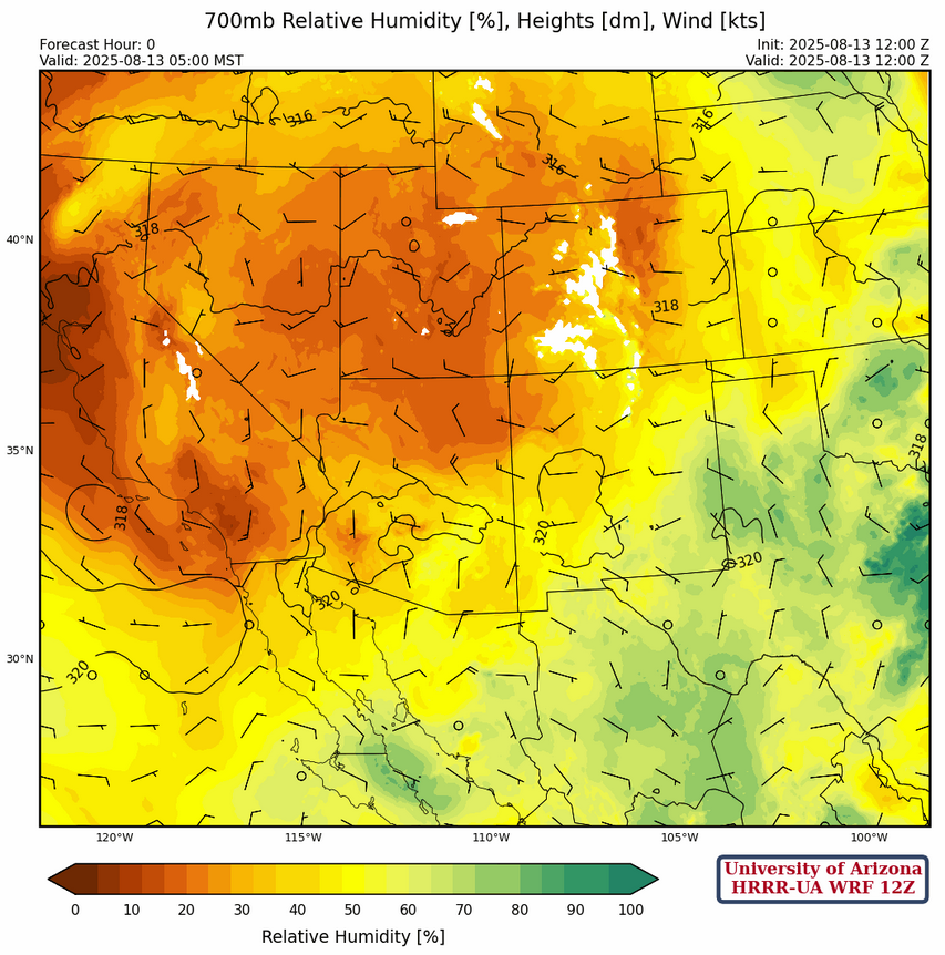
No significant change from yesterday at 700mb, except for westerly flow in New Mexico. Monsoonal deep easterlies are showing up again in Mexico and should strengthen over the next few days.
Today
The forecast soundings for Tucson (left) and Phoenix (right) are remarkably similar except storms forming in the Tucson area can move off the elevation to the west, because of the easterly winds above the boundary layer.

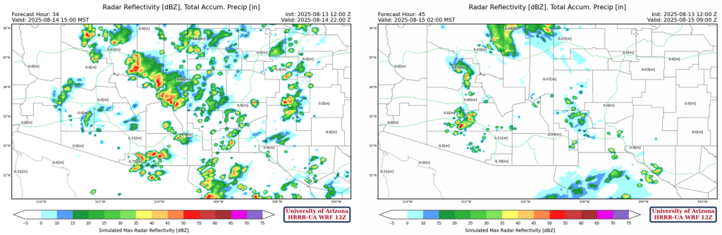
Tucson may get some localized heavy rain in the valley during the early evening. Outflows from storms coming off the Mogollon Rim and the higher elevation at the international border are forecast to converge along I-10 between Tucson and Phoenix between 8 and 9pm. This could cause significant hazards along the interstate including blowing dust and localized heavy rain.
The Convective Available Potential Energy (CAPE) that remains above the boundary layer in Phoenix will be used later in the night as an Mesoscale Convective Vortex (MCV) will develop overnight as a result of the afternoon convection, and move northward towards Phoenix.

Vertical motion ahead of this circulation provides the lifting mechanism for night time convection.
Tomorrow
The HRRR-UA WRF 12Z forecast irradiance for tomorrow at 10am shows cloud cover in Arizona and this will limit the heating in the atmosphere in the low desert areas and thus fewer storms.

Outside of the area with the cloud cover in the morning, storms will start on the Sky Islands across both Arizona and New Mexico. Some overnight storms will be near Phoenix around 2am (below, right).
Outlook
Models forecast a strong surge of moisture up the Gulf of California on Friday morning will help trigger an additional outbreak of storms both Friday and Saturday.


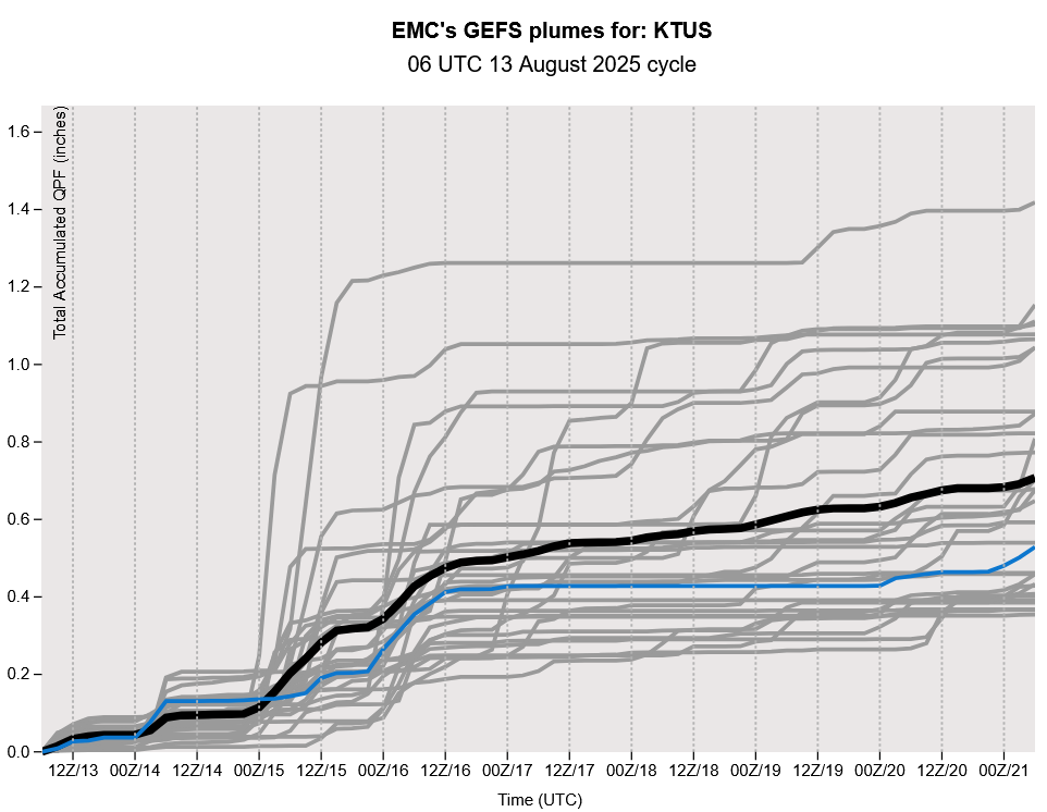
Finally, GEFS plume forecasts continue to imply we will be in an active monsoon period for the next week.
Discussion written by Pat Holbrook and Patrick Bunn