
Yesterday’s Weather
Yesterday’s precipitation in Arizona was caused by two main features; a Mesoscale Convective Vortex (MCV) moving from Pima, to Maricopa, then La Paz counties and then terrain forced convection on the Mogollon Rim/Flagstaff area.
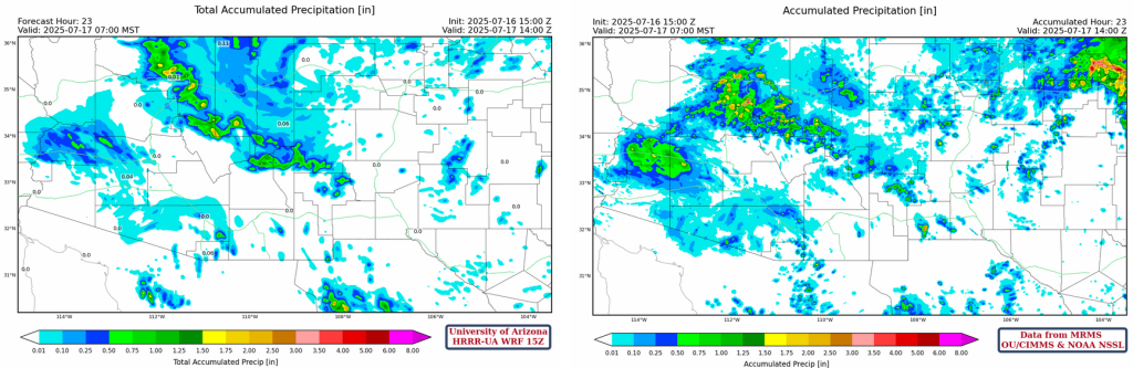
The MCV in central Pima county moved into western Pima county not before resulting in more light precipitation in its wake, especially in the early morning hours. As it moved west, precipitation weakened until the evening when precipitation increased again from Buckeye west to the Arizona/Colorado border.
The second area of storms moved west into Flagstaff and the Prescott Valley and merged with the precipitation area from the MCV. A frontal zone in northeast New Mexico initiated strong storms there, otherwise the rest of New Mexico had isolated storms. The rain cooled areas of southeast Arizona saw only a few mountain storms in the afternoon.
Analysis
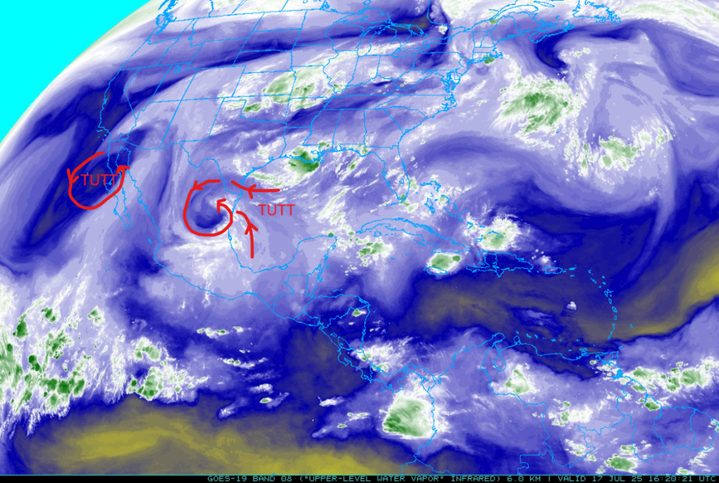
One of the tropical upper tropospheric troughs (TUTT) influencing our situation has moved southwest north of Mexico City. While the other TUTT is drifting slowly north off the west coast of Baja.
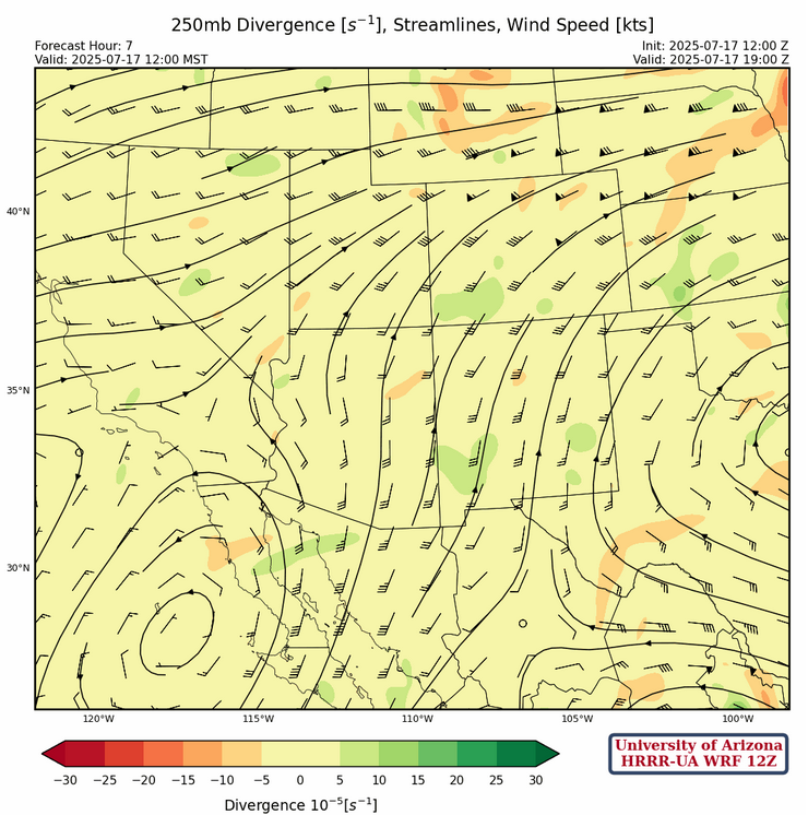
At 250mb, the high pressure ridge is centered over eastern Louisiana, and ridge axis extends west to El Paso and east off the Carolina Coast. This puts southern Arizona and New Mexico in southerly flow at 10 to 15 mph increasing to 30 mph along the Arizona/Utah border. A broad area of divergence is associated with the increased winds from northwest Arizona eastward to southern Kansas.
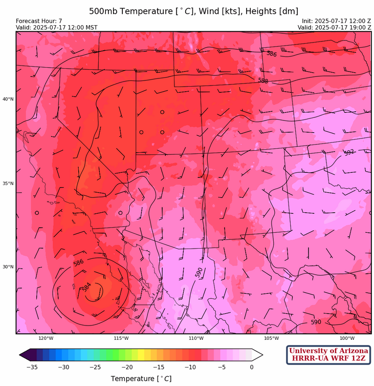
The upper low at 500mb is still off the spur of the Baja and is moving north with southerly winds and warm air advection occurring over the eastern half of Arizona.
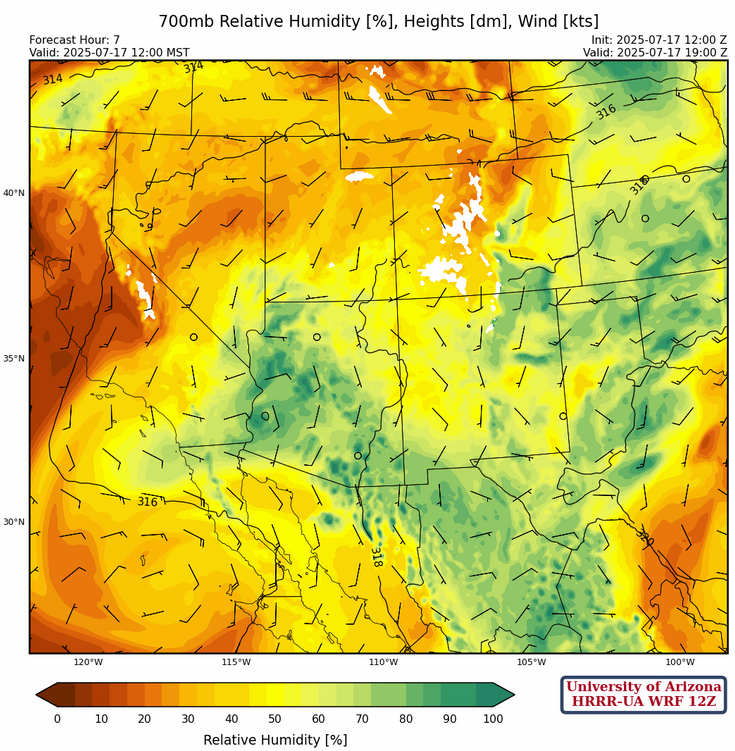
At 700mb, moisture continues to circulate around the low over the Pacific south of San Diego. The best moisture is over northwest Arizona extending eastward into northern New Mexico. Dry air is moving north from western Mexico and is along the international border from Nogales west to Yuma. Higher moisture values from the spine of the Sierra Madre’s is poised to move northward into eastern Arizona.
Today
Model forecast are showing a down day across the state as warm air aloft pushes into the state from the south around the upper low off the Baja Peninsula. The MCV in western Arizona does help storms in far northwest Arizona, but otherwise there’s only isolated mountain storms over the rest of Arizona forecast. In New Mexico, an uptick in storms today in the northern and central portion of the state especially in the eastern portion associated with the weak front in that area.
Tomorrow
Moisture increases in the eastern third of Arizona with an increase threat of thunderstorm from Globe to Nogales and east into New Mexico. The forecast soundings below are for Tucson this afternoon at 2pm (left) versus tomorrow afternoon (right).
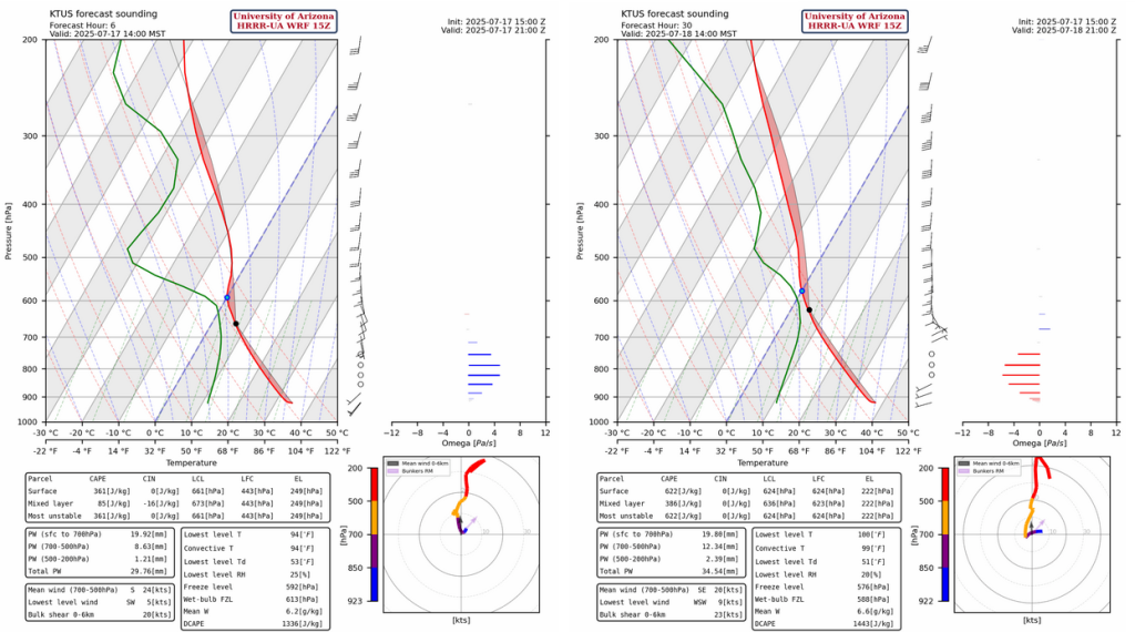
Today the warm/dry air at 500mb will mean cloud tops will only get to 600mb which is above freezing, so no significant precipitation can be made. Whereas, tomorrow the cooling at 500mb and above will allow storms to grow vertically. The only drawback is the southerly wind flow aloft will push anvils northward at a faster speed than the storms making it hard to get storms in the valleys due to anvil shading cooling the near surface. The simulated radar reflectivity below shows higher reflectivity on the mountains, while the light green is associated with the anvils. Any radar reflections less than 35-40 dBZ show cloud liquid water that won’t hit the ground.

Outlook
There is better news in the forecast for Saturday. The soundings below are for Saturday afternoon. The 2pm forecast sounding (left) looks similar to Friday except for a few features. First, the winds above 400mb have weakened. Second, the winds below 500mb will be around 5 knots. This type of profile will allow storms to get into the valleys.

Saturday the weak winds in the lower layers will allow storms to move into the valleys.

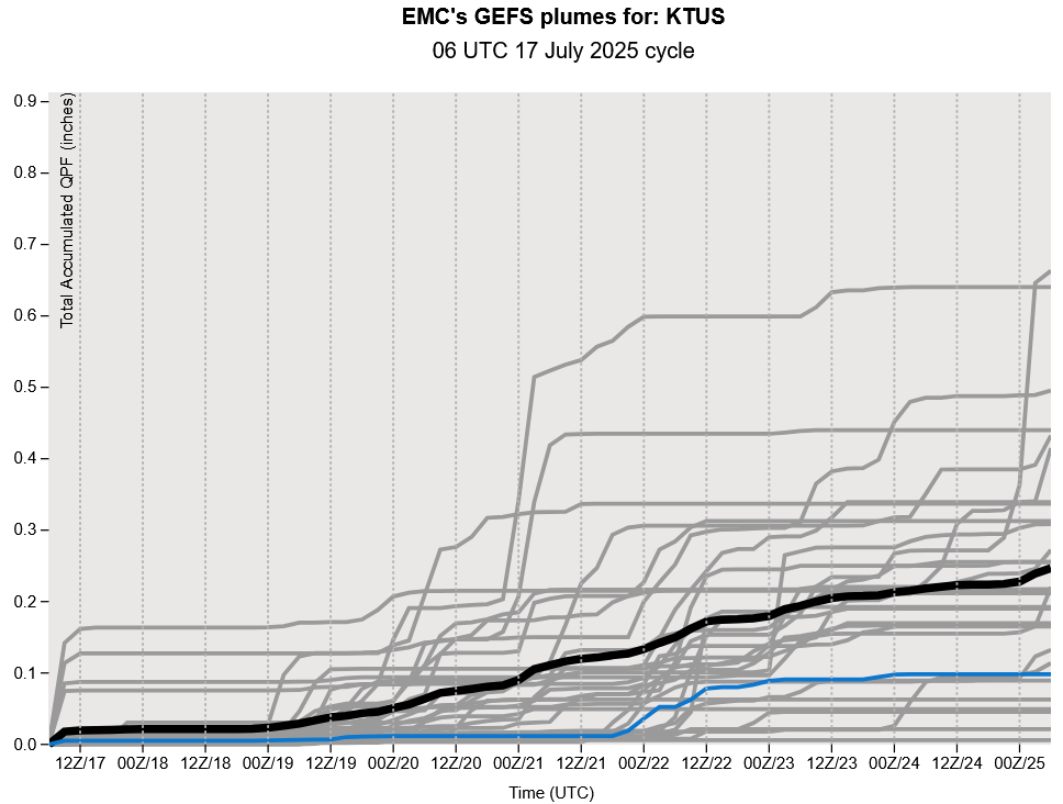
The GEFS plume forecasts for Tucson show good chances of about two rounds of thunderstorms over the next week.
Discussion written by Pat Holbrook and Patrick Bunn