
Yesterday’s Weather
The visible satellite with lightning overlaid shows the thunderstorms that developed with the surge from northern Baja east to Nogales and just south of Douglas. Other isolated storms extended from Cochise County northward to the White Mountains then east across the northern half of New Mexico. Ivo move west and will run into cooler waters in the Pacific and weaken considerably, but surge moisture from Ivo moved into Arizona in the evening.
The HRRR-UA WRF 12Z forecast from yesterday did well on the timing and location of storms in New Mexico and Santa Cruz county and southern Pima County in the afternoon. It did also capture the night time storms in Tucson metro, but they weren’t as intense as forecast and didn’t push northward to Phoenix or extend into the Tohono O’odham Nation and over the international boarder.
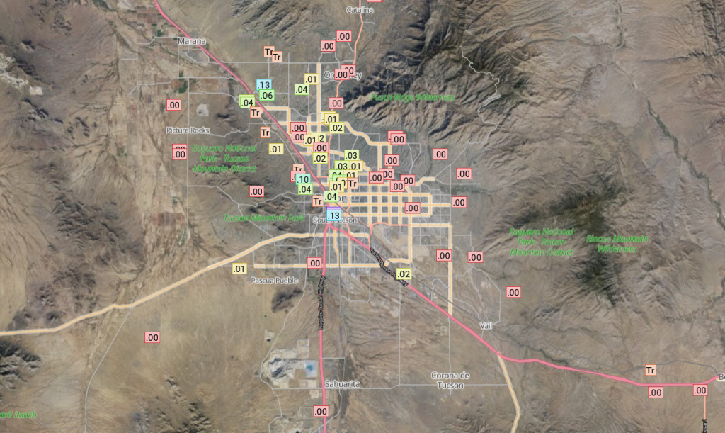
The observed (right) 24-hour accumulated precipitation totals look close to what was forecast (left), despite the forecast misses noted above.

Rainlog.org shows Tucson did get some measurable rain in the early hours of the morning (3-4am on sky cam images), though only about 0.1″ down to trace amounts.
Analysis
Three tropical upper tropospheric troughs (TUTT) lows are along the TUTT axis that stretches from the Atlantic westward to the Gulf of Mexico then into the Pacific.

This morning’s surface observation map with dewpoint temperature contours annotated in green shows the northward extent of the gulf surge moisture. The reinforement of the surge reached Tucson last night between 9 and 10 pm.

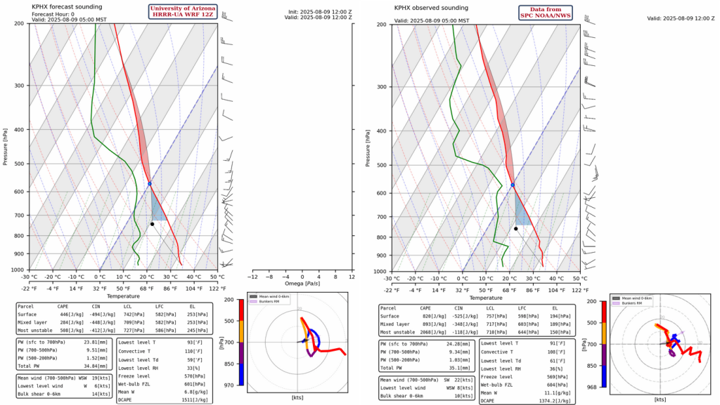
The 5am observed sounding for Phoenix below is in good agreement with the HRRR-UA WRF 12Z model initialization except for the moisture at 650mb. The moisture in the observed sounding at 600mb reflects the mid-level clouds/light showers indicated on this morning’s visible satellite picture below. Also in agreement between the soundings is the amount of convective inhibition (CIN, less than -400 [J/kg]) due to the cooling in the boundary layer as well as the amount of precipitable water (about 35mm).

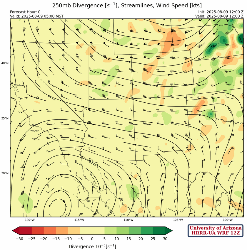
At 250mb a strong, winter like, trough is over the Rocky Mountains and the sub-tropical ridge is pushed to the south. Yesterday the position of the high pressure center was southwest of the spur of the Baja which was incorrectly positioned in model initialzations. Today that location seems about right given the anticyclone over Ivo, a TUTT low just to the northwest, then the ridge center as shown below.
The high pressure ridge axis is annotated on the 500mb temperature forecast intialization below, with a couple of centers as indicated. Flow is stronger underneath the ridge with east winds at 25 knots across northern Mexico. The dashed lines to the north of the ridge are short waves associated with the major polar trough centered in Saskatchewan, Canada.
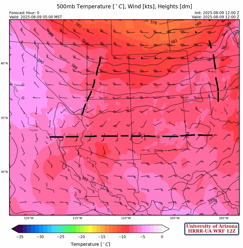
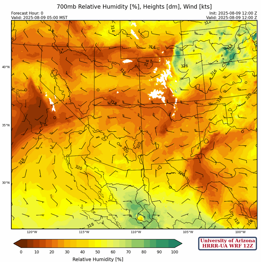
The southern area of Arizona shows an increase in moisture, while flow around the ridge near Safford, northern Arizona, and New Mexico are drier. Some of the dry air to the north is a result of the synoptic scale long wave trough. The spine of the Sierra Madre’s remains moist, but the wind flow to the west will not bring that into southern Arizona.
Today
Both the 5pm forecast sounding for Phoenix (left) and Tucson (right) show too much CIN for thunderstorm development in either valley today.

The only chance is if outflows from the storms near Nogales force some storms in Tucson in the evening. The forecast shows the wind push around 7:30pm, but no convective initiation.
Tomorrow
The upper-level winds are from the northwest on Sunday, so storm motion should be to the southeast. The CIN in the Tucson valley may be overcome by outflow boundaries and there are a good number of storm cells in the vicinity (more than yesterday and forecast today). To the north, storms do form on the Mogollon rim to the north of Phoenix, but CIN in the valleys is still too high for rain in the valley of the sun. A little more activity is over southern New Mexico.

Outlook
The region shows less storms on Monday as we run out of surge moisture and return to storms restricted to in and near the mountains.

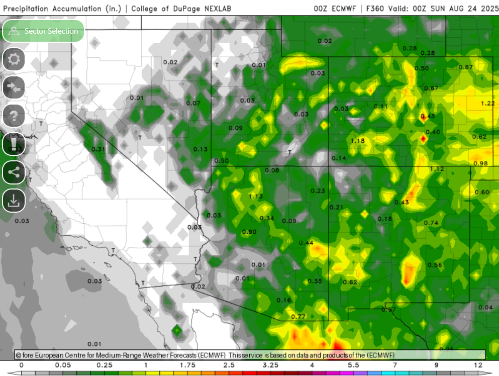
The pattern below doesn’t seem to change much through the week, but long-range model forecast do indicate a ramp up in activity next weekend.
The european model (ECMWF) accumulated precipitation forecast through to August 24th is below…I’m going to given my plants some water.
Discussion written by Pat Holbrook and Patrick Bunn