
Yesterday’s Weather
The comparison between HRRR-UA WRF 15Z forecast 24-hour total precipitation and observations from the multi-radar multi-sensor (MRMS) system is shown below. The model forecast did quite well with the precipitation in the Rincon mountains and Vail area east of Tucson.

We can also compare this to rain gauge data for yesterday. The Rincon mountains had rainfall totals more than ¾ of an inch with a maximum around 3 inches.

Benson, Sierra Vista, and Bisbee all got good amounts of precipiation from 0.25″ to 2″.

Tucson metro had lighter rainfall, generally less than a quarter inch.

Some areas in Phoenix received measurable rain, especially in Gilbert with a few reports of a quarter inch or more. The other area of heavy rain was in north central in central New Mexico with the Albuquerque area getting nearly an inch.
Check out our sky cameras looking north and east in Tucson; the main action starts from 3pm on.
Analysis
The tropical upper tropospheric trough (TUTT) to our south has moved northward into mainland Mexico. The TUTT in Texas yesterday has also moved north into Kansas. The TUTT in the Atlantic yesterday, is now between Florida and Cuba.

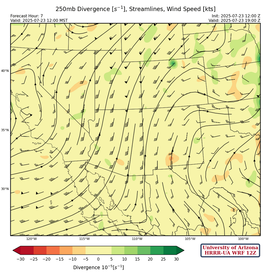
At 250mb, the TUTT to our south is moving northward and will be somewhat absorbed by the larger polar-type trough currently off the California coast. But the TUTT will still supply divergence aloft for eastern New Mexico as it moves to the east, south of Douglas tomorrow afternoon. Winds are 45 to 50 knots across Arizona from the south and will be from the southwest tomorrow.
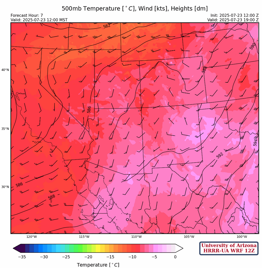
At 500mb, there are toasty warm temperatures at –6°C at both Phoenix and Flagstaff as well as eastern New Mexico, which would suppress any convection getting to that level. The high pressure ridge axis has been pushed well south into central Mexico extending to North Carolina. Winds across Arizona are southerly at 5 to 10 knots but a little stronger along the California border in response to the polar trough off the west coast.
At 700mb, very dry air moves into the state in advance of the west coast trough effectively turning the monsoon into a non-soon by Saturday. This shuts off precipitation in most areas except for far eastern New Mexico.
Today
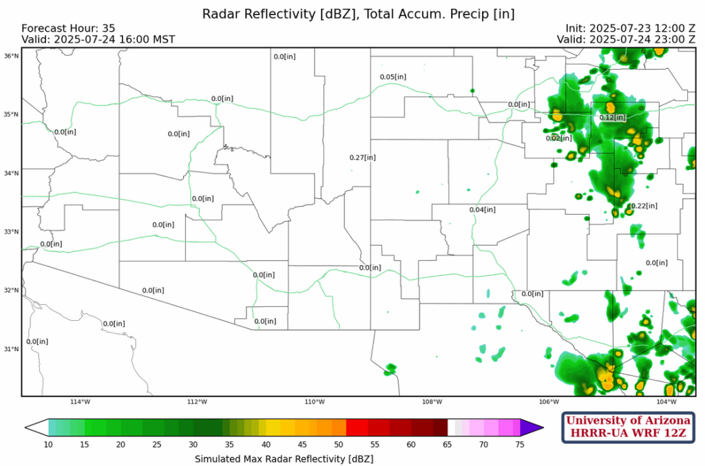
As the dry air advances across the region along with general subsidence, only the White Mountains and areas east into New Mexico will see any storms and they will be limited to the mountains.
Tomorrow
Remaining moisture in New Mexico combined with the upper-level divergence from the TUTT to our south moving east will enhance precipitation in eastern New Mexico. Arizona remains dry.
Outlook
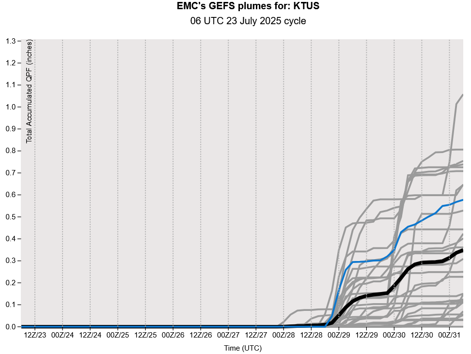
Arizona is still forecast to be in a non-soon mode through Friday and probably into early next week as shown in the total precipitation forecasts below. The totals shown for New Mexico are mainly from tomorrow’s thunderstorms.
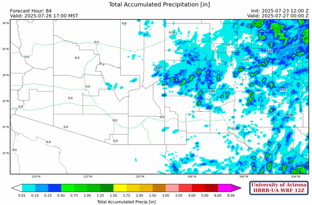
The GEFS plume forecasts for Tucson are showing a restart as early as July 29th, but ECMWF delays the restart of the monsoon until July 31st.
Discussion written by Pat Holbrook and Patrick Bunn