
Yesterday’s Weather
Most of the Arizona precipitation was near the mountains extending from Flagstaff southward to east of Phoenix and south to Tucson and Nogales then eastward across Cochise County and into southern New Mexico. These storms formed in the early afternoon with spotty heavy rain in the Tucson metro area, but most precipitation was light. Phoenix was in a low-CAPE hole as thunderstorm activity from the previous night cooled the boundary layer. Here’s the HRRR-UA WRF 15Z forecast (left) versus the observed hourly precipitation rate (right), pretty good overall!
Some additional storms formed in the late evening northwest of Tucson but only produced light rain. Rain gauges on Pima County Regional Flood Control alert map below show precip totals ranging from trace amounts to 0.2″ in the valley, more in the foothills and Catalinas.

And a more impressive clip from our sky cam:
The rest of the Arizona and northern New Mexico was mostly dry, but check out the mesoscale convective system (MCS) that formed yesterday and is in Texas now. MCSs happen when a group, or series, of thunderstorms start positively influencing each other and can strengthen into one storm system that can grow to be hundreds of miles wide. Divergence in Texas was working with tropical storm Barry’s moisture to produce this MCS. Precipitation in this area has been nearly a foot of rain in some areas!
Analysis
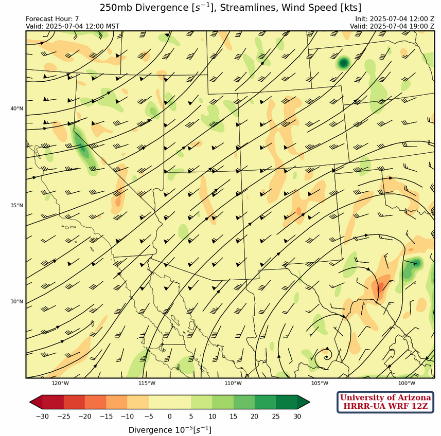
At 250mb, troughs are along the east and west coasts of the United States with a ridge centered in central Mexico and the ridge axis extending northward to eastern Montana. Wind speeds are generally from the southwest at 50 knots and above with broadscale speed convergence and sinking air over the state of Arizona.
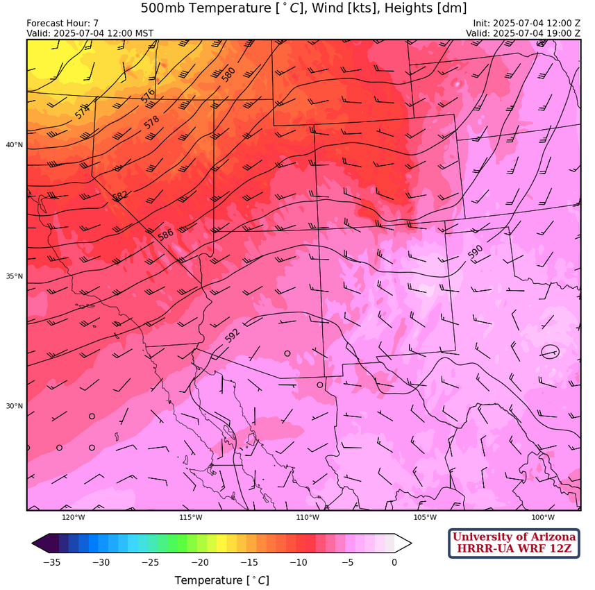
At 500mb, the trough from the west has moved northeast, with the axis in eastern Colorado southward to eastern New Mexico. Another trough has dropped into the Pacific Northwest much farther north than the last one. Temperatures continue to warm and are about –5C across southern Arizona and New Mexico.
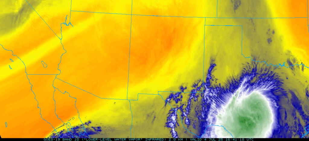
At 700mb, a ridge is centered near Nogales with the ridge axis extending north into Utah. Flow is from the southwest over most of Arizona switching to the northwest over New Mexico. Dry air is moving into the region as noted in the low-level water vapor image below.
Today
Weaker storms are still expected to form over the mountains of southern Arizona, although these storms are not expected to move into the valleys. Some thunderstorm anvils will drift over the valleys in the evening, but precipitation will be isolated to the mountains.
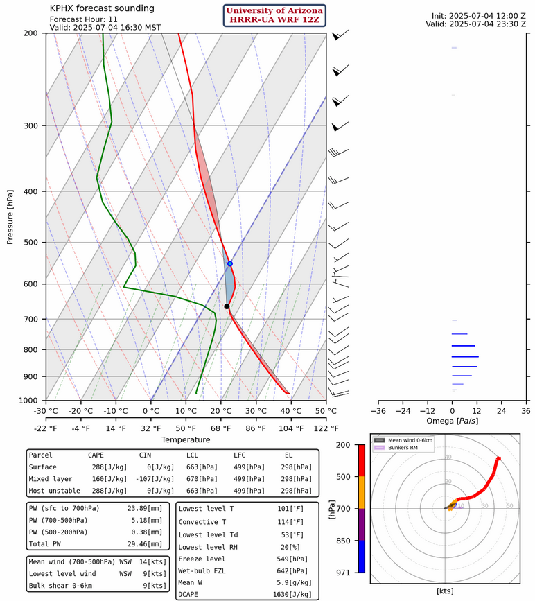
While there is moisture and CAPE over Arizona, as shown in the Phoenix forecast sounding below, surface temperatures will not rise enough to overcome the strong convective inhibition (CIN). New Mexico may have a few thunderstorms over the mountains near the Arizona/New Mexico border. Winds will be the typical upslope/downslope flow due to diurnal, or daily, solar heating. Fireworks are still expected over both states, especially in the evening hours.
Tomorrow
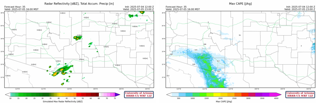
Compared to today, a little more activity is expected over eastern Pima and southern Cochise counties. Slightly stronger storms are expected to form over southern Arizona from mid-level moisture pushed into the region by former hurricane Flossie. The models may be underestimating this moisture, and tomorrow’s forecasts will tell us more. A few storms are also expected to develop over the White Mountains, though no significant microbursts are forecast for the regions mentioned. Temperatures tomorrow will be around 3 degrees F warmer.
Outlook
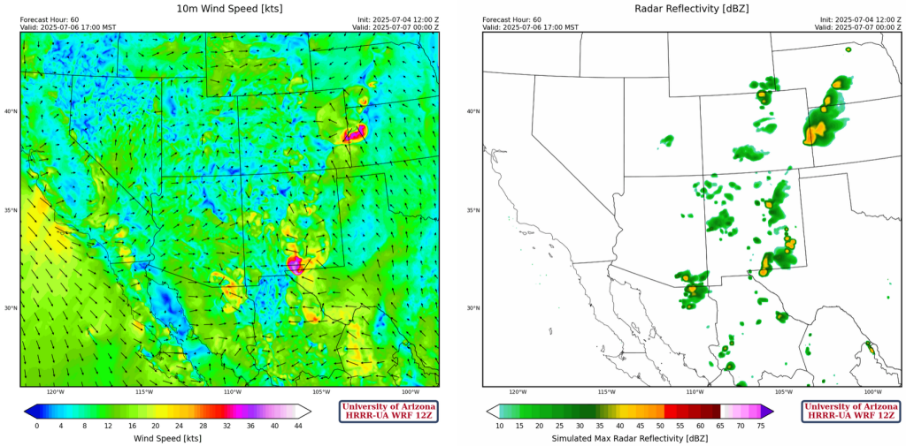
Increased convection is forecast in New Mexico on Sunday and Monday, with a strong potential for microbursts. More widespread thunderstorms are expected over southern Arizona and the White Mountains. Monday should bring even more widespread thunderstorm chances again throughout most of New Mexico and the same places in Arizona. These storms will be primarily over the mountains, as moisture from the Gulf of Mexico pushes into New Mexico and residual moisture from former hurricane Flossie remains in Arizona.
Discussion written by Pat Holbrook