
Yesterday’s Weather
Yesterday’s visible satellite imagery with GLM lightning flash is shown below. In Arizona, thunderstorms were in southeast Arizona with a few storms in the eastern part of the Mogollon Rim and White Mountains. The bulk of the thunderstorms were in southern and eastern New Mexico with storms south of I-40 moving east off the mountains.
Only a trace of rain fell at Tucson International Airport while the four morning HRRR-UA WRF forecasts (00, 09, 12, 15Z) predicted 0.9, 0.0, 0.21, and 0.1 inches, respectively. The HRRR-UA WRF 09Z getting the best prediction at the airport then and that forecast compared to gridded 24-hour accumulated precipitation from MRMS is shown below. A reasonable forecast overall with the pattern of precipitation mostly represented. Though, there were some missed thunderstorms in Graham County, northeast Sonora and eastern New Mexico.

The Pima County Regional Flood Control District gauge about a mile south of the UofA campus recorded over an inch and nearly an inch of rain fell on Mount Lemmon. The heavy precipitation shown by these observations is typical of the slow-moving storms that were forecast.

The storm near UofA campus had a strong gust, so strong it blew the sky camera we operate from it’s usual east facing direction to south-west! Now we have a nice view of downtown and Sentinel Peak until either Leland or Mike can go up and put it back facing east.
Hurricane Erin briefly spun up to Category 5 status which is not atypical for a storm with a pin sized eye, but fortunately Erin will not hit the United States.

Analysis
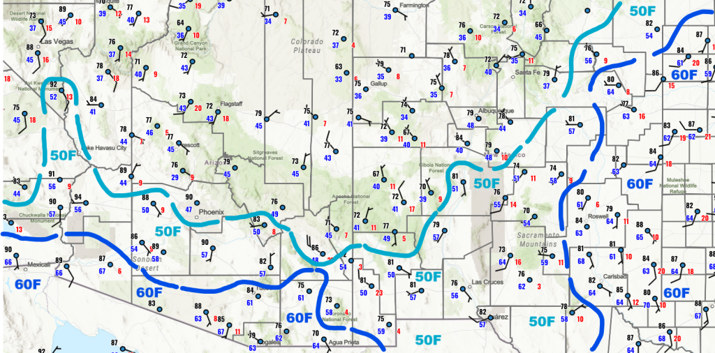
Drying is indicated on the surface observations in Arizona shown below, as the 50F isodrosotherm (lines of equal dewpoint temperature) has been pushed south due to vertical mixing during the day and no reinforcement during the night. New Mexico moisture remains about the same as yesterday
The observed upper air sounding (right) and HRRR-UA WRF 12Z initialization sounding (left) is shown below. The observed precipitable water is down to 1 inch and the model initialized with the same value.

The two tropical upper tropospheric troughs (TUTT) should move westward with the anticyclone over Hurricane Erin. Erin is forecast to turn north and go out to sea well east of the U.S. coastline.

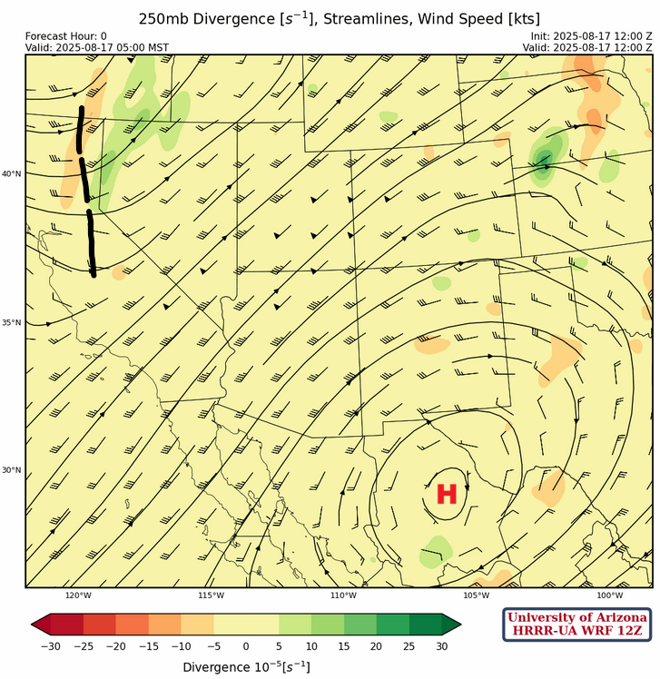
At 250mb, the high pressure ridge and trough are now a little further west today than yesterday and the southwest winds aloft are about the same.
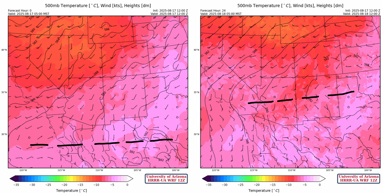
The 500mb forecast initialization is show below on the left. The ridge axis, annotated in dashed black, extends from Big Bend, Texas, westward to the Baja Peninsula. Tomorrow’s forecast for 5am at 500mb is below on the right. The shift of the ridge axis to the north puts the southern half of the region in southeasterly wind flow. The ridge will move to the four corners area in a couple of days.
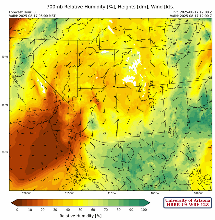
At 700mb, there has been some drying in the northern half of Arizona and New Mexico and along the Colorado River. Otherwise, moisture remains about the same as yesterday across Southern Arizona and New Mexico.
Today
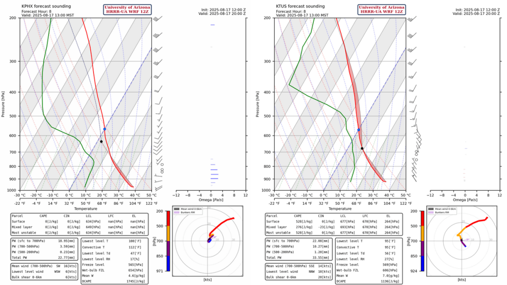
Both the Phoenix and Tucson forecast soundings for this afternoon at 1pm are similar to yesterday. Still no Convective Available Potential Energy (CAPE) for Phoenix, although a little more CAPE in Tucson. Storms will wait to move eastward, but with anvils also moving east their motion will be the same as the storm propagation direction. The anvils will therefore likely limit surface heating ahead of the direction storms will travel. Some storms will produce locally heavy rain and wind gusts should be less than 35 mph.
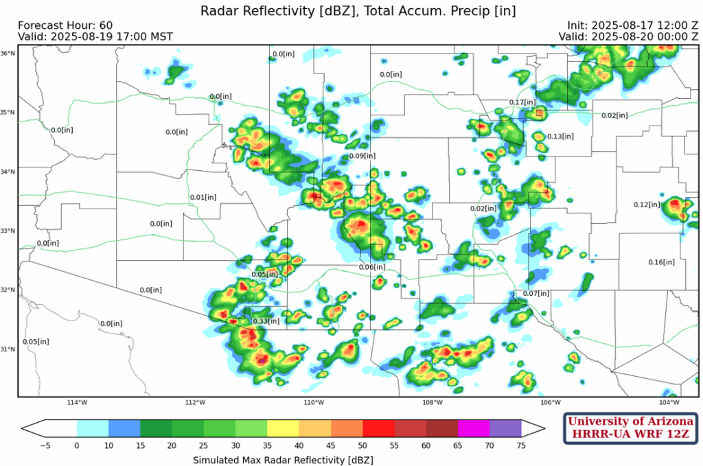
The radar reflectivtiy forecast at 4pm today indicates fewer storms across the northern portion of the region, then overnight light showers develop in Pinal Couty moving northwest to Phoenix area by sunrise.
Tomorrow
With flow increasing from the southeast, as the ridge axis moves north, there’s a general increase in showers and thunderstorms with motion to the west. The location of the thunderstorms will be dependent on cloud cover left over from today’s activity.

Outlook
On Tuesday, thunderstorms develop in the mountains in eastern Arizona and move to the southwest. For Tucson, storms develop in the afternoon and move west into central Pima county by evening. Other storms will develop in the White Mountains and move southwest into Graham, Cochise, and Pima counties in the evening. This is referred to as a rim shot where storms develop in the White Mountains and move off the Mogollon Rim to the southwest. The Phoenix area will miss out on these type of storms until later in the week.
The GEFS plume forecast is showing an ensemble mean of less than 0.3” inches of rain for Tucson out to August 25th. If this happens it’s likely we will end the month with below “normal” total monsoon rainfall.

Discussion written by Pat Holbrook and Patrick Bunn