
Yesterday’s Weather
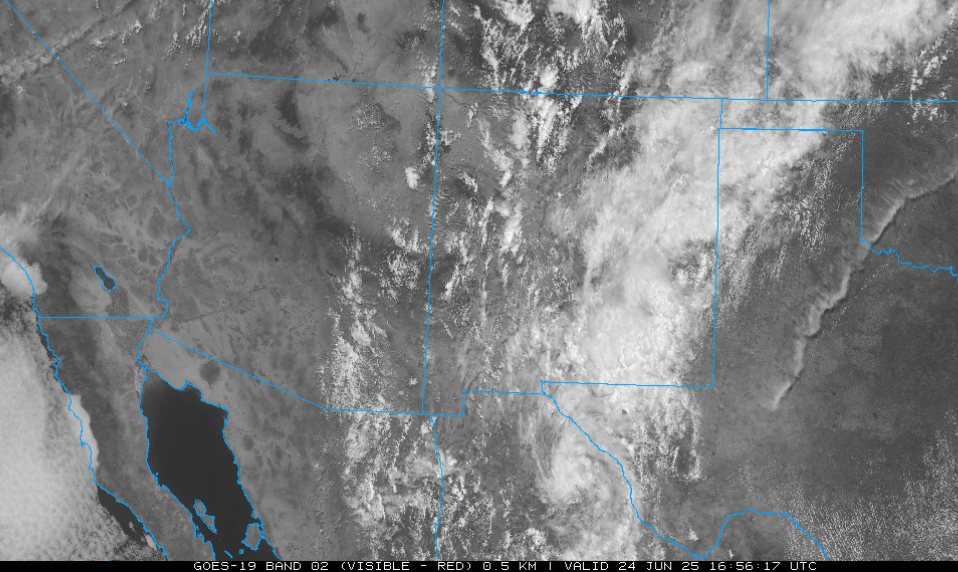
A tale of two states as New Mexico was moisture laden with strong storms that produced heavy rain across the eastern third of the state. These storms were aided by low-level moisture. Moving farther west, the monsoon circulation axis has repositioned from Mexico along the spine of the Sierra Madre’s into central New Mexico in response to the upper level low in California. Moving further west moisture values decreased in western New Mexico and eastern Arizona. A few storms developed in this area as indicated by a couple lightning strikes near the Chiricahua mountains. Mid-level moisture was streaming northward from Nogales to Tucson and into Graham County, but the deserts of central and western Arizona remained dry. The low-level water vapor from yesterday is shown below, with GOES derived lightning flashes superimposed.
Analysis
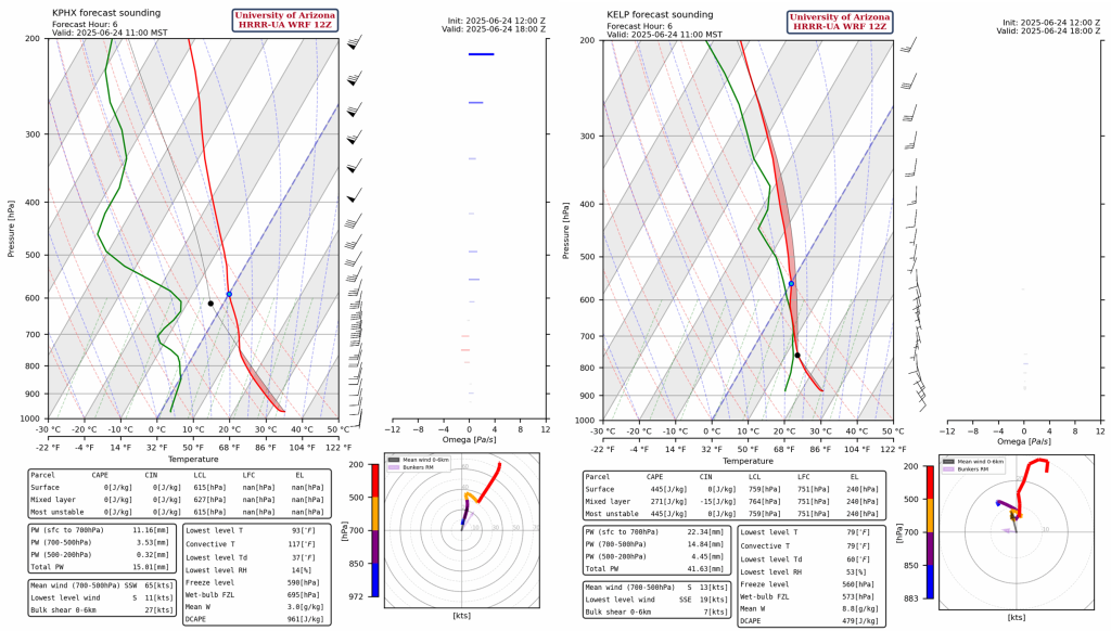
The tale of two states continues as the comparison between the sounding from Phoenix on the left and El Paso on the right shows a significant difference in moisture and temperature. Phoenix has just 15mm (0.6 inches) of precipitable water, and temperature needed for convective initation at 117 F. El Paso has 40mm of precipitable water and surface temp of 79F for convective initation.
At 250mb, the TUTT low (tropical upper tropospheric trough) has moved onshore south of Brownsville and continues to move westward. The region is dominated by the southwest winds associated with the polar jet from 50 to 100kts winds. The core of the jet is on the east side of the trough axis.
The 500mb map below shows an upper low centered over Nevada with a 50kt jet core over northwest Arizona. Temperatures are cooler than normal across the region. Normally 500mb temperatures would be around –5C versus the –8C at Phoenix.

At 700 mb, the moisture axis has shifted to the west, centered over New Mexico with some moisture in eastern Arizona. The winds are strong and southerly, and low pressure remains over California. The low pressure over California is pushing a cold front through southern California and the Gulf of California, shown by the curved line of moisture in yellow.
Today
New Mexico is quite puzzling as the low-level cooling and cloud cover should limit deep convection. Jet dynamics will force strong storms in from northern New Mexico west of Santa Fe and Albuquerque southward to Lordsburg and then into Mexico into the Sierra Madre’s.
A few storms will develop in Cochise county. Storms will develop in Mexico, the driving force will be the TUTT low setting up some upper-level divergence in that area. Model forecast radar reflectivity and precipitable water is below.
Tomorrow
As the low pressure in Nevada lifts out, the thunderstorm activity in New Mexico will shift eastward across the northern portion of the state and remain in about the same location in the southwest with even more activity than yesterday in Southeast Arizona. The heaviest precipitation totals will remain in New Mexico. Any precipitation in southeast Arizona should be limited to in and around the mountains.

Outlook
New Mexico has a few more rainy days ahead, but everything should begin to dry out by Friday. Eastern Arizona will have a few more rain chances throughout this time, but this rain will remain primarily over the mountains. Both states will experience increasing temperatures for the rest of the week.
These maps compare the total precipitation accumulation through Wednesday (left) versus through Saturday (right). There’s not much difference since the majority of the precipitation occurs from now until the tomorrow at midnight.

Discussion written by Pat Holbrook