
Yesterday’s Weather
The Mesoscale Convective Vortex (MCV) in western Arizona moved northwest into California west of Las Vegas and storms were limited to far northwest Arizona. Storms were limited in the rest of Arizona due to warm air aloft advecting in from the south. Storms in the mountains that did form had their tops ripped off by strong winds aloft.
New Mexico continued to have storms over the eastern portion of the state while the rest of the state saw mostly mountain storms.

Analysis
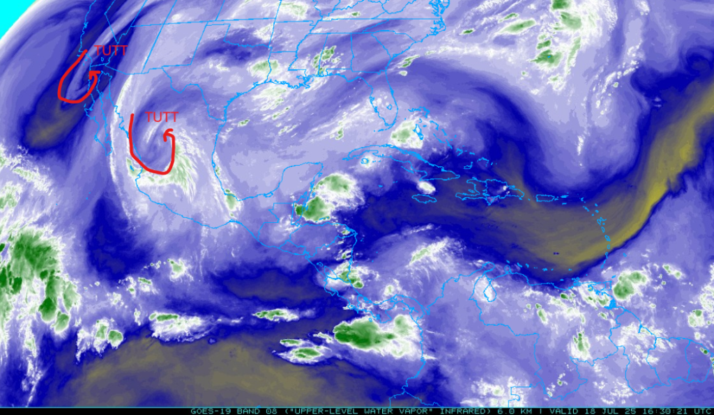
A tropical upper tropospheric trough (TUTT) is near San Diego now and continues to move north while the other TUTT has moved west to near Durango, Mexico with a north-south convergence center between the two circulations. Ther e is a col along the mainland Mexico side of the Gulf of California, from Guaymas to Culiacan and should be a location for strong convection today.
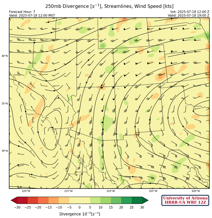
Stong southerly winds are over Arizona at 250mb, with maximum winds of 50 knots. This will push anvils well to the north ahead of the storms. The ridge is centered over northern Mississippi with ridge axis extending from North/South Carolina border west to northern New Mexico.
At 500mb, the TUTT to our west has a center in about the same position as at 200mb, south of San Diego, and is moving north. The 500mb low associated with the other TUTT to our southeast, is further southeast of the 200mb center, implying baroclinicity. The warmest air aloft is over southeast Arizona, but models show that by late afternoon cooling will occur as the circulation from the TUTT to our southeast brings in some cooling into this area. The flow in western Arizona is stronger from the south. New Mexico has mostly light winds withe the coldest air aloft remaining in eastern New Mexico.
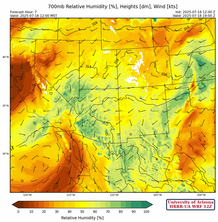
There is plenty of moisture across both states at 700mb, with the limiting factor in the western half of Arizona being warm air aloft. New Mexico has more of a southwest flow and a tad less moisture in the northern half of the state.
Today
Most of Arizona will be dry, but as stated above there should be cooling at and above 500mb this evening over southeast Arizona enhancing storm development.The storms will develop in Cochise County this evening and spread north and west before weakening by midnight near Tucson. Storms will also develop across southwest New Mexico to northeast New Mexico. The rest of Arizona will only see isolated storms in the mountains.
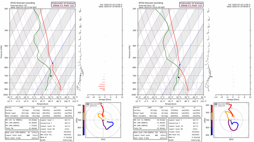
The sounding below is for Tucson at 11pm tonight. The layer from 550mb to 450mb shows 2C of cooling. With a relatively moist boundary layer below, this layer some storms should form.
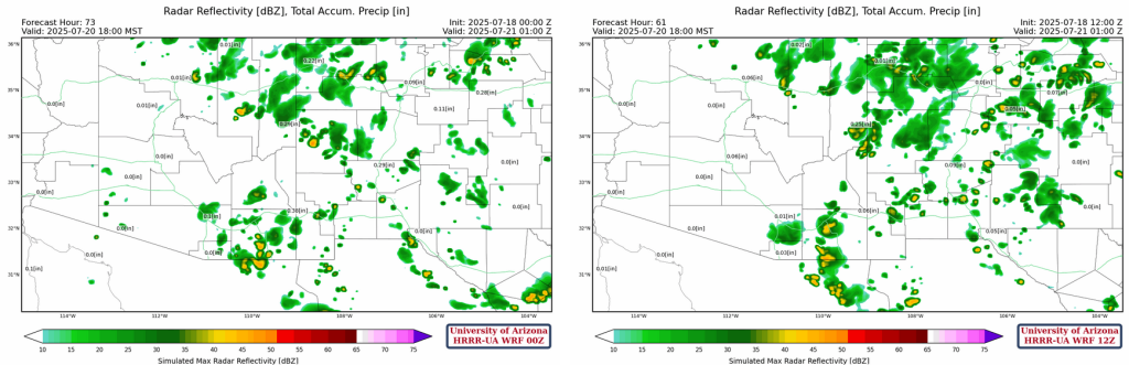
Reflectivity for tonight’s storms is below. Storms will be mainly on the mountains with little precipitation and no significant wind gusts.
Tomorrow
Pretty much the same weather pattern tomorrow, but the thunderstorms form further west. Some make a run towards Phoenix overnight, but still not a lot of precipitation, less than 0.1″ for the Tucson and Phoenix metro areas in all model forecasts. The Mogollon Rim and White Mountains get into the action, while the eastern half of New Mexico drys out.
Outlook
Sunday looks similar to today and Saturday with slightly less activity over the Mogollon Rim.
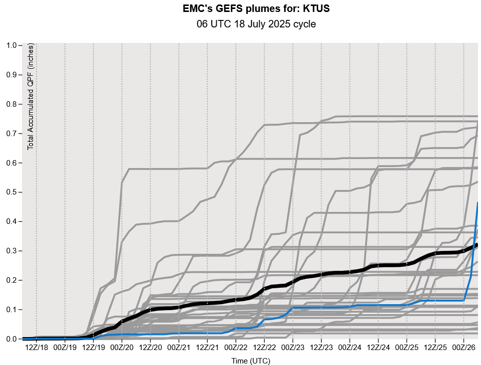
Lastly, the GEFS plume forecast for Tuscon is shown below. The forecast looks like there will be one good storm over the next eight days, but which day it will be will be up to the luck of the Irish. An about equal number of the ensemble members shows more and less than two tenths of an inch, likely meaning one good storm (about 0.2″) at some point over the next week or so, but talk about uncertainy forecasting in the monsoon season…this is it!
Discussion written by Pat Holbrook and Patrick Bunn