

Summary
Hurricanes Karina and Marie continue to move west across the Pacific, while Hurricane Lowell is expected to move north near the western Hawaiian Islands. Satellite water vapor imagery shows moisture transport from Baja California into southeastern Arizona and New Mexico around the subtropical high-pressure system. The subtropical jet will bring moisture sheared off from Marie into the region tomorrow. Satellite imagery and weather station data indicate reduced surface moisture in Arizona, lessening the potential for severe rainfall. New Mexico has more surface moisture, but warm mid-level 500 mb temperatures will limit the vertical extent of storms that develop.
Forecasts show limited thunderstorm activity today, mostly in New Mexico’s mountains, with very few storms in Arizona. Tomorrow, monsoon moisture will shift west, bringing thunderstorms to eastern Arizona and west-central New Mexico, but rainfall is expected to be light, especially in western Arizona and southern Nevada due to dry surface conditions. Most precipitation will fall on Monday, primarily in New Mexico and south of the international border in SE Arizona. After Monday, no activity is currently being forecast through to next weekend.
Yesterday’s Weather
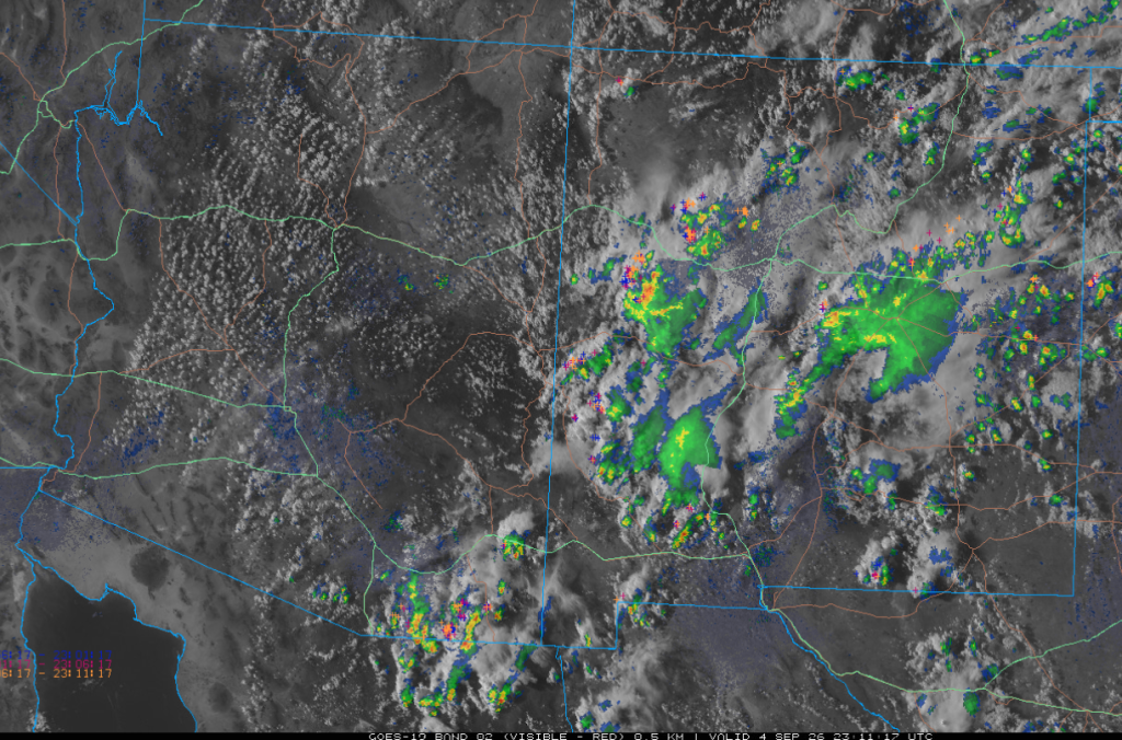
Visible satellite imagery overlaid with lightning and radar from 4 pm yesterday shows showers and thunderstorms from southeast Arizona northeast into New Mexico. The strongest storms were near Sierra Vista and in west-central New Mexico. The western portion of Arizona had very low surface dewpoint temperatures.
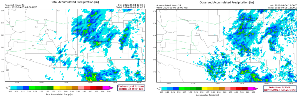
The HRRR-UA WRF 12Z 24-hour accumulated precipitation forecast (left) and corresponding observed precipitation from MRMS (right) are shown below. The forecast precipitation looks about right, except for the southern part of Santa Cruz and the southern half of Cochise counties extending southward into Mexico.
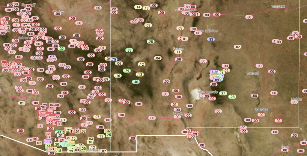
Precipitation reports from the Rainlog network are below. The heaviest rain was in Santa Cruz and Cochise counties in Arizona and in the mountains east of Alamogordo in New Mexico. Most valley locations had very little rainfall.
Analysis
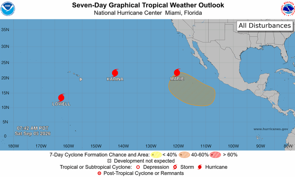
Hurricanes Karina and Marie are still moving westward across the Pacific Ocean while major Hurricane Lowell will begin moving northward and skirt the far western Hawaiian Islands.
The polar low and jet stream (black arrow) are maintaining their position in the Pacific Northwest. From tomorrow onward, Marie will begin to interact with the subtropical jet (red arrow), and mid- and high-level moisture will be pulled across western Arizona and southern California, bringing a few light showers. The monsoon moisture flow (green arrow) is from northern Mexico into far southeast Arizona and New Mexico. An upper-level low covers the northern Gulf of Mexico.

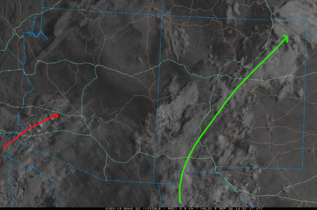
The visible satellite picture from 7 am shows two flows: the first is the monsoon flow from Mexico into southwest New Mexico, then bending to the northeast into southwest Kansas (green arrow). The other flow is mid- and high-level clouds coming from Hurricane Marie into southwest Arizona (red arrow).
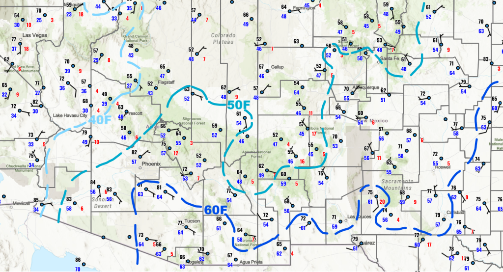
Overall surface moisture has decreased in Arizona and slightly increased in New Mexico, as shown by 2-meter dew point temperatures from 7 am this morning.
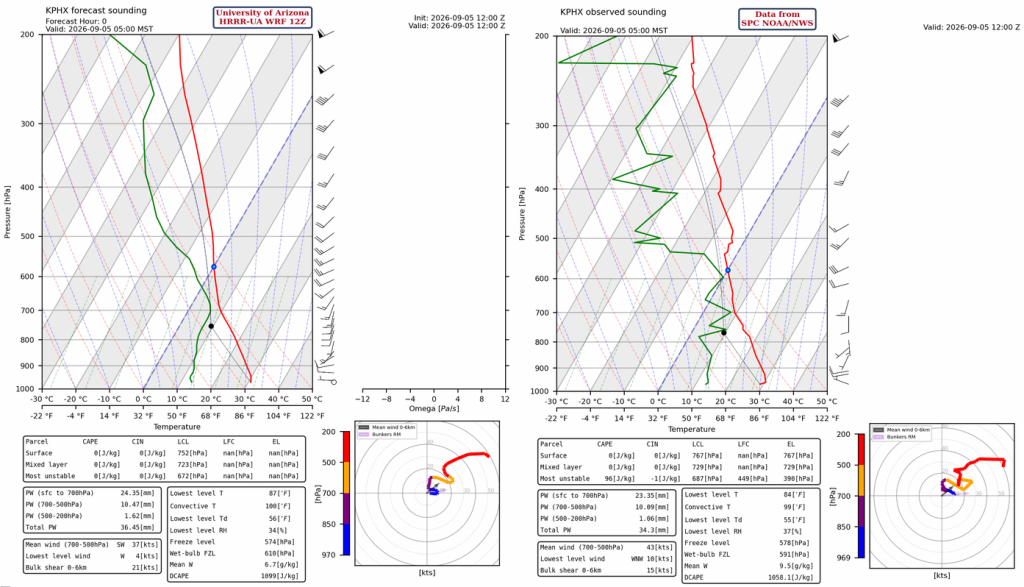
The HRRR-UA WRF 12Z initialization (left) and observed (right) sounding for Phoenix at 5 am are below. The observation shows a warm layer aloft between 530 and 490 mb, which will slow the rise of cumulus clouds this afternoon.
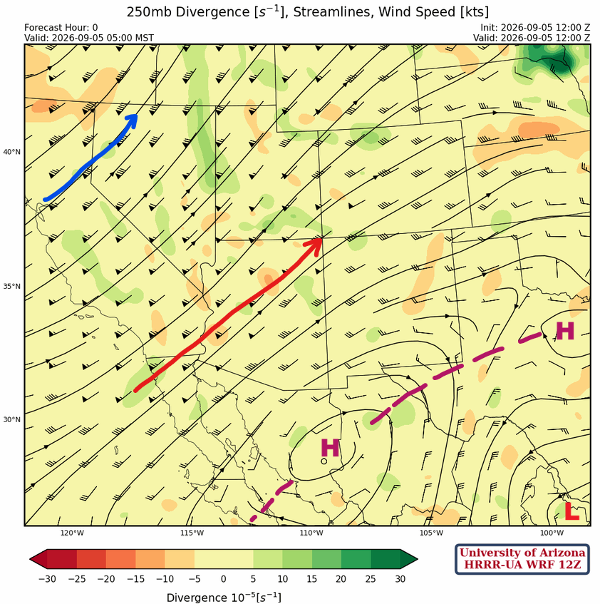
At 250 mb, the polar jet is across northern California into southwest Idaho. The subtropical jet is from northern Baja to northeast Arizona. The ridge has two centers; one in northern Mexico and the other in north Texas. The western part of the low in the Gulf of Mexico is near Brownsville.
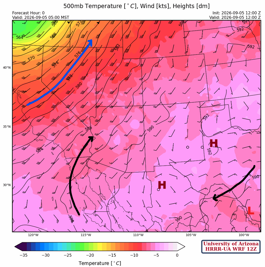
The polar jet extends from central California into southeast Idaho at 500 mb. The ridge is over west Texas and northern Mexico with a broad flow from the tropics into southeast California. An upper-level flow is in southeast Texas.
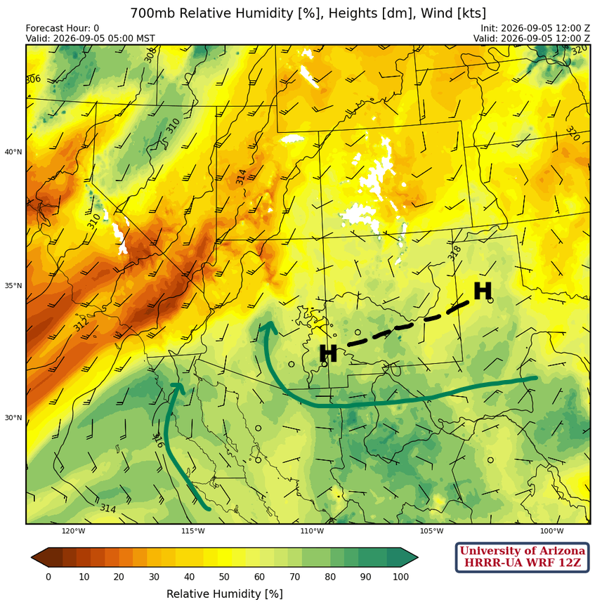
At 700mb, there is a fair amount of moisture south of the ridge, and some is moving northward into Arizona, but there is no strong flow.
Today
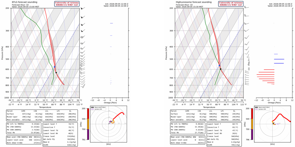
Looking through most of the forecast soundings for Arizona and New Mexico, only a few soundings have a temperature and moisture profile that will support thunderstorm development. The mountains in New Mexico should have the best thunderstorm activity, though Flagstaff at 3 pm (left) shows that storm development is possible. Note that the High Lonesome site (right) is southeast of Albuquerque, near Vaughn.
Very few storms are in Arizona today, as shown by the forecast radar reflectivity animation. The strongest activity is in New Mexico, in the southern half of the state.
Tomorrow
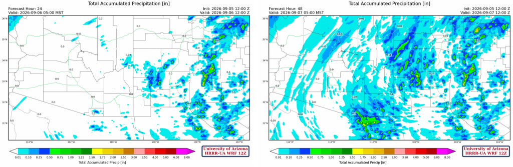
Monsoon moisture shifts back to the west, with thunderstorms in eastern Arizona and west-central New Mexico; storms will weaken during the evening hours, with a few showers moving into the Tucson area by midnight and the early hours of Monday morning. No severe weather is expected. The precipitation in western Arizona and southern Nevada is from Hurricane Maria, and if any reaches the ground, it will be light because low surface dewpoint temperatures will cause evaporation as it falls (virga).
The forecast 24-hour total accumulated precipitation (left) and 48-hour (right) show most precipitation falls on Monday, with heavier rainfall in New Mexico and south of the international border in SE Arizona.
Outlook
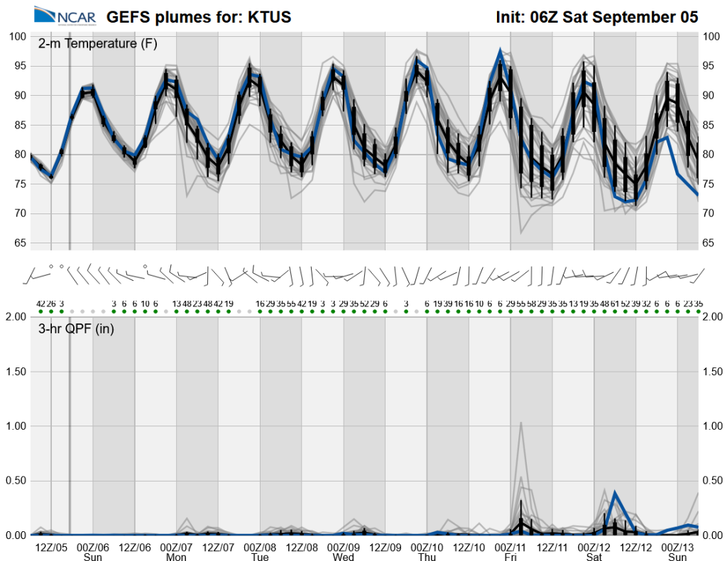
Except for some isolated storms Monday in southeast Arizona, no significant precipitation is expected until Friday. The moisture shown from Friday through Sunday is from a possible tropical system in the southern Gulf of California.
Discussion written by Pat Holbrook and Patrick Bunn