

Summary
A polar low-pressure system and the jet stream have moved into central California, causing a shift in the regional weather pattern. Several upper-level disturbances (TUTTs) have migrated and are being absorbed into broader flows; one remaining TUTT could influence storm development in Arizona and New Mexico today. Satellite imagery shows scattered showers across northern and southeastern Arizona, with high surface dewpoints following recent thunderstorms.
Today, marginal instability will lead to afternoon thunderstorms in southeastern Arizona, with limited heavy rainfall expected. Tomorrow, the low-pressure system moving into New Mexico will suppress storms in southern Arizona but allow isolated activity in northern Arizona and New Mexico due to a jet streak. By Saturday, the monsoon ridge will return to Arizona, bringing back moisture and isolated storms, with the potential for enhanced thunderstorm activity by late next week as tropical moisture arrives from the south.
Yesterday’s Weather
Thunderstorms formed in the northern half of Arizona as forecast, even getting as far south as I-10 from the California border east to Phoenix. Convection initiated in SE Arizona as forecast, and the Tucson airport was hit by a single cell about 7:30 pm that dropped 0.59”. Later, a line of thunderstorms developed from the Pima/Pinal County line around 10 pm and moved slowly southeast through the Tucson metro area. The Tucson Doppler radar animation (below) at 1 am (06Z) shows the storms continuing slowly southeast, reaching Vail at 3 am (08Z). The line of storms traveled 40 miles in 5 hours and continued moving southeast to Sierra Vista.
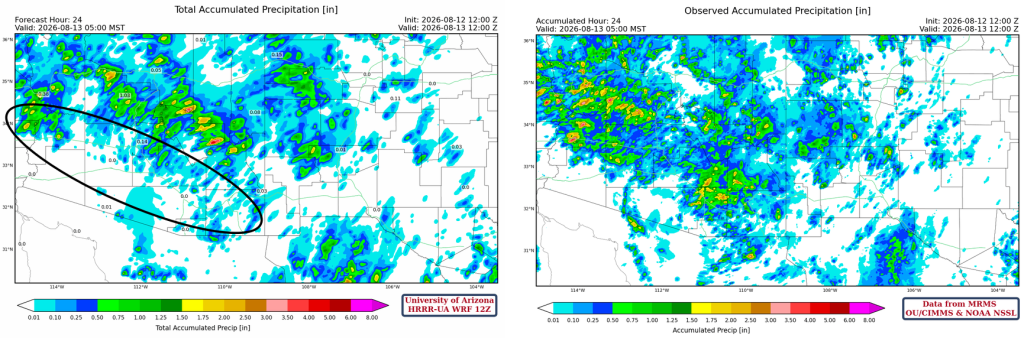
Here’s the comparison of yesterday’s 12Z HRRR-UA WRF radar reflectivity forecast (left) to the observed radar (right)
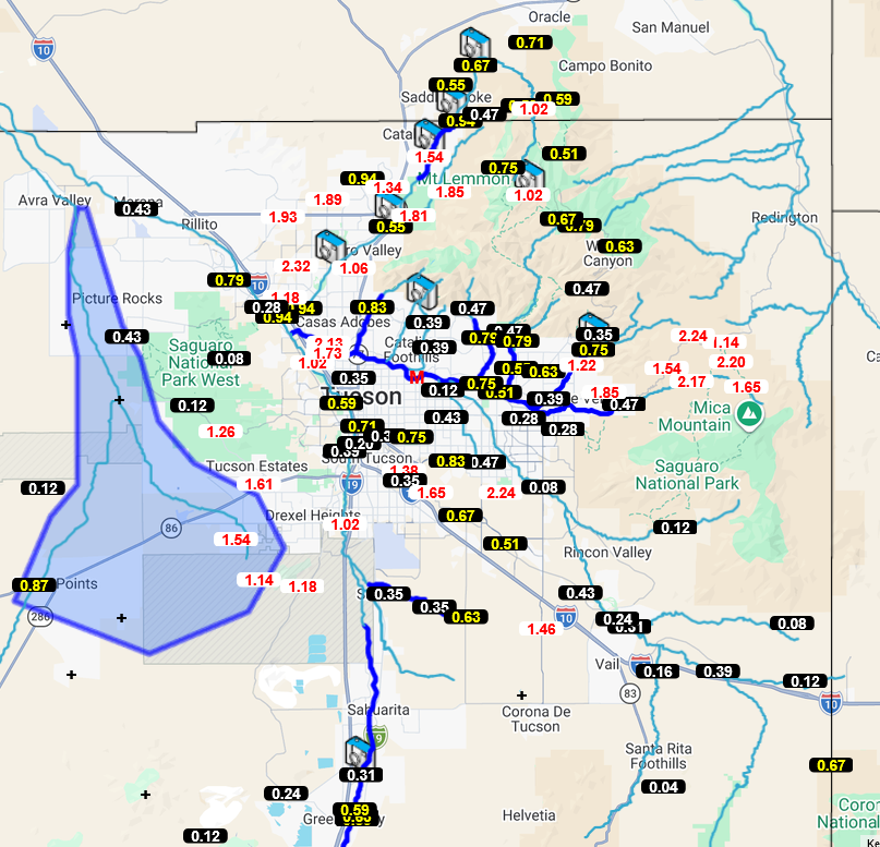
Precipitation gauges from the Pima County Flood Control Alert show heavy rainfall across most of the metro area, >0.5” in many locations, and>2” in several mountain locations. Although no major flooding in Tucson yet, some roads have been closed, and the rain that fell in the mountains may not have reached the largest washes.
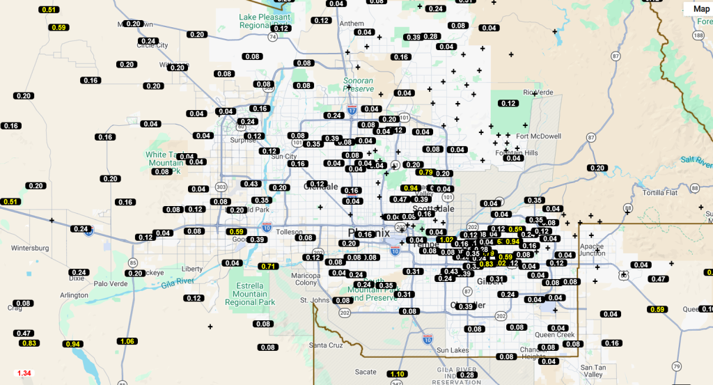
Phoenix-area precipitation was also more than forecast, but the overall forecast was much closer to observations than in Tucson.
The HRRR-UA WRF 12Z 24-hour accumulated precipitation forecast (left) and corresponding observed precipitation from MRMS (right) are shown below. The precipitation forecast was not too bad in northwest Arizona and the Mogollon Rim. The area underestimated (black oval) was caused by back-building storms from the Mogollon Rim southward to I-10 and down to the Tucson metro area. Although we expected a few storms overnight and backbuilding was forecast northeast of Phoenix, which did happen, the extent of the backbuilding to the area marked was a forecast bust. All numerical weather prediction models (HRRR, UA WRF) and the NWS were oblivious to these storms until they formed. Would 12Z and 00Z weather-balloon launches in Tucson have helped both numerical models and forecasters? Probably.
Analysis
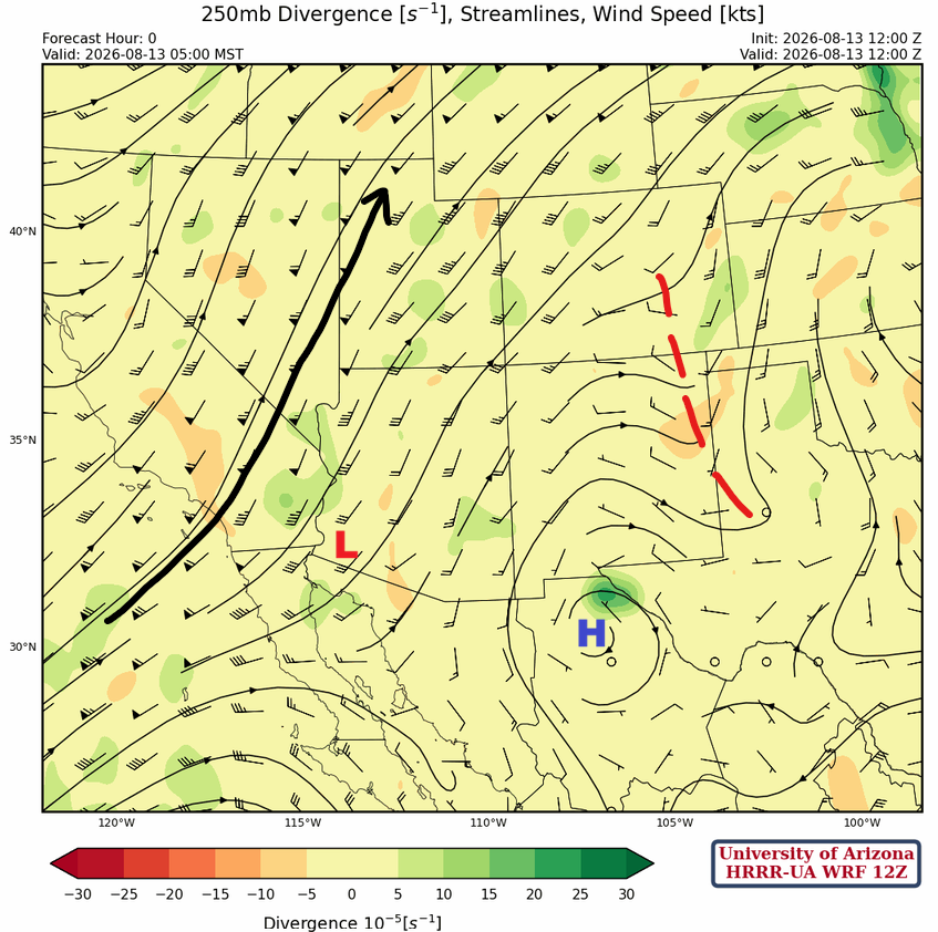
The polar low-pressure system (blue “L”) and jet stream (black arrow) have moved onshore in central California. Two TUTTs from yesterday, one on the CA/AZ border and one in NM, have moved northward and been absorbed into the flow between the monsoon ridge and the polar low. The TUTT over Baja yesterday is now in southwest Arizona and will also be absorbed into the convergent flow. Before that, this TUTT could aid storm development in parts of Arizona today. Another TUTT is in the Gulf of Mexico just onshore; this circulation could pass below the passing low-pressure system and move moisture east.

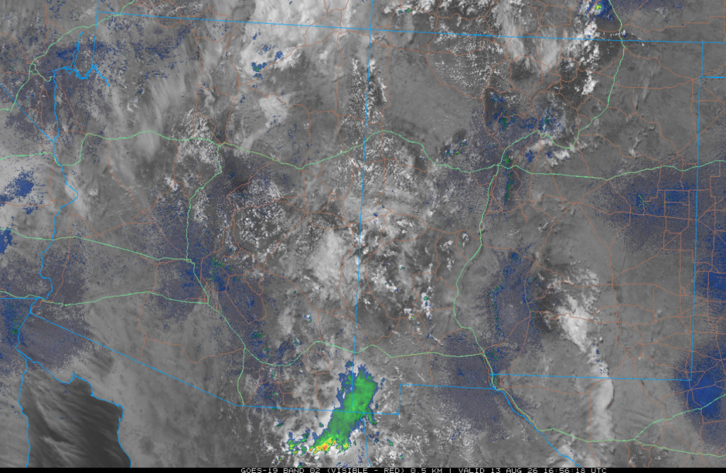
Visible satellite imagery from 8 am shows a few showers are scattered in northern Arizona, the White Mountains, and near Douglas.
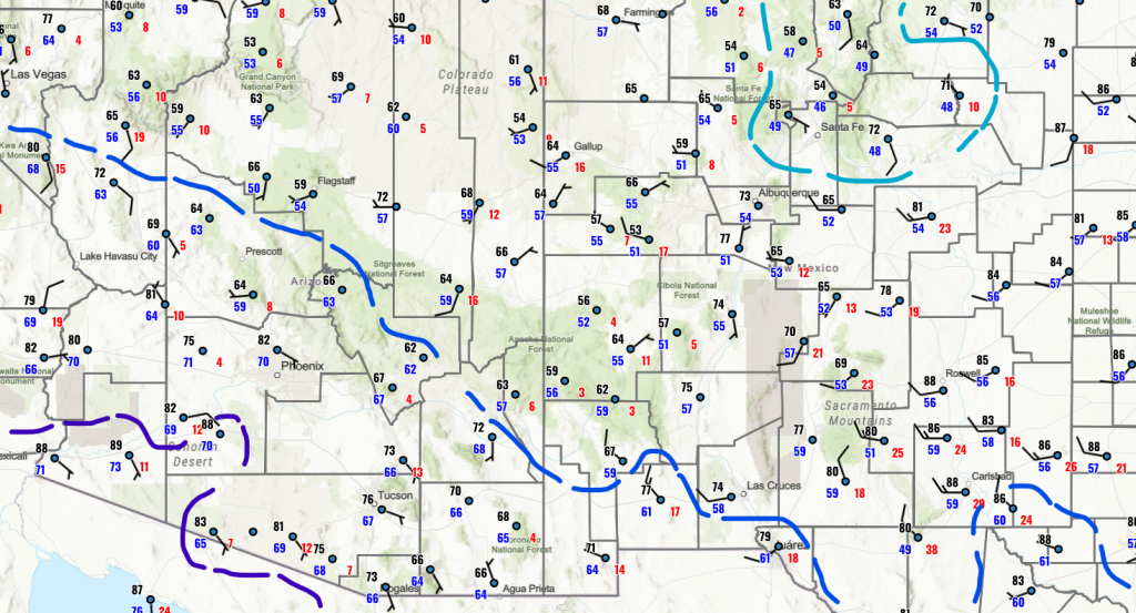
Surface dewpoint temperatures are high across Arizona in the wake of the thunderstorms, exceeding 60°F in the southern half of the state.
Both the forecast and observed soundings are similar and reflect the atmosphere in the wake of the thunderstorms; a disturbed atmosphere that’s difficult to use for forecasts today.

At 250 mb, the polar jet is cutting across California and Nevada, then northward into Idaho and Montana. The monsoon ridge has been pushed southeast into Mexico just south of El Paso. The TUTT in New Mexico yesterday is now the open wave in Colorado and eastern New Mexico.
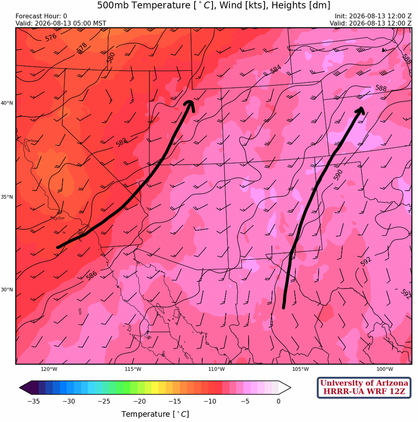
At 500 mb, the flow around the monsoon ridge has shifted eastward, and polar air has moved into the western United States.
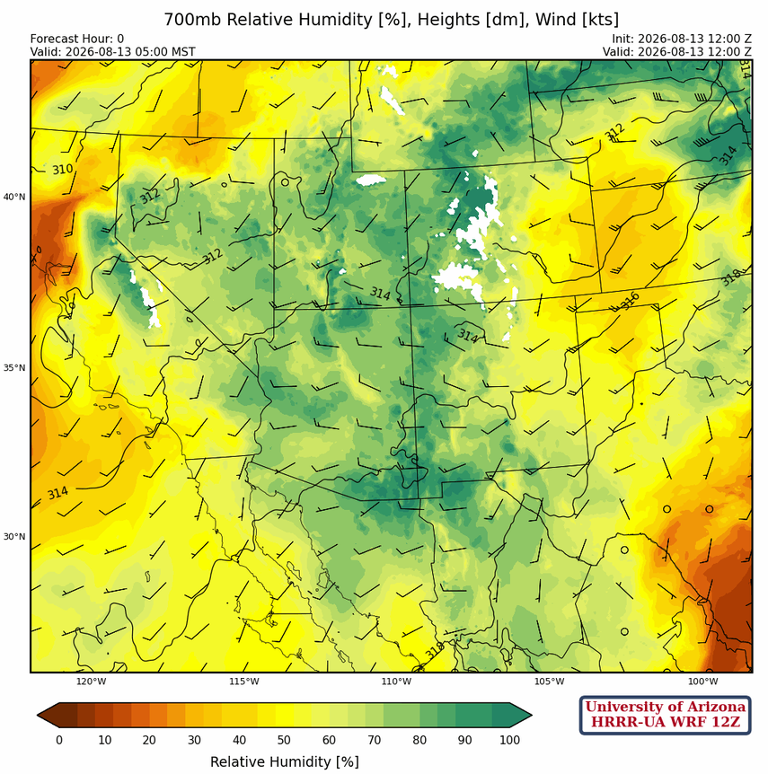
At 700 mb, monsoon moisture is present across the western United States and northern Mexico. The winds are westerly across the region, and technically we are done with the monsoon until east winds return. The remaining moisture can still produce strong thunderstorms, but there will be less each day.
Today
The Phoenix (left) and Tucson (right) forecast soundings for 1 pm this afternoon indicate a marginally unstable atmosphere that will need surface heating to initiate storm development; this is more likely in southeast Arizona than in the Phoenix metro area.
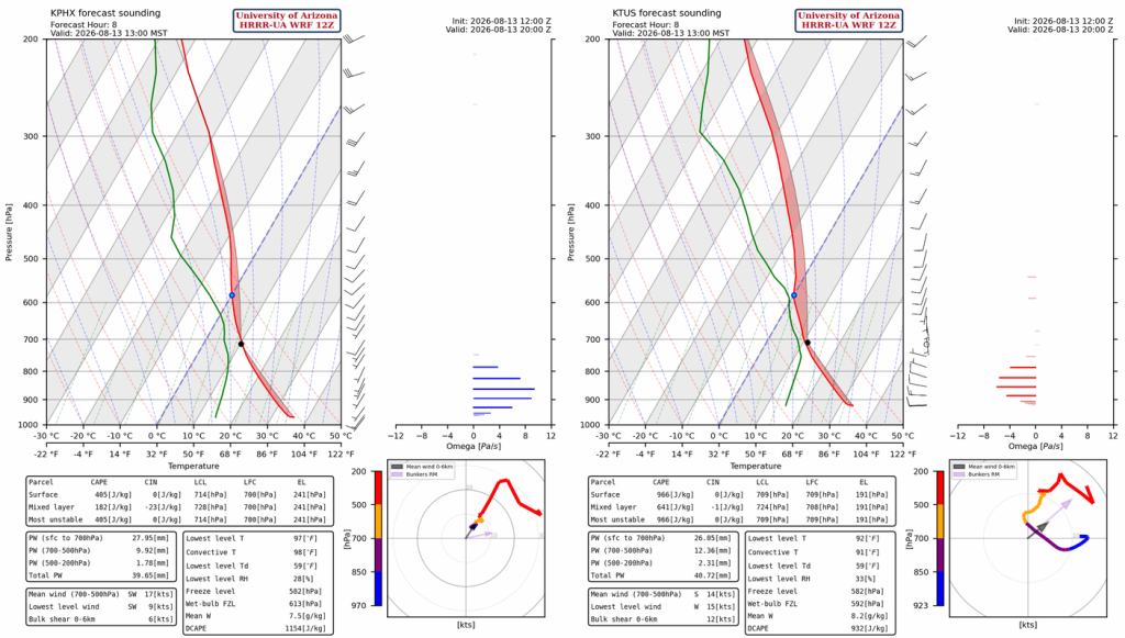
Thunderstorms will develop early this afternoon (by 1 pm) and evening in SE Arizona, the Mogollon Rim, and La Paz County. Storms will move slowly north, with the afternoon activity in the Tucson area advancing to Phoenix on outflow winds by evening. Some local heavy rain is possible with storms, though 24-hour totals are expected to be below 0.25″ in the Tucson metro area. No high winds are expected as DCAPE is 900 [J/kg], meaning ~30 kts outflows. The SkewTs above show weak 10 kts winds from 700 mb to 500 mb, evidence of slow storm movement and lack of storm organization.
Tomorrow
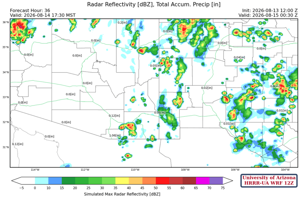
The jet stream will move into Arizona tomorrow, and the convergence of the trough and the monsoon high will shift to New Mexico. Behind it, subsidence associated with the jet will suppress thunderstorm activity in southern Arizona.
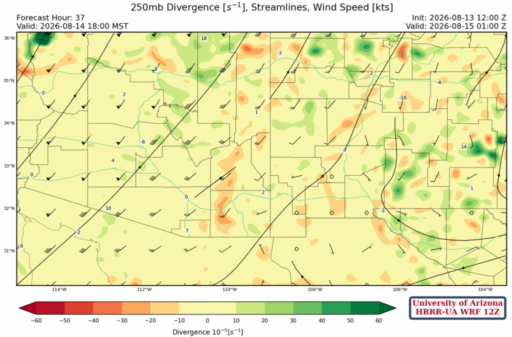
The forecast radar reflectivity for tomorrow evening shows isolated storms mainly over eastern and far northern Arizona. Jet streak dynamics (right entrance region) are responsible for the storms in far northwest Arizona and southern Nevada near Las Vegas. New Mexico has a scattered thunderstorm pattern, as Arizona did yesterday/today.
Outlook
The monsoon ridge builds back into Arizona by Saturday, bringing moisture back into the state as the monsoon flow reestablishes itself. Isolated storms will form in Arizona Saturday afternoon. The TUTT, now in the Gulf of Mexico, will move into central Mexico Sunday, enhancing thunderstorms in northern Mexico, and move into southeast Arizona.
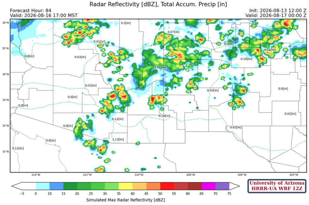
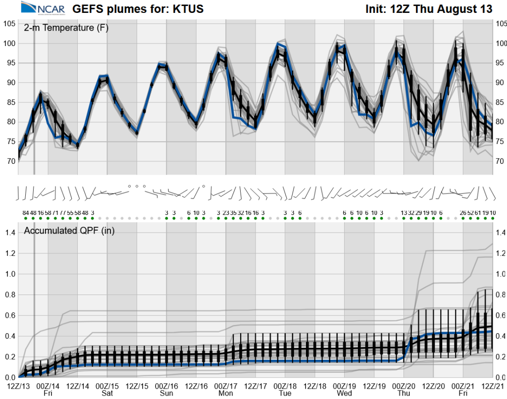
After today, the monsoon will be low-grade until late next week, reflecting the lack of significant moisture. Tropical activity south of the Baja Peninsula late next week is predicted to bring in additional moisture.
Discussion written by Pat Holbrook and Patrick Bunn