

Summary
Two tropical storms, Lowell and Karina, have recently developed in the Pacific, with Karina potentially affecting the Southwest U.S. if it moves northeast. Moisture is flowing into the region from remnants of tropical storm Iselle and the easterly monsoonal transport around the subtropical high. Surface dewpoint observations indicate a continuing moisture surge, with similar values and spatial pattern to yesterday.
Forecasts predict weaker thunderstorm activity today compared to yesterday. Tomorrow, severe storms are expected in Tucson and Phoenix, with heavy rainfall, strong winds, blowing dust, and a possible haboob. A polar low and the associated jet stream will drive storm activity from Saturday night through Monday, allowing storms to develop at any time of day. A break in precipitation is forecast from Tuesday on, though high temperatures are expected to drop below triple digits next week.
Yesterday’s Weather
Yesterday, we debated between the HRRR-UA WRF 12Z (below, left) and the 15Z, trying to determine which forecast was more likely.
We decided on the more aggressive 15Z forecast (below, left). What happened (right) was a blend between the two, with isolated storms more like the 12Z forecast, but with the intensity of the 15Z forecast.
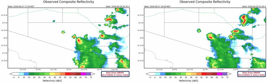
The observed radar reflectivity shows a storm at 5:30 pm (left) that produced a 67-mph microburst at Tucson International Airport; outflow from this storm helped develop the storm that produced over an inch of rain near downtown Tucson at 6 pm (right). Again, a blend of 12Z and 15Z forecasts: isolated, but more intense storms.
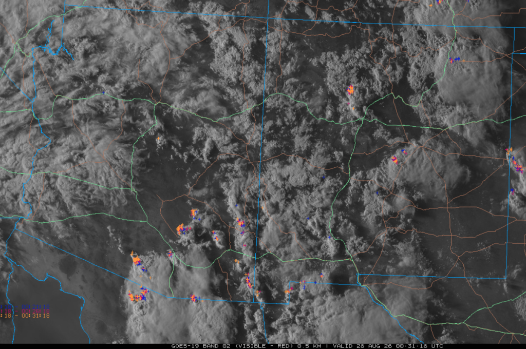
Visible satellite imagery at 5:30 pm, overlaid with lightning data, shows thunderstorms in southeast Arizona and northeast New Mexico. Most of the clouds in western and northern Arizona and parts of New Mexico were mid- and high-level clouds from former Tropical Storm Iselle.
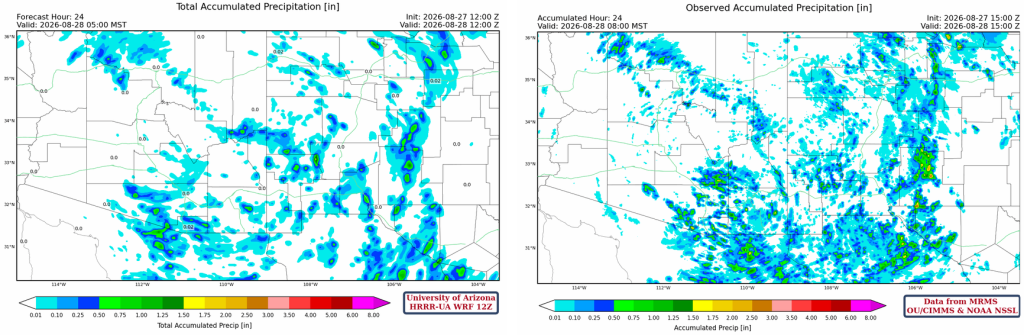
The HRRR-UA WRF 12Z 24-hour accumulated precipitation forecast (left) and corresponding observed precipitation from MRMS (right) are shown below. The forecast precipitation was close to observed in New Mexico. The forecast still underestimated precipitation in northern Mexico south of Douglas. Surge moisture resulted in more precipitation in the mountains east of Puerto Peñasco and in southeast Pinal County.
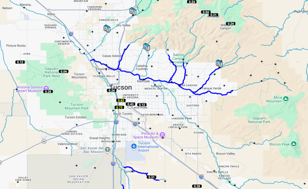
Pima County Flood Control alert gauges below show the rain was isolated but heavy. Other than the microburst over downtown Tucson, most other rain fell near the mountains. Only a few gauges in Maricopa County had light precipitation.
Analysis
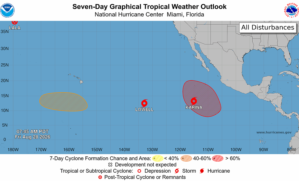
The National Hurricane Center (NHC) tropical weather outlook shows Tropical Storms Lowell and Karina formed yesterday. The tropics are a source of late-monsoon moisture, and any tropical systems near the southern tip of Baja could push moisture into Arizona. Lowell is too far west to affect Arizona, but Karina may affect the Southwest United States depending upon its movement.
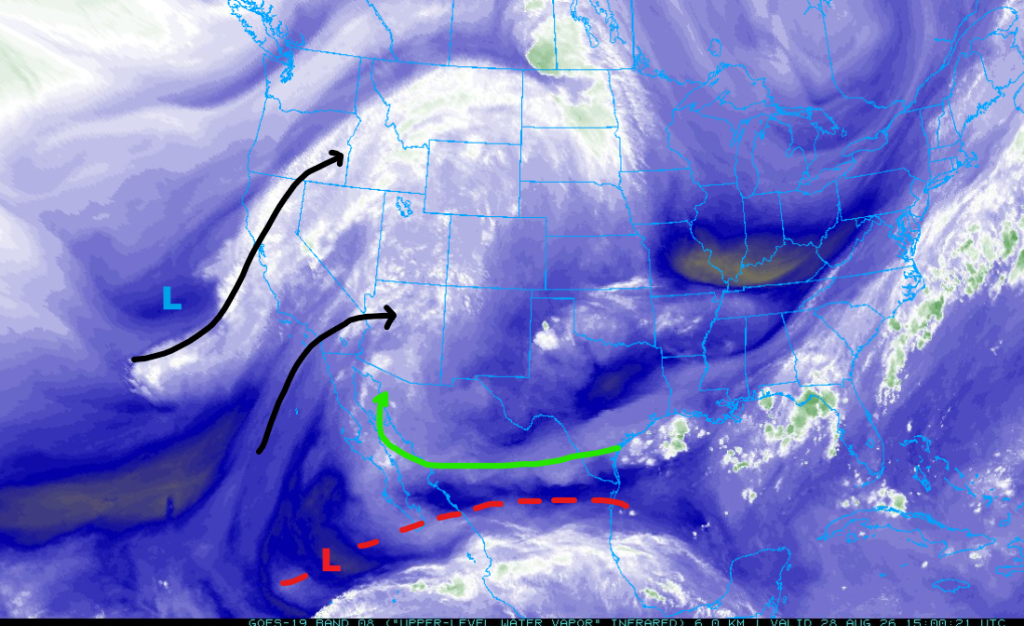
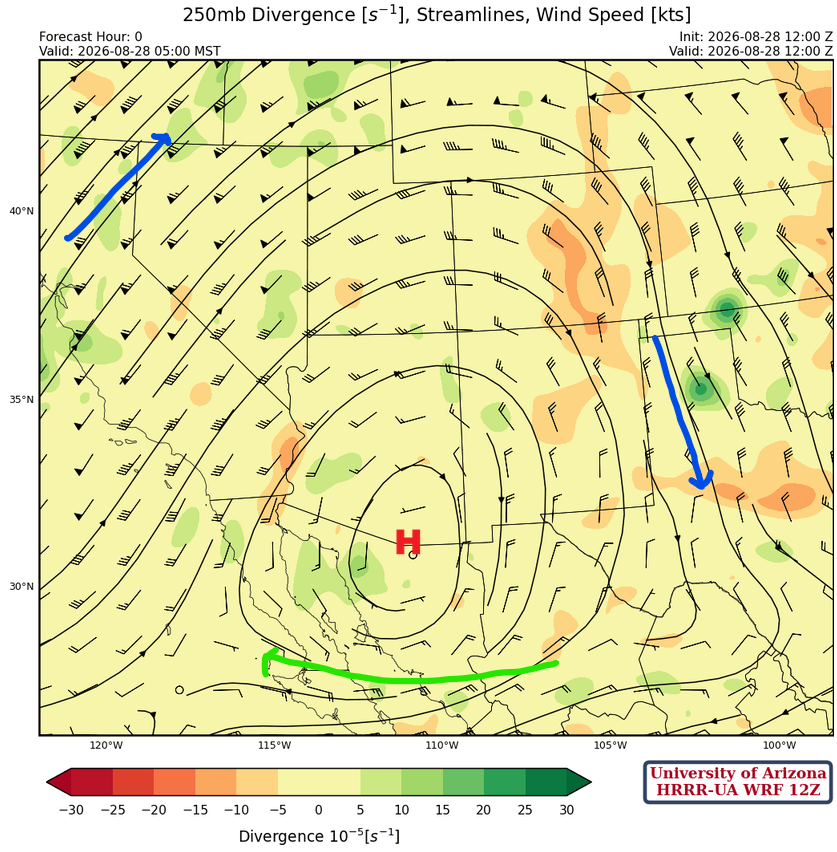
The Tropical Upper Tropospheric Trough (TUTT) has moved further west with a trough extending east into the Gulf of Mexico. The polar low is west of the California low, and the associated jet stream extends into Montana. Two other moisture flows come from the remains of Tropical Storm Iselle, and the flow to its south (green arrow) is around the subtropical high-pressure.
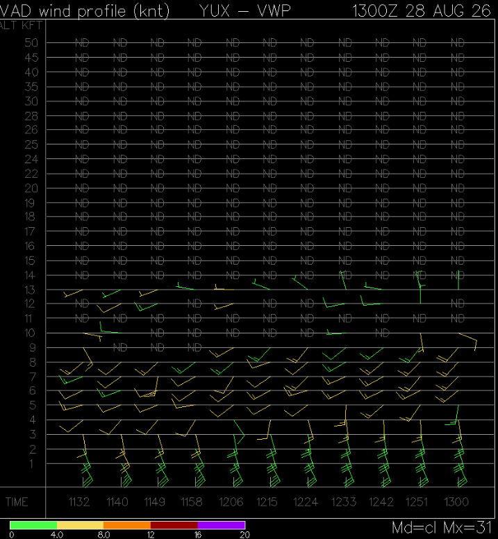
The Velocity Azimuth Display Wind Profile from Yuma shows the surge is continuing with a depth of 3000 feet.
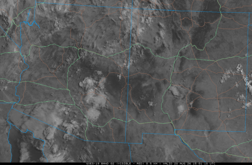
The visible satellite picture taken at 8 am shows scattered mid- and high-level clouds over Arizona, while New Mexico is mostly clear.
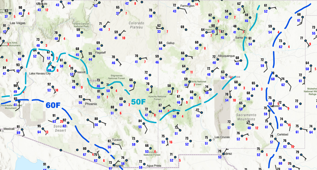
There has been no significant change in surface dewpoints since yesterday, as surge moisture is being balanced by vertical mixing of dry air aloft.
The HRRR-UA WRF 12Z initialization (left) and observed (right) sounding for Phoenix at 5 am are shown below. The forecast initialization captures the surge of moisture from 880 mb down to the surface with a little warming aloft just above 420 mb. The observed sounding better captures the mid-level moisture between 550 mb and 680 mb.

At 250mb, the ridge is just south of Nogales, with anticyclonic (clockwise) flow around it. The jet associated with the polar low off the West Coast is from California to Montana. The jet stream will continue to move east into the western United States over the weekend.
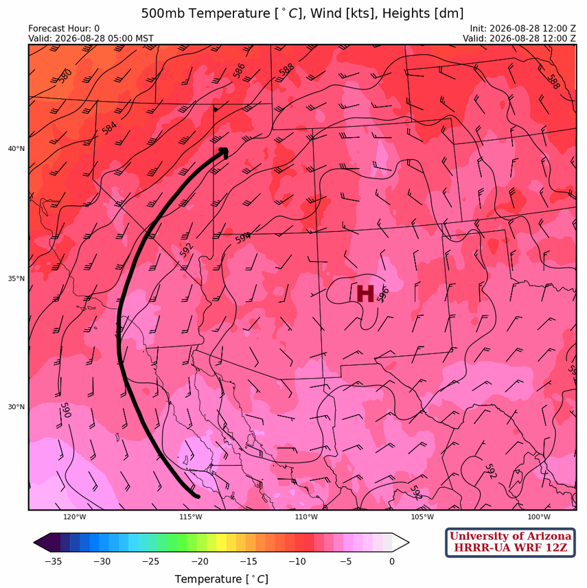
The high-pressure ridge in west-central New Mexico has a broad circulation over the western United States at 500 mb. Temperatures have cooled in California and Oregon due to the trough off the West Coast.
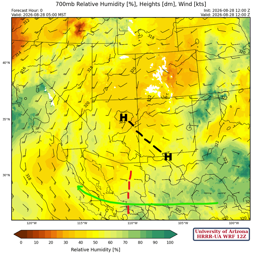
At 700mb, the monsoon high is over northeast Arizona with a ridge axis extending southeast to the El Paso area. A trough extends south from Douglas into Mexico. The circulation and moisture transport are weak across Mexico.
Today
The forecast sounding for Phoenix at 5:00 pm (below, left) shows a good profile for thunderstorm development because of increased low-level moisture. The Convective Available Potential Energy (CAPE) is around 600 [J/kg] with very little Convective Inhibition (CIN). The forecast sounding for Tucson at 3:00 pm (below, right) shows that, despite the low CIN indicated on the sounding, the CAPE is unimpressive. Warming aloft at 500 mb is probably the reason the Tucson sounding indicates less activity than yesterday.
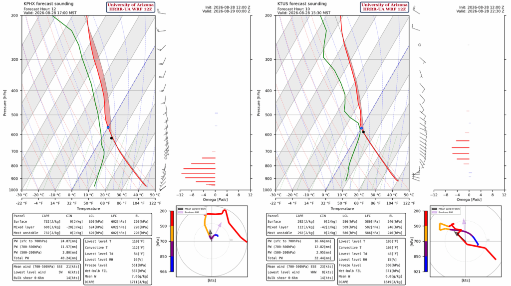
Thunderstorms aren’t forecast to be as strong in Pima County as they were yesterday, but they are predicted to develop further west into Maricopa County and the Phoenix area by evening. Wind gusts up to 40 mph and blowing dust can be expected with the storms, especially in the Phoenix metro area.
Tomorrow
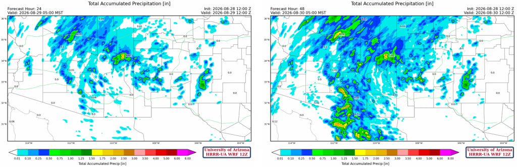
Tomorrow, a major increase in precipitation is forecast, with strong to severe storms in Tucson between 3-5 pm and in Phoenix between 6-9 pm. Threats include strong winds, heavy rain, blowing dust and/or a haboob. It’s still not cold enough aloft for large hail yet. Additional storms may develop overnight in eastern Pima and Pinal counties.
Total precipitation forecasts through 24 hours (bottom left) and 48 hours (bottom right) show most precipitation falling tomorrow afternoon and evening. Totals above 0.5″ and up to 2″ are predicted for central Pima and southern Pinal County.
Outlook
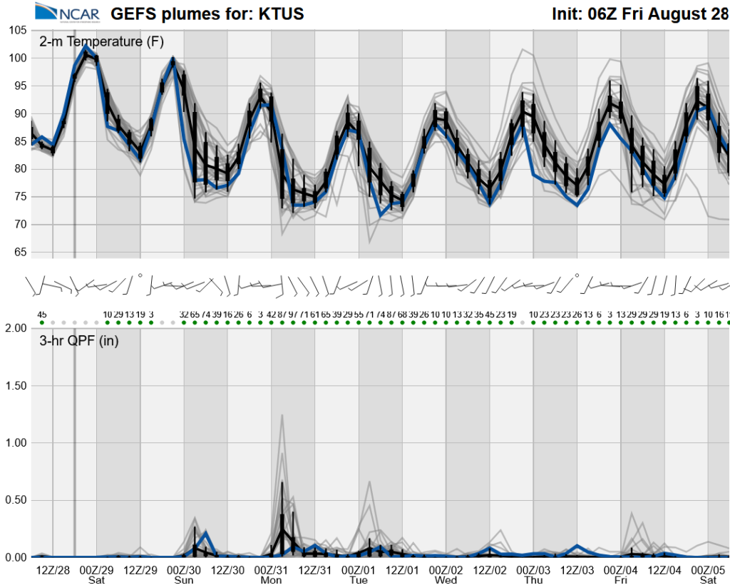
From Saturday to Sunday night, the polar jet stream will affect the area. Unlike the typical monsoon, synoptic-scale dynamics cause the ascent needed for storm development (positive vorticity advection). This means storms can occur day and night, and many per day as they’re not reliant on diurnal heating. The radar reflectivity forecast from tomorrow night at midnight to Monday at 5 pm illustrates this point with both day and nocturnal rainfall predicted.
From Tuesday, we will have a break in precipitation until the following weekend. It looks like there will be no more triple-digit high temperatures from Sunday into next week.
Discussion written by Pat Holbrook and Patrick Bunn