

Summary
Two tropical moisture streams from the Gulf of California/Hurricane Marie and Hurricane Karina are influencing the region as they merge over New Mexico. Moisture transport from these hurricanes is modest and may be the main source of error in recent forecasts. Satellite and surface observations show dry air moving into western Arizona, similar to a dry line in West Texas, while mid-level warming is capping most storm development.
Today, only strong surface-based updrafts are likely to produce isolated, non-severe storms with localized heavy rain, mainly over higher terrain. Tomorrow, storm activity is expected in southeastern Arizona and New Mexico, with precipitation shifting eastward. Light rain is possible in western Arizona by Saturday from flow associated with the dissipation of Marie off the West Coast. Overall storm chances are decreasing early next week, though another tropical system could increase rainfall chances next weekend.
Yesterday’s Weather
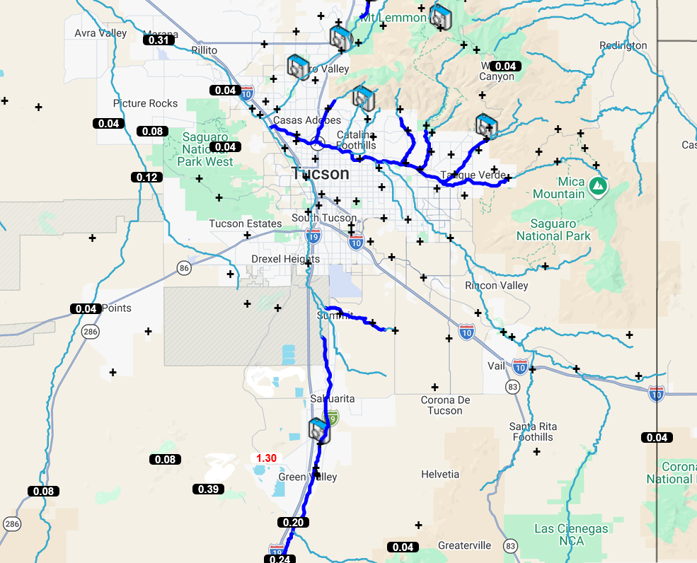
The visible satellite overlaid with lightning animation shows that warm air at 500 mb suppressed most storms. The 12Z HRRR-UA WRF forecast sounding for Nogales yesterday afternoon showed more Convective Available Potential Energy (CAPE) than the rest of the region, and thunderstorms formed in southeast Pima and Santa Cruz counties. A rain gauge near Green Valley reported 1.3″ of rain, but most of the rainfall was less than a third of an inch. Although the clouds in the mountains in the rest of the region did not have much vertical extent (probably topping out at less than 20,000 feet, 6km), some did produce light precipitation.
Overnight, as forecast, showers moved into southern Arizona, Cochise and Santa Cruz counties, from a dying Mesoscale Convective System (MCS) in Mexico. The showers dissipated before 3:00 am. Other light showers developed in eastern Pima and southern Pinal counties, as shown in the radar animation, and had much less precipitation than forecast. One reason may be that Hurricane Marie is supplying much less moisture than forecast. Also, the showers formed on the west side of the Tucson Mountains, not in the Tucson metro.
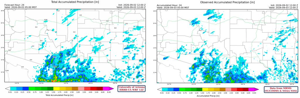
The HRRR-UA WRF 12Z 24-hour accumulated precipitation forecast (left) and corresponding observed precipitation from MRMS (right) are shown below. Typically, the forecast gets the location of the precipitation right, but in this case it overestimated the rainfall, especially south of the border.
The 24-hour rainfall totals for eastern Pima County are shown below.
Analysis
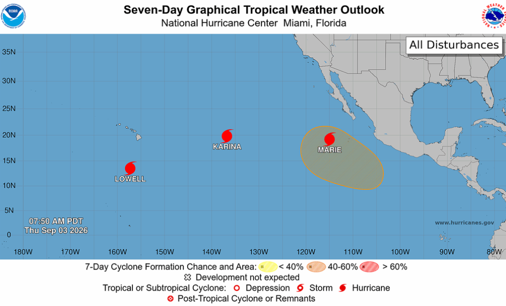
None of the three hurricanes in the central and eastern Tropical Pacific are expected to significantly affect Arizona.
Several flows of tropical moisture are entering the region. One flows from the southern Gulf of California northward into New Mexico (green arrow), and another comes from Hurricane Karina across northern Baja, combining with the first flow in central New Mexico (red arrow). The red arrow represents a mid- to upper-level moisture flow and contains little precipitable water. The other arrows (black) are related to the jet stream and circulation around the polar low off the California coast. A Tropical Upper Tropospheric Trough (TUTT) has moved further south into Mexico.

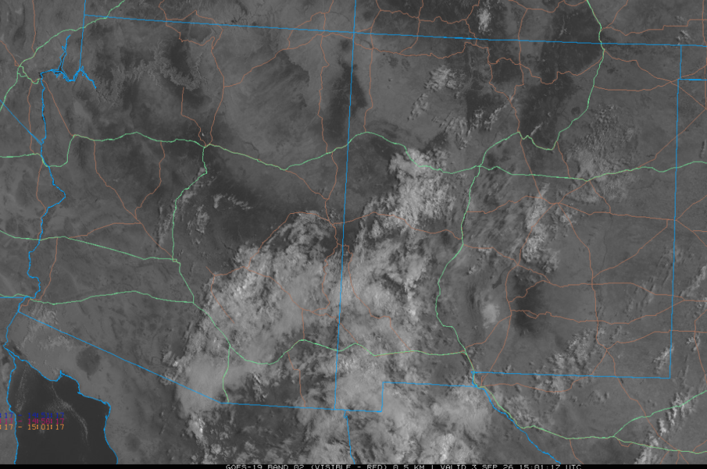
The 8 am visible satellite image shows debris clouds that moved into Mexico overnight. A few light showers remain in Graham County.
Surface dewpoint temperatures in western Arizona have decreased sharply as dry air moves in from the Pacific Ocean. It’s reminiscent of a West Texas dry line.

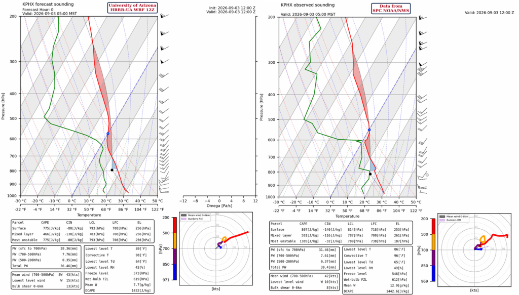
The HRRR-UA WRF 12Z initialization (left) and observed (right) sounding for Phoenix at 5 am are below. Both the initialization and observed sounding capture the warming between 500 and 600 mb, which will cap the boundary layer. Any cumulus clouds below the cap will be unable to produce precipitation, as there’s not enough vertical extent for droplet formation.
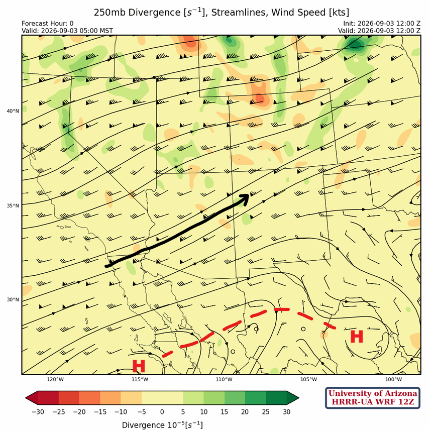
Like the water vapor satellite imagery, two jet streams are apparent at 250 mb. The one to the north (out of frame) is the polar jet stream and extends from northern California east to central Wyoming. The jet to the south (black arrow) is the reemergence of the subtropical jet and extends from northern Baja to southern Nebraska. The high-pressure ridge is in north-central Mexico, centered west of Laredo, and the other is west of the Baja Peninsula spur.
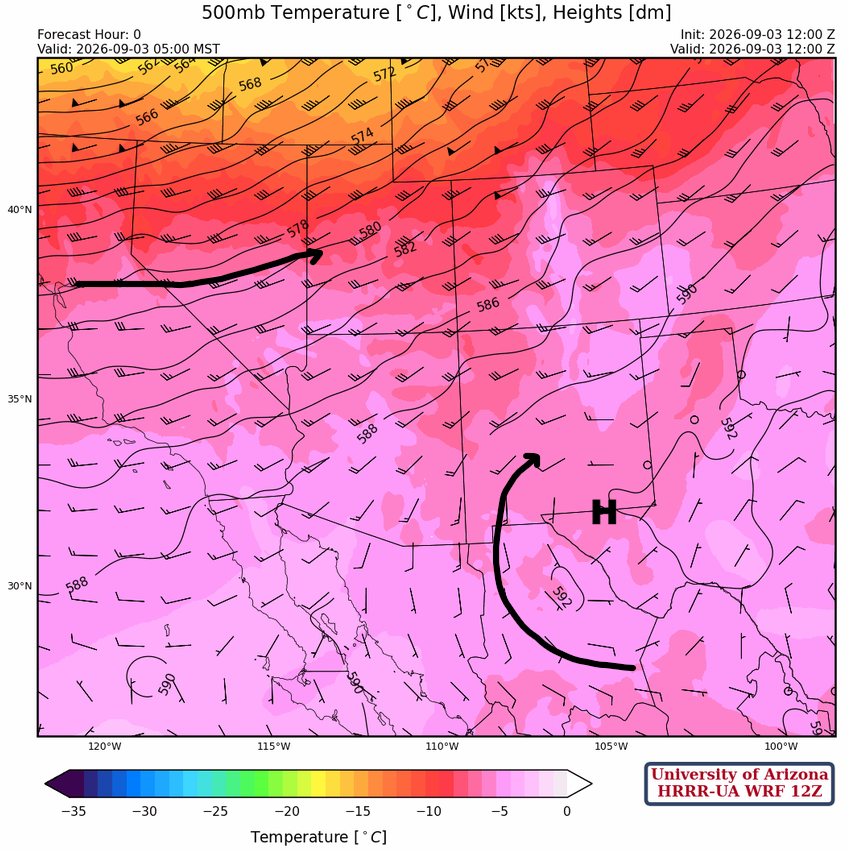
The polar jet is well to the north, and what’s left of the monsoon ridge is east of El Paso at 500mb. Warm air aloft is being pulled into Arizona.
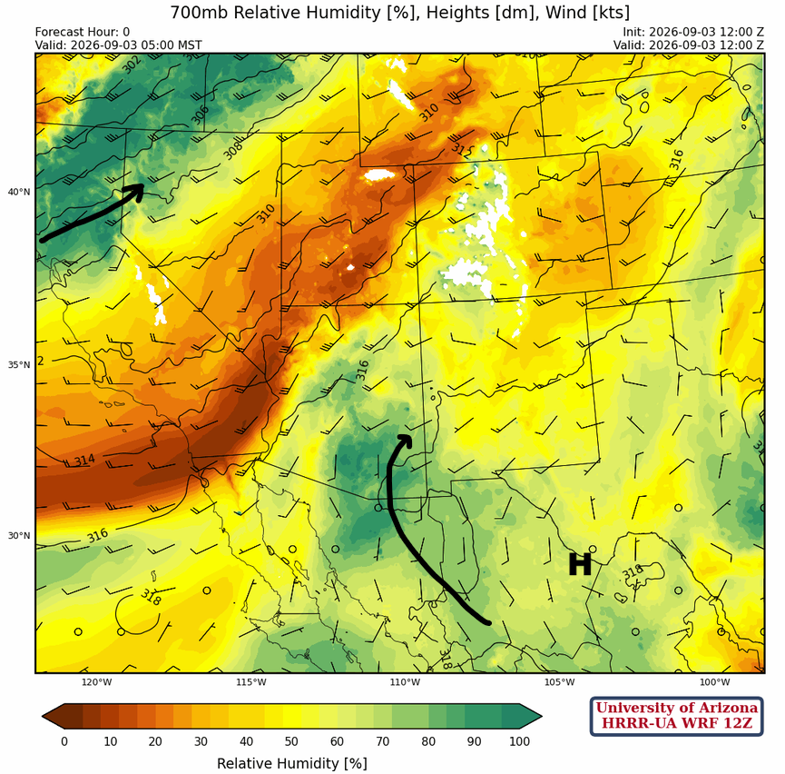
At 700mb, moisture in Arizona is rotating northward between the monsoon high located over Big Bend, Texas, and a trough off the West Coast. The moisture is mostly trapped under a mid-level cap from the international border northward, and we will need to reach convective temperatures for storms to start from the surface.
Today
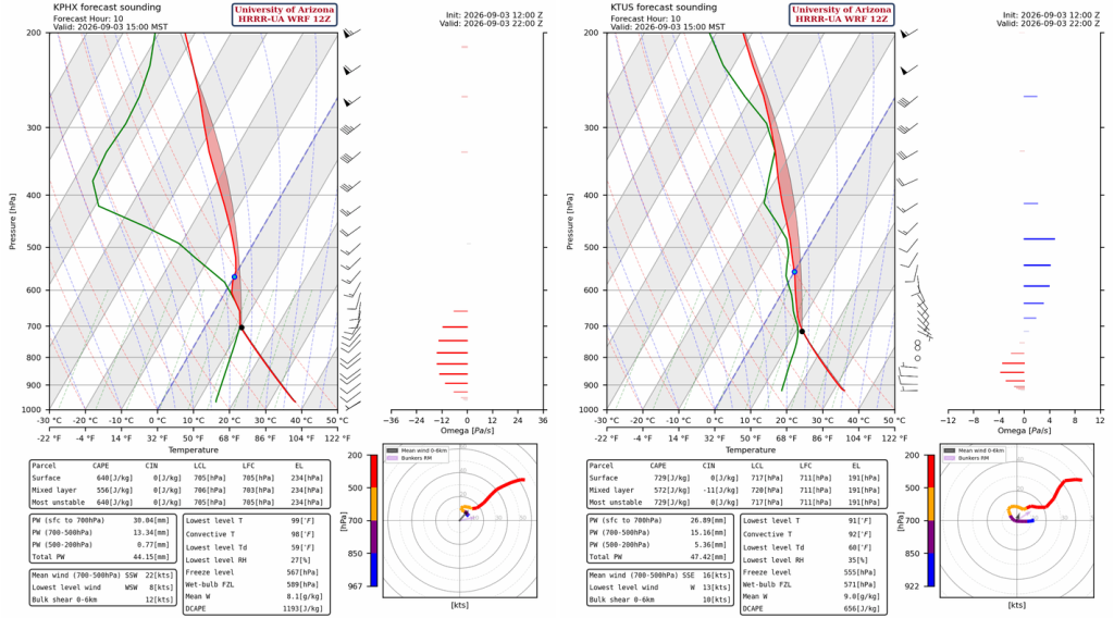
The Tucson and Phoenix soundings are similar, and there is enough Convective Available Potential Energy (CAPE) to get past the mid-level warming for storms this afternoon. Only the strongest surface-based updrafts will be able to break the cap, most likely over higher terrain. The storms that can use the CAPE will be non-severe and will produce only localized areas of heavy rain near the storm cores.
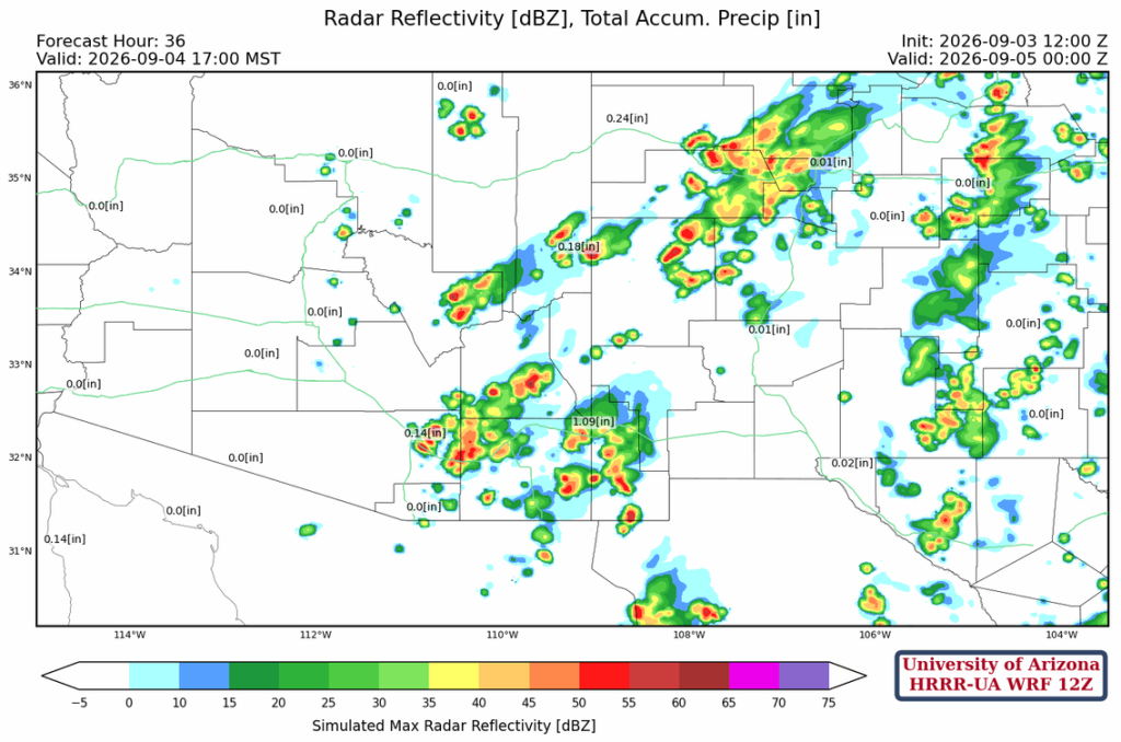
The radar reflectivity forecast shows the storms in Arizona east of the dry line, extending west into New Mexico. Storms will be more numerous in Cochise County and strongest in Santa Cruz and central Pima counties. Storms may form overnight in Pinal and far southeast Maricopa counties, then move up to northwest New Mexico, as shown below.
Tomorrow
The focus of the activity shifts east into eastern Pinal and Pima counties as the West Coast trough and the dry line move further east. Storms in New Mexico will be more numerous in the northern part of the state.
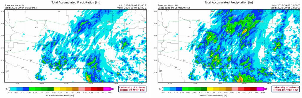
The forecast 24-hour total accumulated precipitation (left) and 48-hour (right) show most precipitation falls today in central and southern Arizona; the two-day precipitation in New Mexico is about the same each day.
Outlook
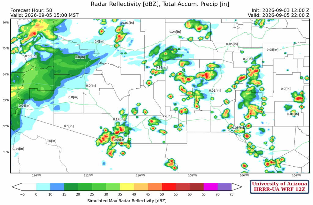
On Saturday, scattered showers and thunderstorms are expected over eastern Arizona and New Mexico, in about the same locations as Friday, over the mountains. In western Arizona, mid-level moisture from Hurricane Maria is pulled into the state by the subtropical jet stream. Most of the rain will be light.
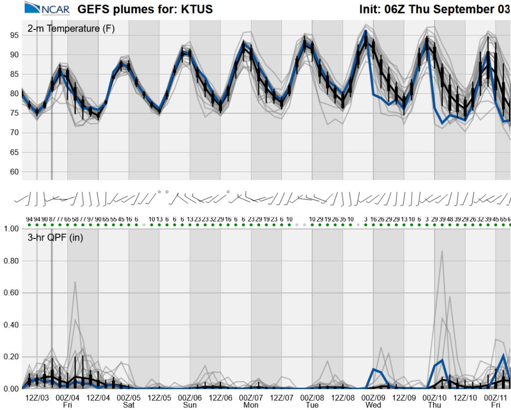
The long-range global model ensemble shows a marked decrease in storms Sunday through Thursday. Another tropical system may increase rain chances next weekend.
Discussion written by Pat Holbrook and Patrick Bunn