

Summary
Upper-level water vapor satellite analyses show a TUTT low moving northwest along the Baja coast, interacting with Gulf Surge moisture to create favorable conditions for storm development in Mexico over the last few days. However, the Gulf Surge has ended, leading to a gradual decline in thunderstorm activity over Arizona and New Mexico, although storms will persist for a few days, especially in higher elevations.
Forecast soundings indicate limited potential for storms in Phoenix and Tucson today, with only isolated storms likely in mountainous areas and possible outflow-driven storms in the Tucson area. Storms are expected to move westward tomorrow, potentially bringing rain to the Phoenix area and on to the Colorado River. Precipitation will generally be light in the lower deserts, with heavier amounts in higher terrain.
By Sunday, thunderstorms will again remain near the mountains, and the Phoenix area may see less activity due to previous cooling. Longer-range forecasts suggest continued day-to-day variability typical of the monsoon season, but precipitation chances remain low for Tucson in the near term.
Yesterday’s Weather
Strong thunderstorms developed in the mountains in northwest Arizona near Kingman, extending southeast to Payson, using Gulf Surge moisture that pushed north into Nevada. Lighter thunderstorms developed southeast into the White Mountains and down to El Paso, and some more thunderstorms were in the mountains of eastern New Mexico. Some storms developed in southeast Arizona, Cochise County, around the Dragoon Mountains and moved south to the Mexican border. Southwest Arizona stayed clear.
The infrared/lightning satellite imagery at 8 pm last night shows thunderstorms in southeast Cochise County to the boot heel of New Mexico; they moved southwest and developed into an MCS. The Douglas Airport reported a 68-mph wind gust at 9 pm. The MCS moved west with the northern edge skirting the international border, reaching Nogales by 2 am.
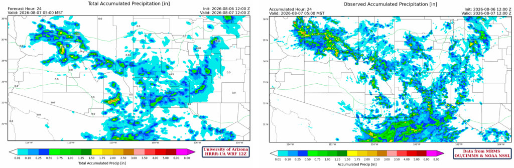
MRMS precipitation observation data (below, right) showed the heaviest rain was associated with the Gulf Surge moisture becoming lighter in eastern Arizona and New Mexico. Phoenix and Tucson metro areas were generally free from rain. The HRRR-UA WRF 12Z 24-hour accumulated precipitation forecast (below, left) shows that, except for an underestimation in northwest Cochise County and south of the border associated with the MCS, observed precipitation amounts and location were generally in good agreement over Arizona and New Mexico.
Analysis
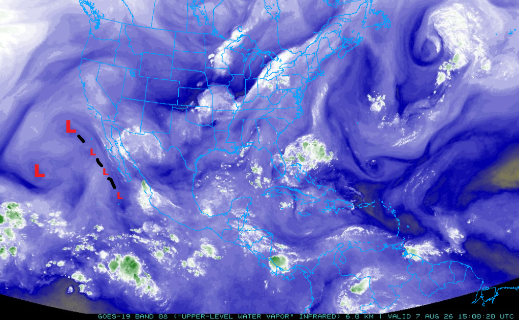
The water vapor satellite image from 8 am this morning shows the movement of a TUTT low as it moved northwestward paralleling the Baja coast over the last three days (shown by smaller “L”s). This TUTT low aided MCS/MCC development in Mexico as it combined with Gulf Surge moisture that was moving northward. The combination of Gulf Surge moisture and the TUTT low creates a favorable upper air environment for an MCS to develop in. There’s another TUTT low to its southwest, and their respective flows are interacting.
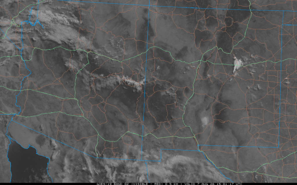
The visible satellite image from 8 am shows only a few showers near Las Vegas, NM. Otherwise, only a scattered amount of mid and high-level clouds are present.
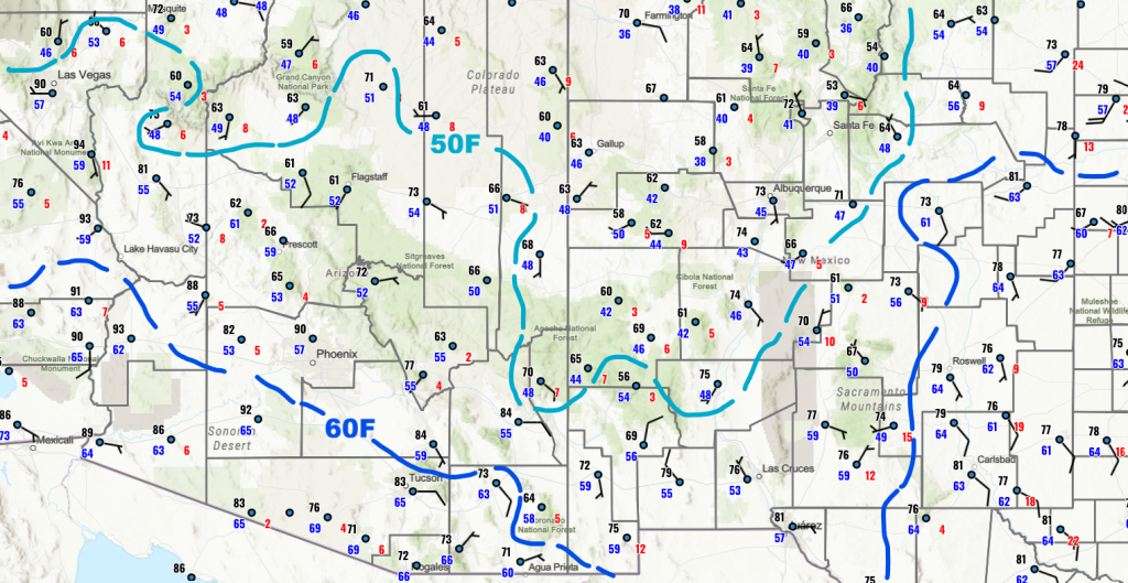
The 60°F dewpoint temperature line has retreated to the south across central and southeast Arizona, and the 50°F dewpoint temperature has also retreated across northeast Arizona and New Mexico. More importantly, Gulf Surge has ended. This does not mean an immediate decline in thunderstorm activity, but a slow decline will happen over the next few days.
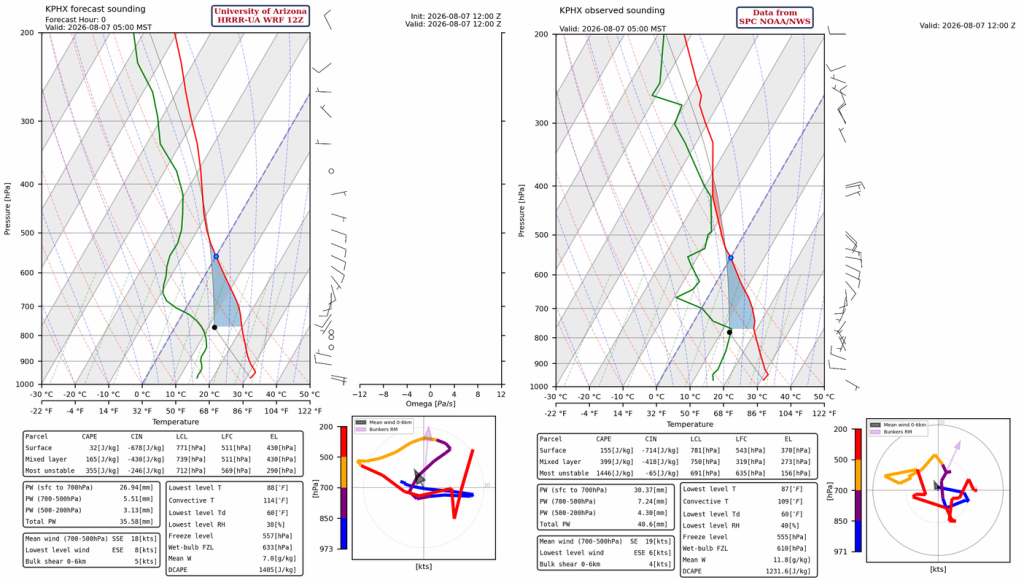
The 12Z HRRR-UA WRF forecast initialization vs the observed sounding from Phoenix at 5 am shows a 5 mm (0.2”) underestimation in precipitable water through the atmosphere in the 12Z initialization versus the observed value, especially in the layer between 900 and 780 mb. We’re inclined to think that the initialization is the more representative value as it’s more consistent with the surface dewpoint analysis above.
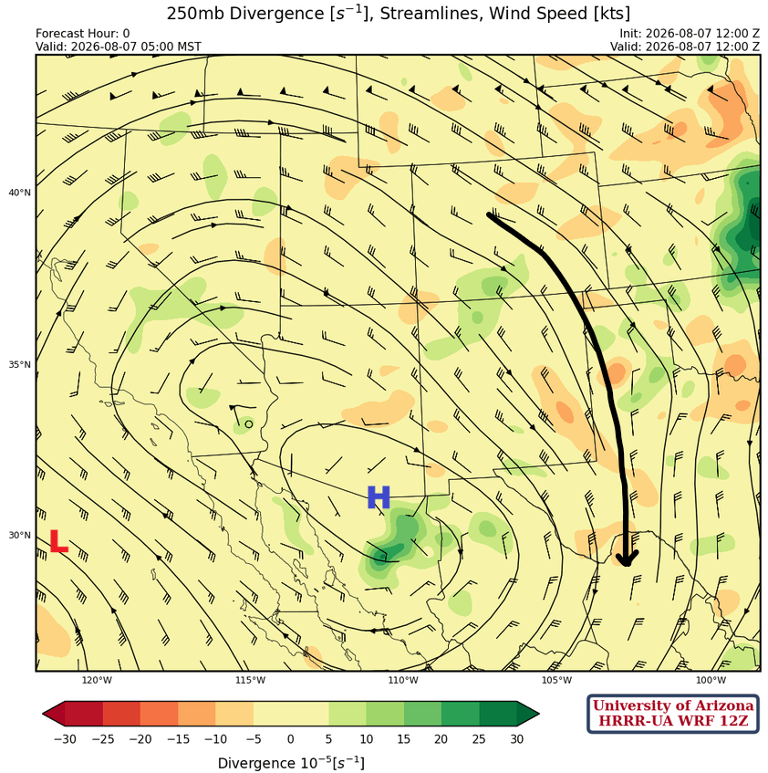
At 250 mb, the low west of Baja and its associated wind flow are positioned incorrectly. The numerical weather prediction models have merged the two TUTT lows shown on the water vapor satellite above into one broad low. In actuality, the two TUTT lows are moving around a common midpoint. This is known as the Fujiwhara effect, named after the Japanese meteorologist Sakuhei Fujiwhara. It’s difficult to determine if this will significantly affect the forecast.
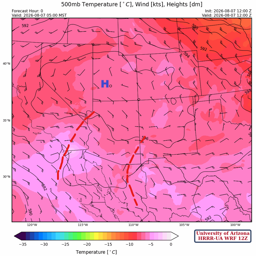
Two short waves are rotating around the bottom of the monsoon high-pressure ridge at 500mb, which has now moved to southern Utah.
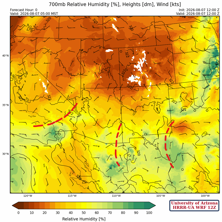
At 700mb, another shortwave trough is at this level in the Big Bend area; each is about a day apart in travel time. So the trough in the Big Bend may affect Arizona tomorrow, while the one in eastern Arizona will affect us today.
Today
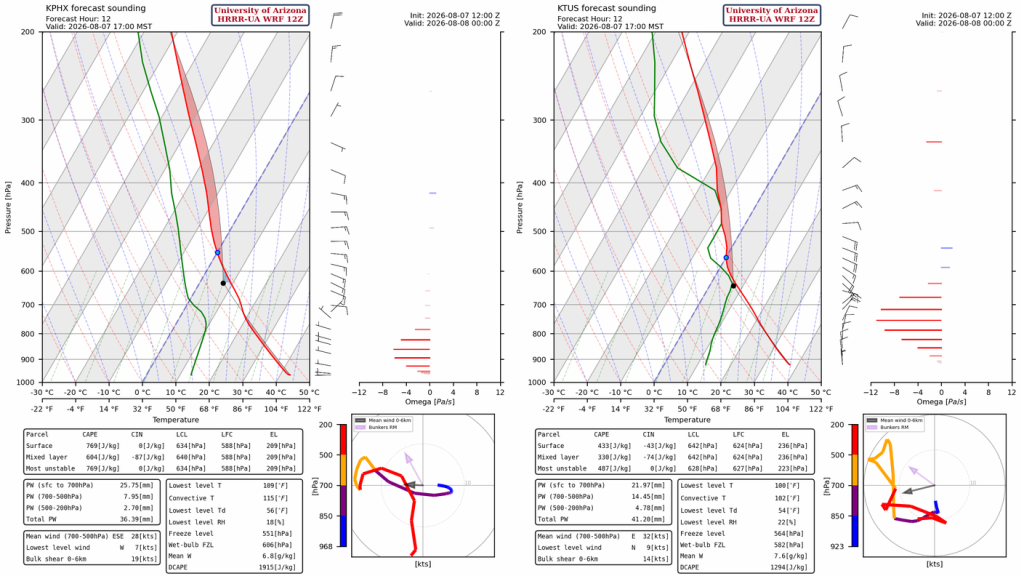
The Phoenix forecast sounding for 5 pm (below, left) does not have enough Convective Available Potential Energy (CAPE) to overcome Convective Inhibition (CIN). Tucson has a similar problem, but storms will form on the mountains, and thunderstorm outflow could produce isolated storms in the metro area.
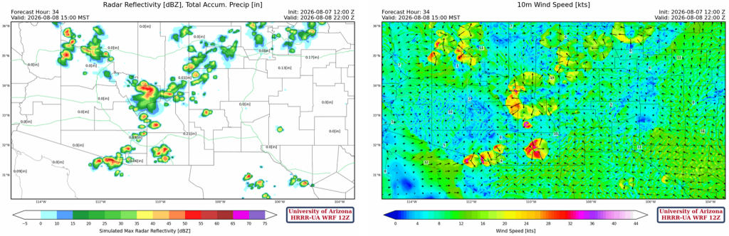
The 12Z HRRR-UA WRF (left) shows some storms moving into the southern part of the Tucson metro in the late evening, followed by a storm moving into southeast Pinal County after sunset, crossing I-10. The 15Z HRRR-UA WRF (right) is similar, but does not show storms as far north as the 12Z forecast.
Tomorrow
Tomorrow afternoon is like today except for the timing of the storms. The forecast below is for 3 pm, two hours earlier than the forecast of peak activity for today. Thunderstorms move west to the Colorado River by midnight. The Phoenix metro area and the rest of Maricopa County may also get rain.
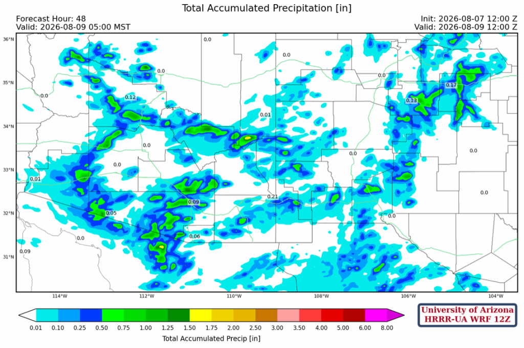
The forecast 48-hour precipitation accumulation shows light totals (<0.5″) in the lower deserts of SE Arizona, with only the higher terrain and surrounding areas getting more (>0.5″). If the storms move west in Maricopa County and continue to develop toward the Colorado River, they could also drop >0.5″ of rain.
Outlook
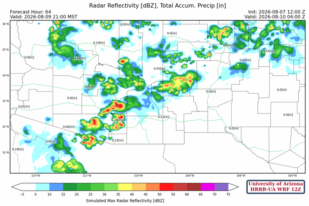
For southern Arizona on Sunday, there is not much change in the afternoon and evening thunderstorms, but the storms will stay near the mountains in Tucson. The Phoenix area may see a down day on Sunday due to cooling from Saturday night’s storms.
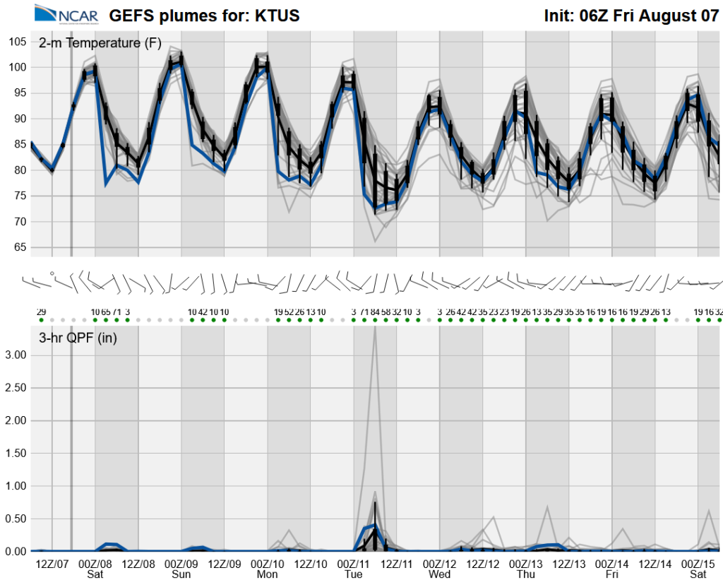
The long-range global model ensemble forecasts show typical day-to-day variability with the monsoon, though with low chances of precipitation at the Tucson airport for the next three days. Maybe next week will be better.
Discussion written by Pat Holbrook and Patrick Bunn