

Summary
Tropical Storm Iselle has formed rapidly and is expected to strengthen into a hurricane soon. Currently, a TUTT low remains over south-central Mexico. Satellite and radar images from this morning show scattered showers and thunderstorms, primarily north of I-10 and into California. While surface dewpoints are decreasing, especially in eastern New Mexico, limiting activity at low elevations, dewpoints remain sufficient for storm development at higher elevations.
Forecasts indicate limited thunderstorm activity for Phoenix and Tucson today due to insufficient Convective Available Potential Energy and Convective Inhibition due to dry air at 700 mb. Tomorrow, the monsoon ridge will begin to rebuild, leading to a slight increase in storms in New Mexico and northern Mexico, but Arizona will see little to no activity. By Wednesday, thunderstorms may return to southern Arizona, though severe weather is not expected. A greater chance of rain is forecast for the weekend.
Yesterday’s Weather
Yesterday afternoon started with thunderstorms across northern Arizona and isolated storms across the south. Then by late afternoon, a cluster of thunderstorms developed over eastern Pima and Santa Cruz counties and moved west-northwest into Tucson and central Pima County before turning north into western Pinal and central and western Maricopa counties. These storms contained mostly blowing dust and strong winds, with Phoenix Sky Harbor Airport reporting a gust to 55 mph.
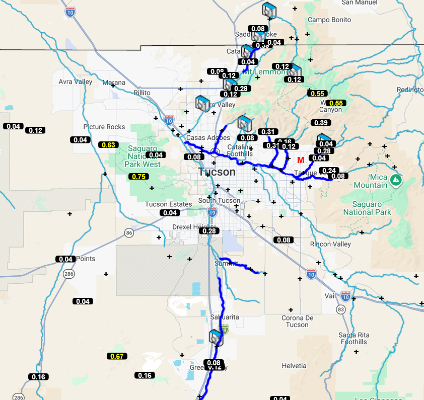
Precipitation totals in eastern Pima County show that the storms were mainly in and near the mountains where >0.5″ fell, whereas in the foothills totals were <0.3″.
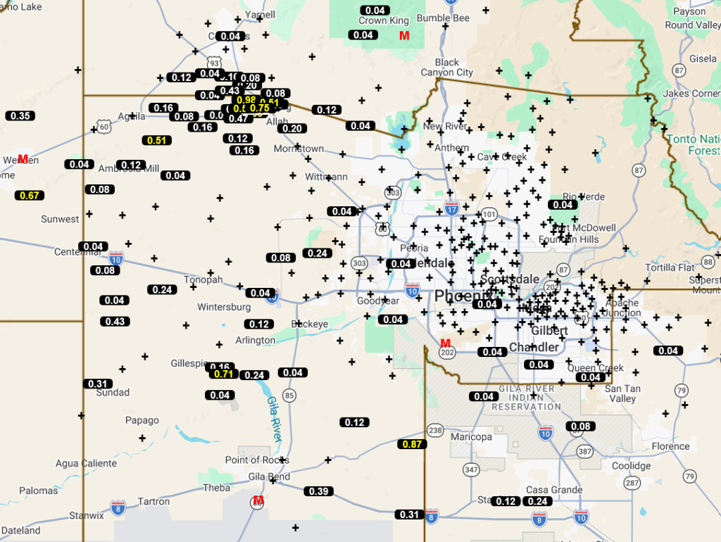
For Maricopa County, the precipitation was mainly over the western half of the county.
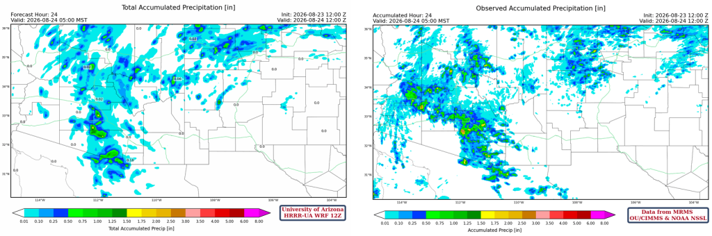
The HRRR-UA WRF 12Z 24-hour accumulated precipitation forecast (left) and corresponding observed precipitation from MRMS (right) are shown below. The MRMS observed data show a broad view of precipitation across the region: one area of precipitation was the more typical storms across northern Arizona, and another was a cluster of thunderstorms that developed from Tucson northwest to Maricopa and La Paz counties. The forecast did well with the two clusters of thunderstorms, except the storms extended further into western Maricopa and La Paz than predicted.
The cloud camera on UofA campus caught the storm that hit the Catalina Mountains.
Analysis
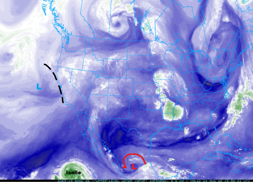
Tropical Storm Iselle has formed quickly and is expected to become a hurricane later today. A Tropical Upper Tropospheric Trough (TUTT) low remains in south-central Mexico, while the upper low and trough along the west coast are lifting northeast.
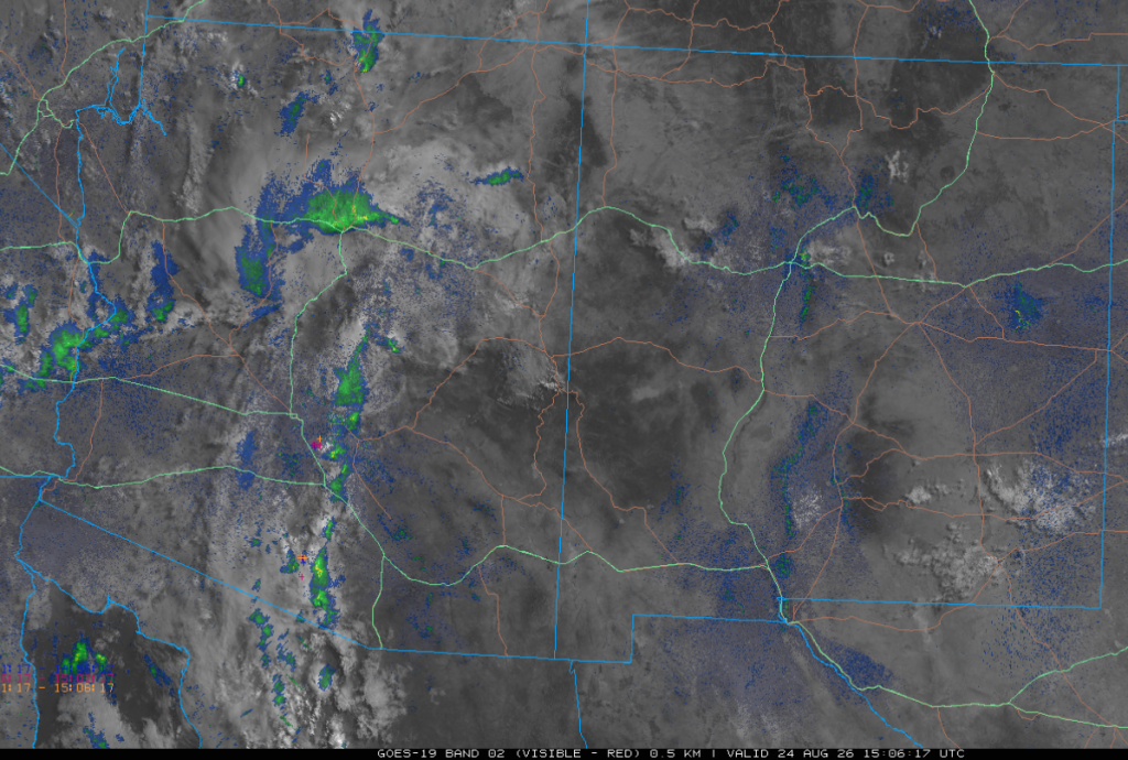
The visible satellite image overlaid with radar and lightning data from 8 am shows a thin line of showers from central Pima County to near Casa Grande, then north to Flagstaff. More showers extend from Flagstaff west into California north of I-10. The trough off the West Coast continues to pull showers north.
Surface dewpoint temperatures show decreasing moisture across the region, especially in eastern New Mexico. However, 50°F dewpoints in the mountains are generally enough for thunderstorms to develop.

The HRRR-UA WRF 12Z initialization (left) and observed (right) sounding for Phoenix at 5 am are shown below. There are clouds in the profile with bases about 14,000 feet (4.2 km) and tops extending to 30,000 feet (9 km). There appears to be too much cooling below 750mb to get surface-based thunderstorms this afternoon.

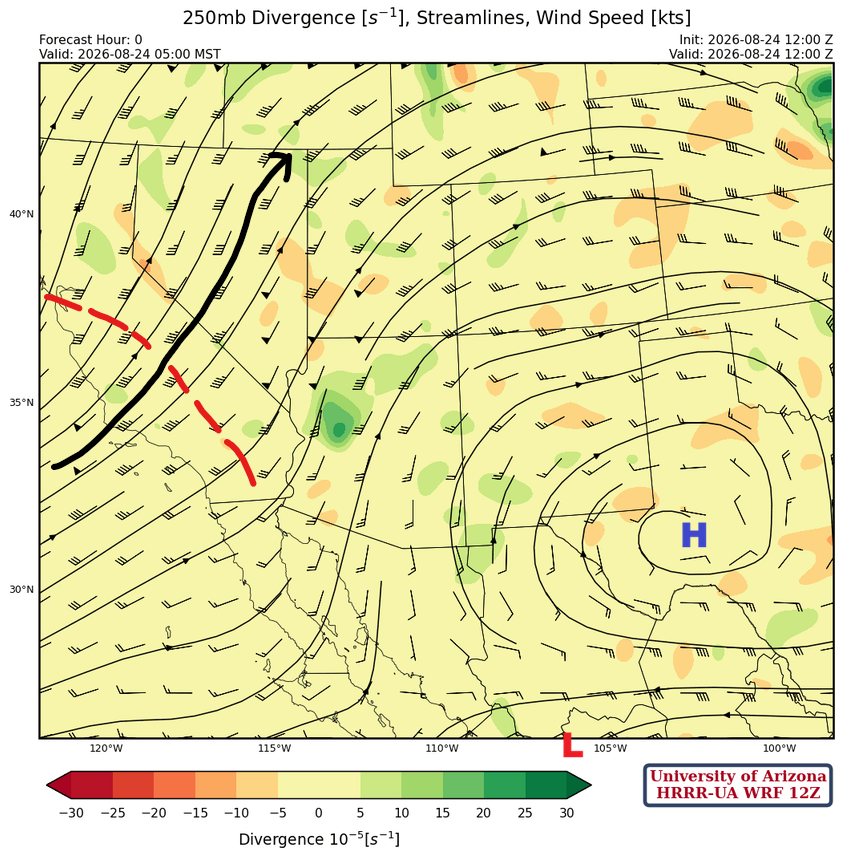
At 250 mb, the jet stream and trough will dry Arizona out for the next few days as they move east. The subtropical high-pressure ridge is near Midland, Texas, while the TUTT low is in south-central Mexico.
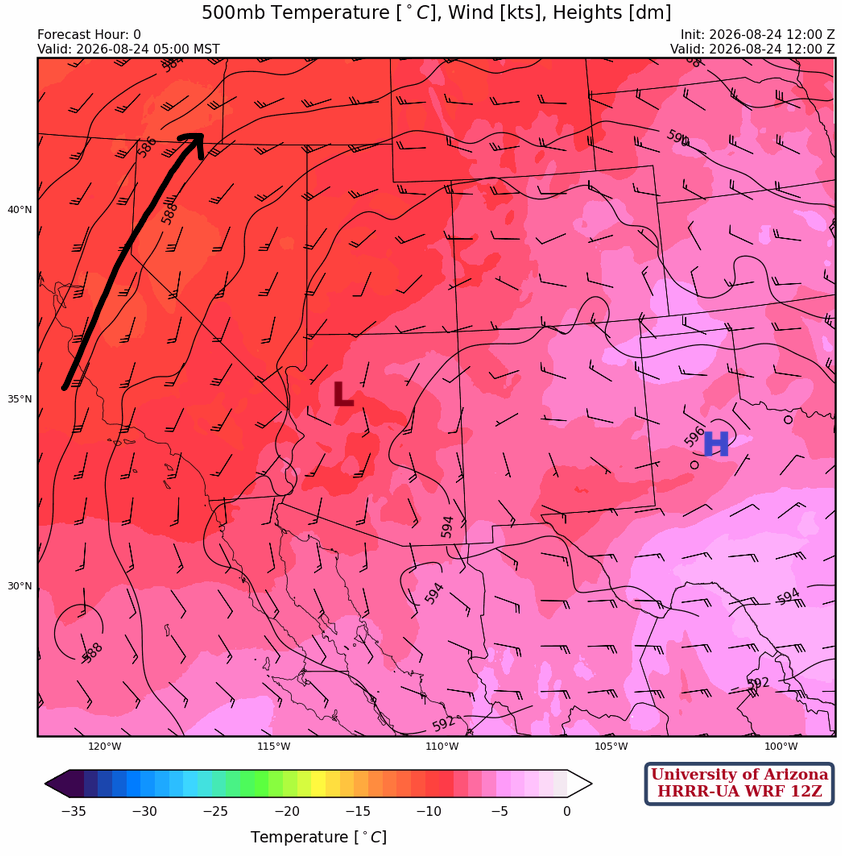
At 500mb, the ridge is near Lubbock, Texas, with a broad anticyclonic circulation dominating the region. A small cyclonic circulation (anti-clockwise) west of Flagstaff is moving north and will be the focus of storms in northern Arizona and southern Utah.
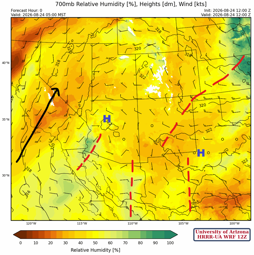
The monsoon ridge has two centers at 700 mb; one in northern Arizona and another near Midland, Texas. A trough splitting the ridge extends southwest from Kansas to north central New Mexico. Several short-wave troughs are rotating under the trough and will aid thunderstorm development along the spine of the Sierra Madre mountains.
Today
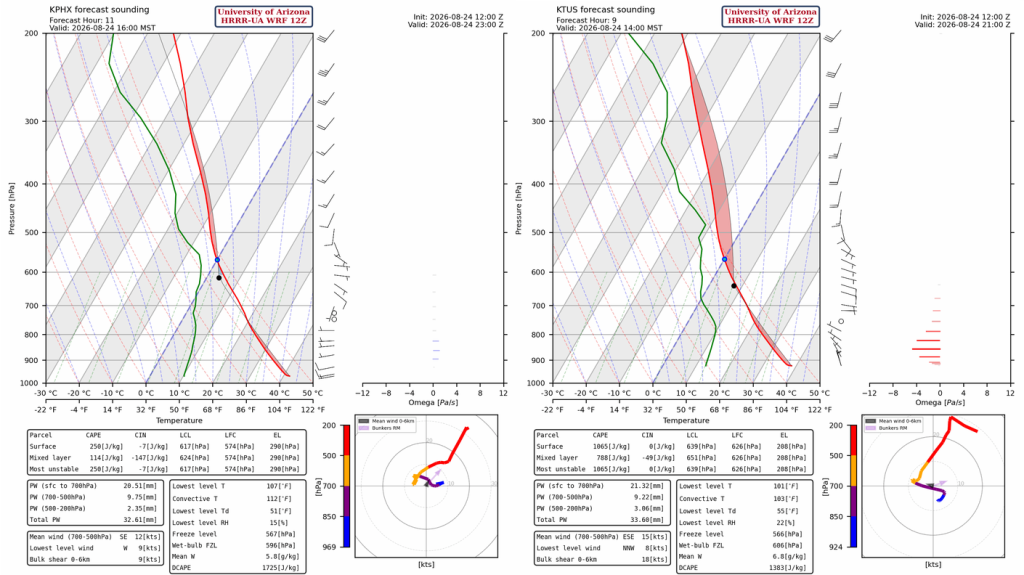
For Phoenix, the forecast sounding at 4 pm (left), there is too much Convective Inhibition (CIN) and not enough Convective Available Potential Energy (CAPE) to make thunderstorms. In Tucson at 2 pm (right), there may also be too much CIN in the wake of yesterday’s storms. The dry air at 700 mb will inhibit convection from reaching the Lifting Condensation Level (LCL).
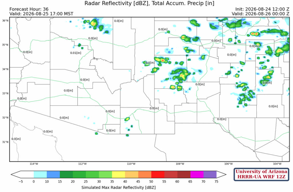
The forecast radar reflectivity for this afternoon is lackluster in southern Arizona and New Mexico, with only a few storms over the northern half of the region.
Tomorrow
The monsoon ridge will begin building back into the region with a few more storms in New Mexico, but mainly in northern Mexico. Arizona will have few to no storms.
Outlook
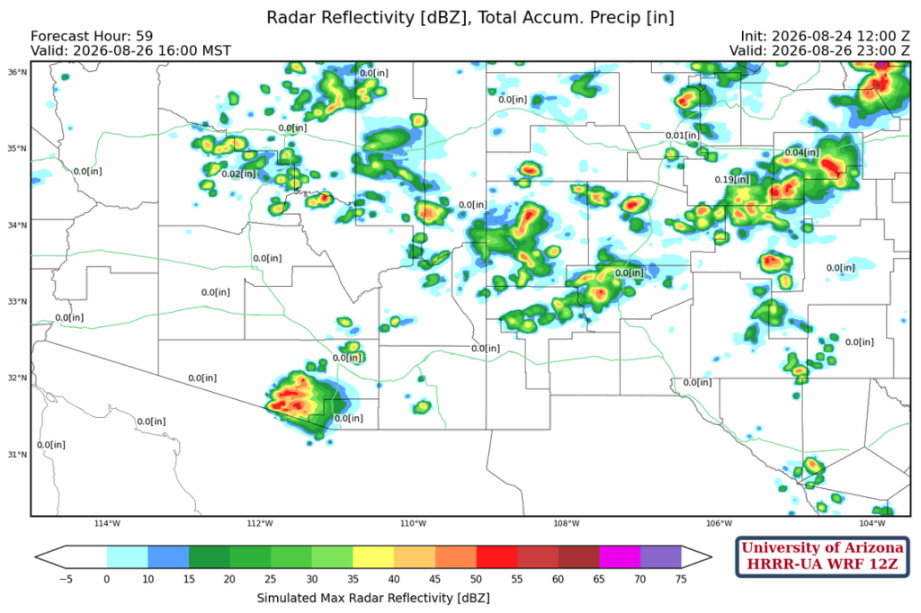
The monsoon ridge continues to move further west, with an uptick in thunderstorms in southern Arizona on Wednesday. No severe storms are expected, but a few thunderstorms may affect Tucson in the afternoon.
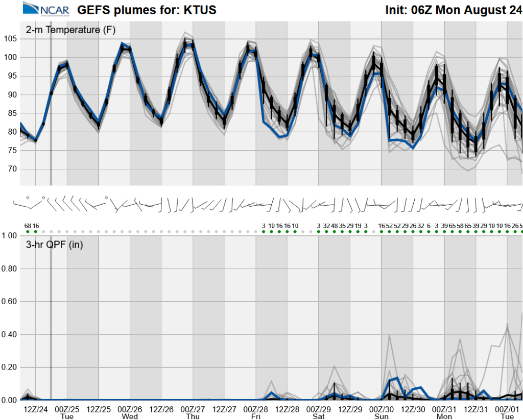
Long-range global model forecast shows a return of moisture Thursday through the weekend. The best chance of rain in the valleys will be this weekend.
Discussion written by Pat Holbrook and Patrick Bunn