

Summary
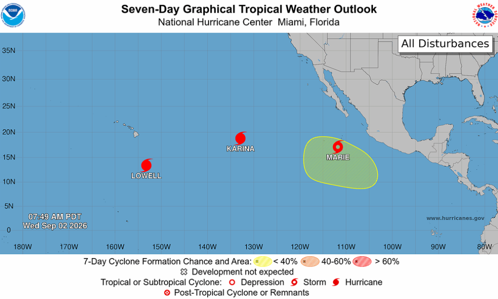
The tropics remain active with two hurricanes and one tropical storm in the Pacific. The furthest east, Tropical Storm Marie, is expected to become a hurricane as it moves northwest over the Pacific. Marie will stay west of the coast and not directly affect Arizona. However, its circulation could increase moisture in parts of Arizona, supporting thunderstorm development. Convergence of the passing trough/jet stream and monsoon moisture is providing favorable conditions for thunderstorm development in southern Arizona.
Today, thunderstorms are possible in southern Arizona, especially around Nogales and Tucson, though no severe weather is expected. A Mesoscale Convective System may bring heavy rain to southern Arizona early Thursday morning, with varying rain totals in the Tucson metro from 0.5″ to more than 1″ at higher elevations. Continued storm activity is expected into the weekend, although storms may become more isolated next week.
Yesterday’s Weather
The visible satellite overlaid with mosaic radar shows isolated thunderstorms in Arizona and the western half of New Mexico. Thunderstorms were more concentrated in eastern New Mexico, moving off the mountains and almost reaching the Texas border before dissipating around 9 pm.
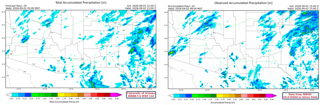
The HRRR-UA WRF 12Z 24-hour accumulated precipitation forecast (left) and corresponding observed precipitation from MRMS (right) are shown below. Overall, a good forecast, though slightly light on precipitation associated with mountain thunderstorms.
Analysis
The tropics are still active with two hurricanes and a tropical storm. Tropical Storm Marie will become a hurricane later today.
The forecast track for Marie is shown below. The forecast on Monday showed the storm moving into San Diego, but now the track is well west of the coast. Although this storm will not directly affect Arizona, the circulation around Marie may push additional moisture into southwest Arizona tomorrow and northwest Arizona on Sunday, which could support thunderstorm development.
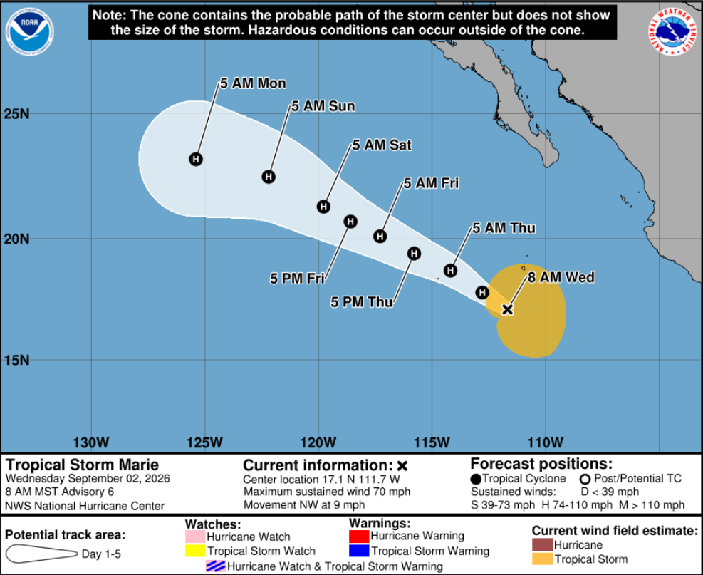
Tropical Storm Marie should reach hurricane status later today as it moves northwest over the Pacific Ocean. Edouard formed in the Gulf of Mexico and moved onshore near Beaumont, Texas. It has since weakened to a tropical depression, although it looks more impressive on the satellite image now than it ever did as a tropical storm.

The visible satellite image at 8 am shows scattered clouds across the region.
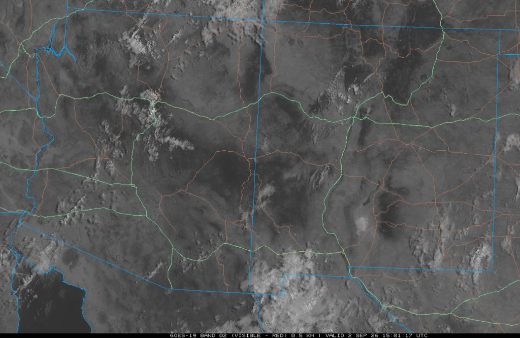
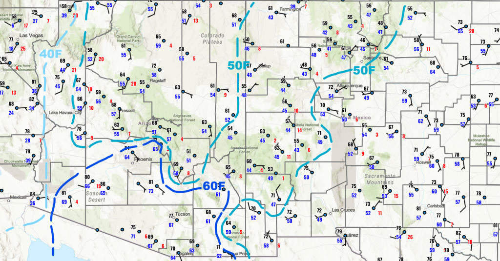
Dry air has moved into Arizona along the Colorado River to the west; the rest of Arizona remains humid. In New Mexico, some drying is shown in the north-central part of the state.
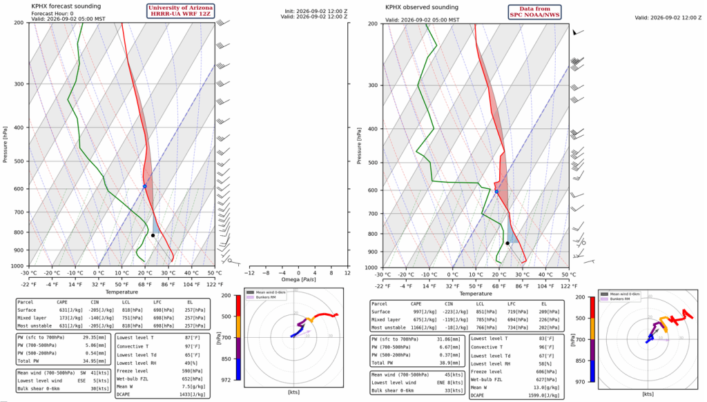
The HRRR-UA WRF 12Z initialization (left) and observed (right) sounding for Phoenix at 5 am are below. There are minor differences near 600mb as moisture is being pulled north in a southwest flow at that level. This moisture increased the precipitable water by a couple of millimeters; it’s now 35mm initialization and 39 mm observed.
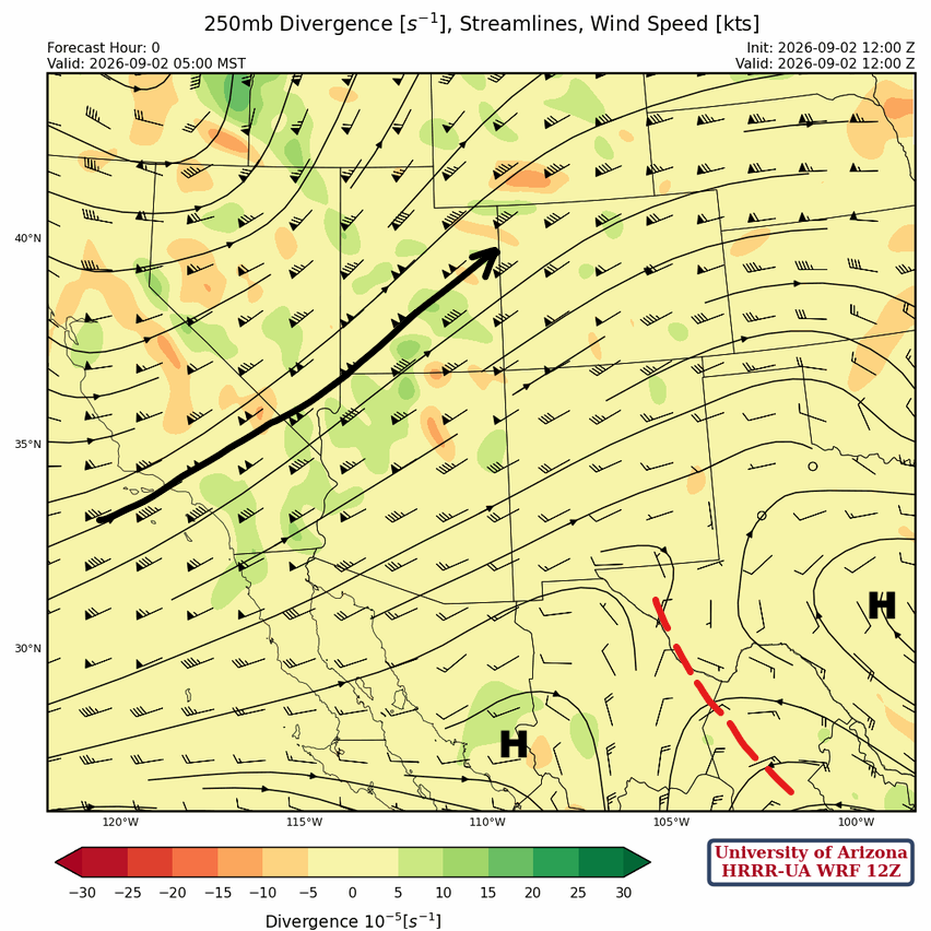
At 250mb, the polar jet is cutting across south-central California into central Utah with a short-wave trough rotating around the polar low in Oregon. A ridge is in western Mexico east of Hermosillo and a second center in south central Texas. A trough is between the ridges, extending from the Big Bend southeast into Mexico.
The ridge is centered over West Texas, with warm air aloft moving into Arizona at 500mb. The jet stream is almost vertically stacked with the 250mb jet stream location. A short-wave trough is moving northeast over Nevada.

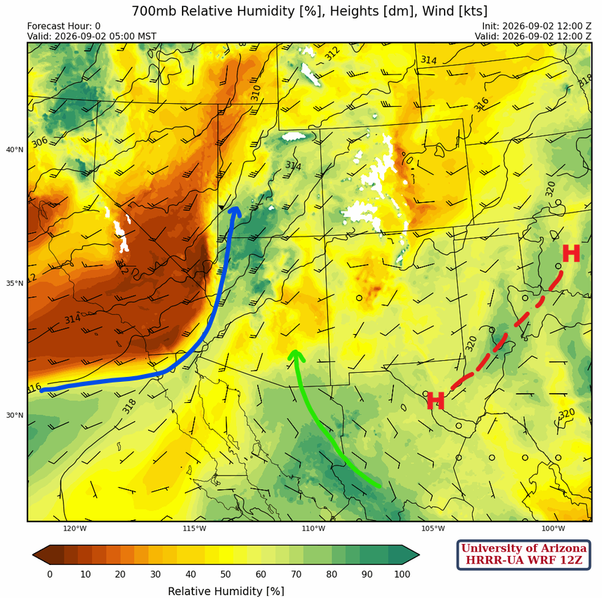
At 700mb, the monsoon ridge is over west Texas, and the flow around it is pushing moisture into central Arizona. A front in California (blue arrow) is bringing mid-level moisture across western Arizona and southern and eastern Utah. It is very dry behind the front from 700 mb down to the surface, with low dewpoint temperatures along and west of the Colorado River.
Today
Although the 4 pm forecast sounding shows a decent amount of Convective Available Potential Energy (CAPE), warming at 500 mb will slow development in Phoenix. Nogales has more CAPE and should be able to overcome the mid-level warming to produce thunderstorms.

Tucson is caught between a few showers near Phoenix and thunderstorms at Nogales and into Cochise County. The storms near Tucson should be mainly in and near the mountains. No severe weather is expected from these storms.
Tomorrow
A Mesoscale Convective System (MCS) is expected to move northward into southern Arizona early Thursday morning with locally heavy rain possible. Note that the 15Z forecast (right) has nearly ¾ inch of rain at the Tucson International Airport, which is down from the inch of rain forecast by the 12Z (left). The exact track of the MCS may be further west or east than the current forecast, with even less precipitation. The MCS will then move northeast into eastern Pinal, Graham County, and the White Mountains by afternoon and into northwest New Mexico in the evening.
Outlook
Early morning Friday storms develop in the Phoenix area and move north to the Mogollon Rim. More activity develops in southeast Arizona during the afternoon, producing non-severe storms and localized heavy rain.
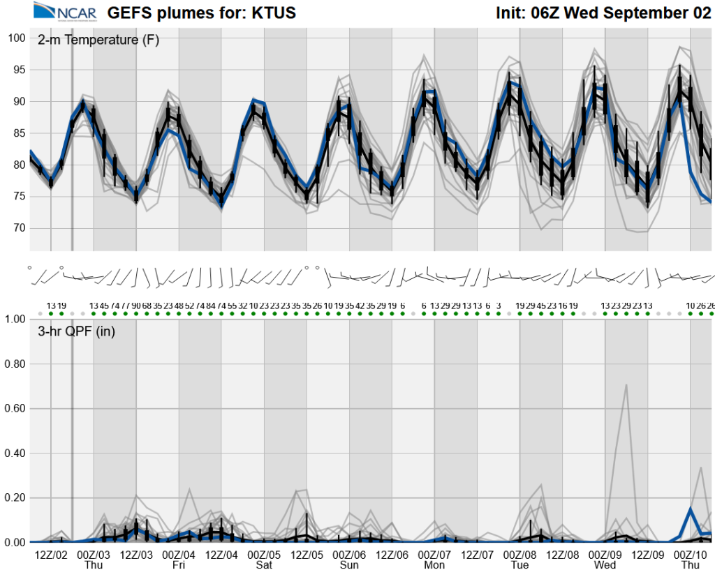
The long-range global model ensemble shows scattered storms are forecast each day throughout the weekend and next week, although storms may become more isolated from Monday and Tuesday onward.
Discussion written by Pat Holbrook and Patrick Bunn