

Summary
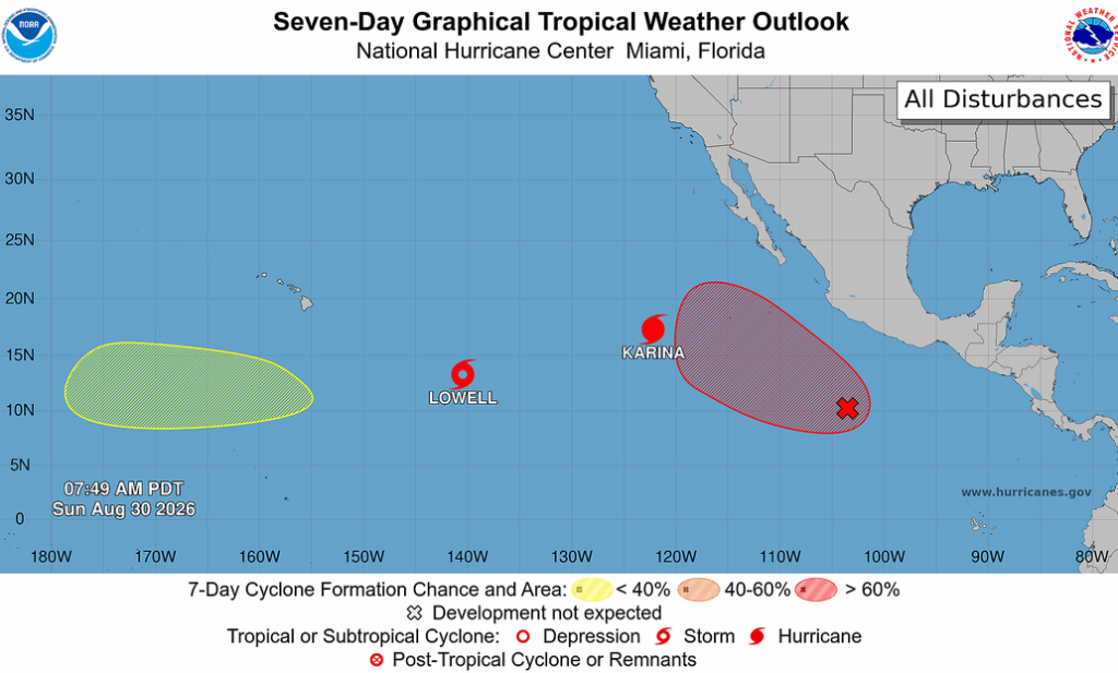
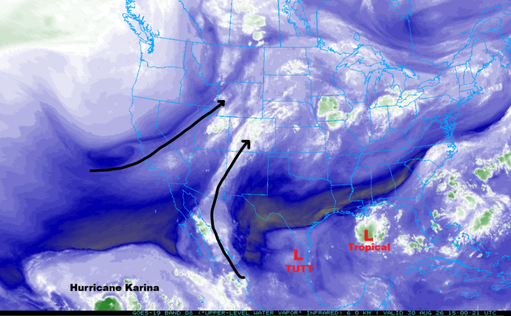
Karina has reached hurricane strength, but is moving away from the United States, while another developing storm in the Pacific may impact the West Coast next weekend. The polar jet stream is drawing tropical moisture northward, and a tropical low in the Gulf of Mexico is expected to become a tropical storm over the next few days.
Across Arizona and New Mexico, surface moisture has increased, leading to favorable conditions for thunderstorms. Severe storms are forecast for Arizona, especially around Phoenix and Tucson, with strong winds, heavy rain, and hail possible. Storms will develop tomorrow, bringing additional rain, though the risk of severe winds will decrease. Overall, the region can expect active weather through the weekend, with the monsoon gradually subsiding by Tuesday unless new tropical systems bring more moisture.
Yesterday’s Weather
The visible satellite image overlaid with lightning data shows the thunderstorms extending north from the Mogollon Rim into Nevada and then east into western New Mexico.
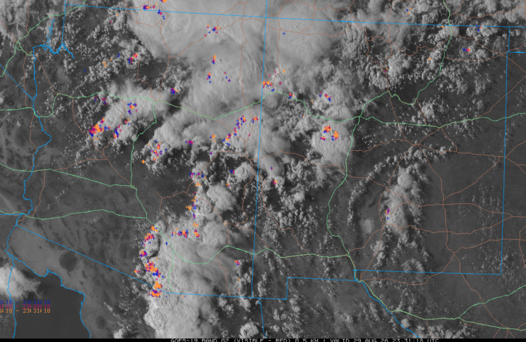
Another cluster of thunderstorms was in southeast Arizona from Casa Grande and Graham County southward to Tucson, Nogales, and then into Mexico. A severe wind gust of 80 mph occurred near Green Valley, AZ, and 75 mph in Kane County, Utah, along the Arizona/Utah border. Non-severe wind gusts were over 50 mph in Tucson and Sells.
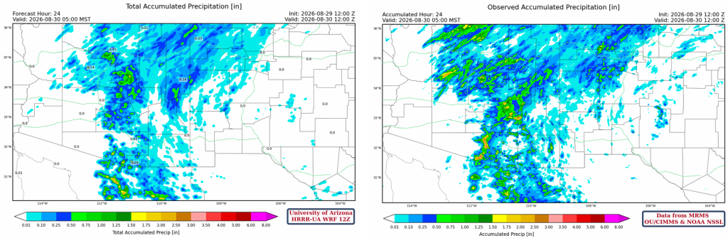
The HRRR-UA WRF 12Z 24-hour accumulated precipitation forecast (left) and corresponding observed precipitation from MRMS (right) are shown below. The forecast was very good in where the precipitation would fall, although it underestimated the amount.
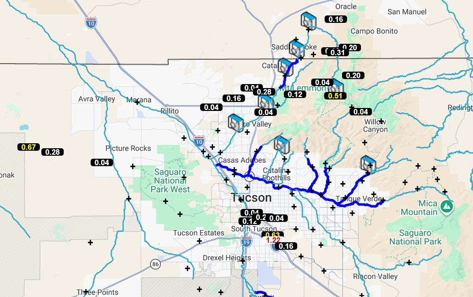
Precipitation recorded by the Pima County Flood Control Alert network shows the heaviest precipitation in Tucson along I-10, with other precipitation in the Catalina Mountains and in areas west and south of Tucson.
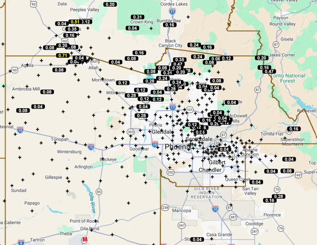
The storms near Tucson moved toward Phoenix, as shown on the precipitation gauge map in eastern Phoenix below. Other storms in the Wickenburg area moved east, outside and north of Loop 101 in northern Maricopa County.
Analysis
Karina has been upgraded to a hurricane as it continues to move away from the United States. The developing storm southeast of Karina has the potential to affect the West Coast of the United States next weekend.
The polar jet stream continues to drop to the southeast and is drawing moisture from the tropics. A tropical low in the Gulf of Mexico will probably develop into a tropical storm as it moves west. The Tropical Upper Tropospheric Trough (TUTT) west of Brownville will remain nearly stationary.
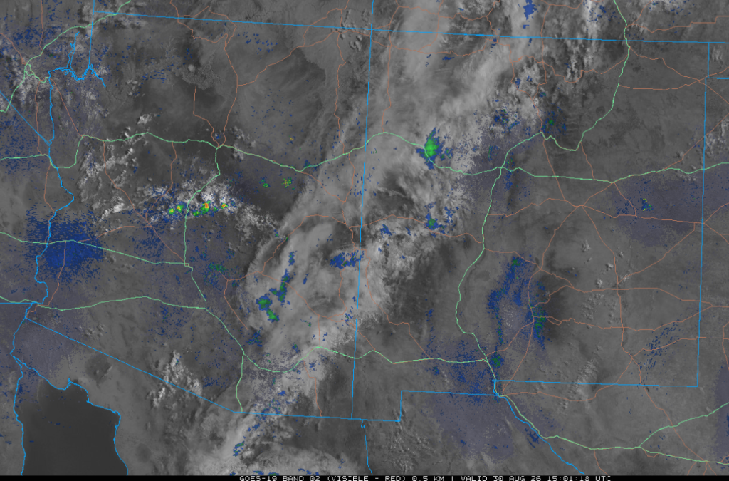
The 8 am visible satellite image overlaid with radar data shows a line of clouds and showers from northwest New Mexico to southeast Arizona. Other showers and thunderstorms are along the Mogollon Rim between Phoenix and Flagstaff.
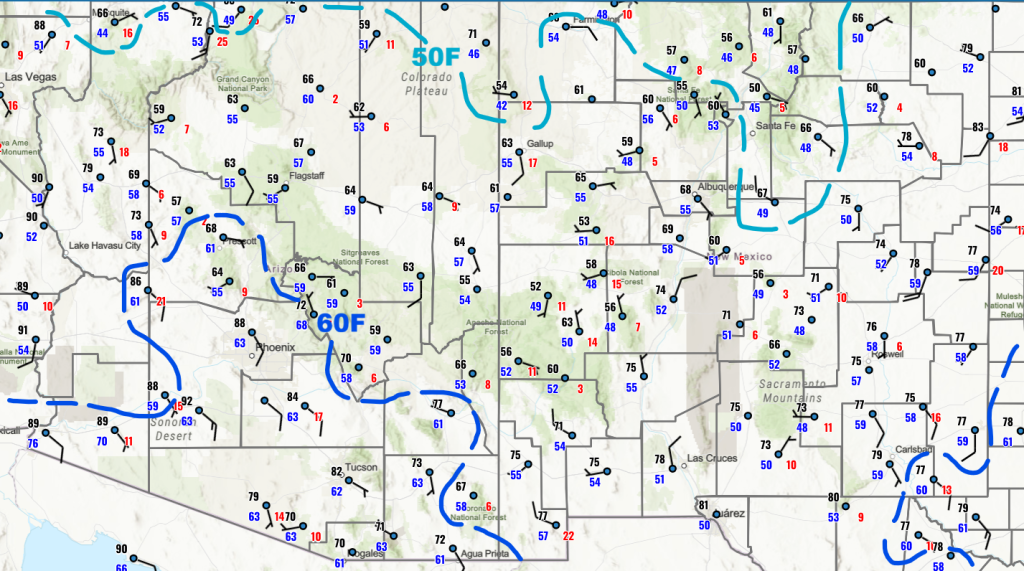
Both Arizona and New Mexico have more surface moisture than yesterday, with the 60°F dewpoint temperatures having pushed eastward into Graham and Cochise counties.
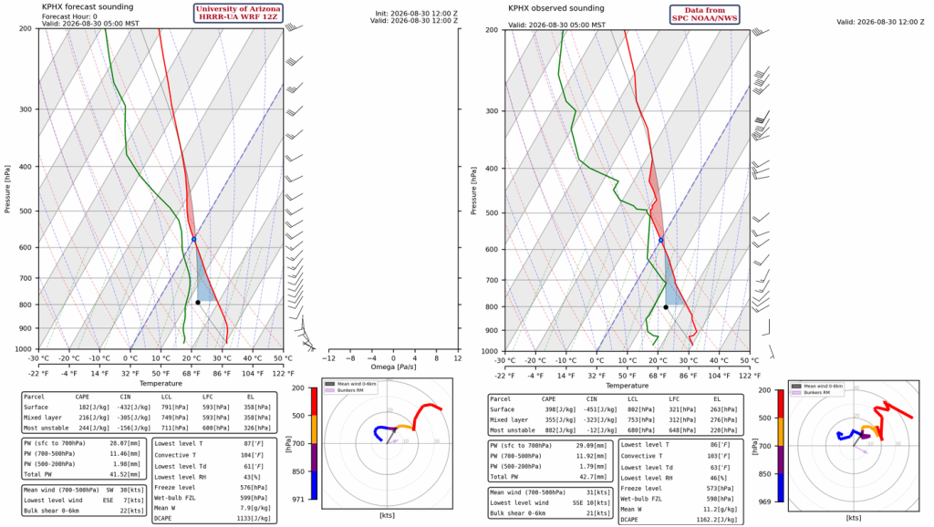
The HRRR-UA WRF 12Z initialization (left) and observed (right) sounding for Phoenix at 5 am are similar. The observed sounding has more data points that are plotted than the initialized sounding, but both soundings have precipitable water near 42 mm (1.7″).
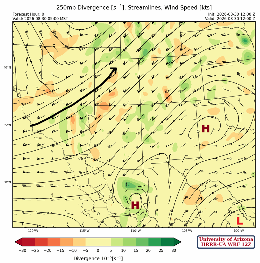
The jet stream continues to drop slowly southeast and extends from south-central California to northeast Utah at 250mb. Two high-pressure centers are in northwest Texas and near Hermosillo, Mexico. A TUTT low is west of Brownsville.
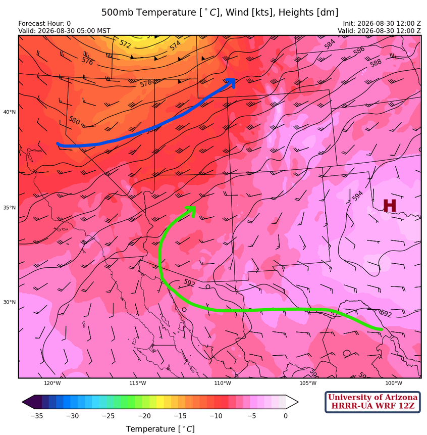
At 500 mb, the polar jet stream extends from central California to southeast Wyoming with the coldest air aloft over Idaho. The subtropical high pressure (monsoon ridge) is now over Oklahoma. Westerly winds dominate Arizona, with the strongest winds near 35 knots in far northwest Arizona.
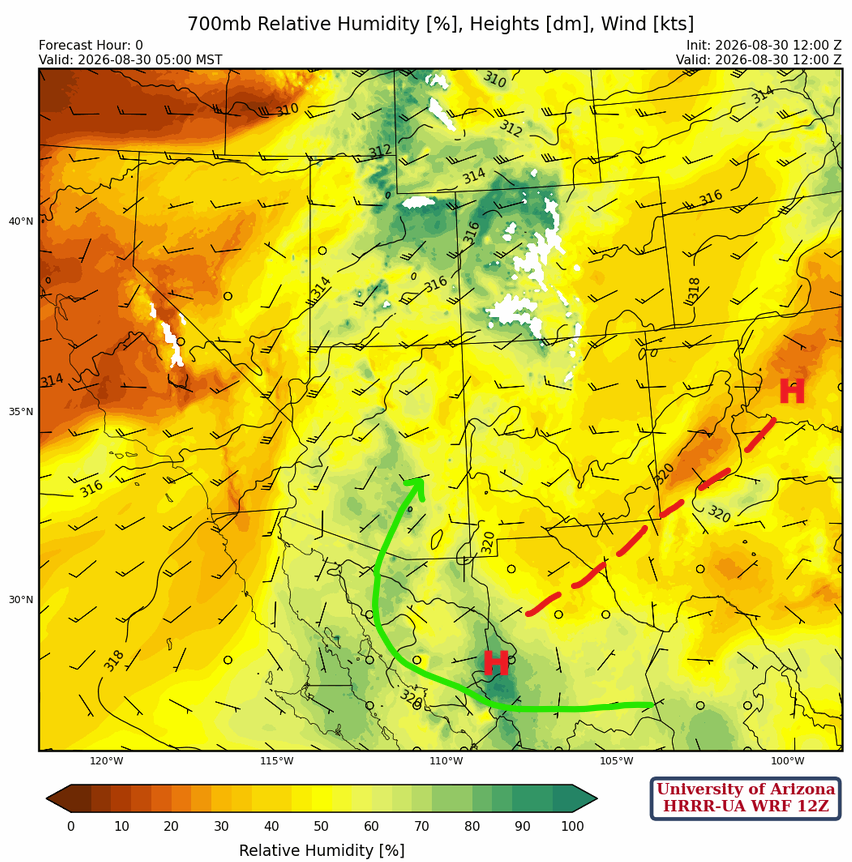
At 700mb, the monsoon flow is pushing moisture into Arizona clockwise around the high-pressure ridge from Oklahoma to northwest Mexico.
Today
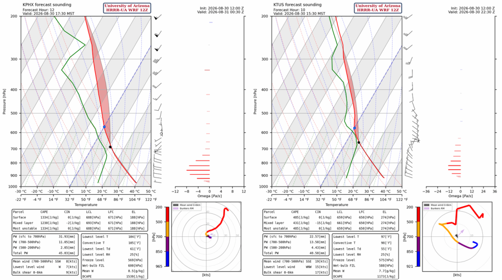
The forecast sounding for Phoenix at 5:30 pm (left) shows a good profile for making severe thunderstorms with Convective Available Potential Energy (CAPE) over 1200 [J/kg] with no Convective Inhibition (CIN). Storm motion will be to the northeast at 10–15 mph, as shown by Bunkers Relative Motion wind arrow on the hodograph (bottom right corner). The forecast sounding for Tucson at 3:30 pm (right) has slightly less CAPE than yesterday at around 430 [J/kg] CAPE with little CIN. There is also potential for severe storms in southeast Arizona.
Thunderstorms will form around the Tucson area in the afternoon and move northwest to Phoenix, arriving near 7 pm. Then they move northeast into the Mogollon Rim around 9 pm and northwest to the Arizona/California border by midnight. The storms will produce wind gusts over 60 mph with blowing dust, heavy rain, and large hail. The hail will be the largest in the central and northern parts of Arizona, with hail size around 1″.
Other storms develop overnight from Yuma to Kingman, with weaker storms in Santa Cruz and eastern Pima County
Tomorrow
Thunderstorms will develop near Tucson around noon and by afternoon extend from southern Maricopa County east across the Tucson metro area and then east into Cochise County. The storms will move into the Phoenix metro area, Wickenburg, and the Mogollon Rim by evening. The storms probably won’t produce severe wind gusts, but the strongest storms could reach 45 mph. Heavy rain will be the primary threat. Thunderstorms will develop in northeast Arizona and western New Mexico during the afternoon.
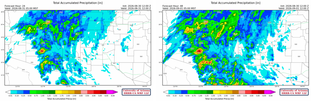
24-hour total accumulated precipitation (left) shows bands of >0.5″ rainfall in central Pima County, eastern Pinal, north of Phoenix, and on the Mogollon Rim. 48-hour totals (right) add to what will fall on the Mogollon Rim today and other areas of higher elevation in Pima County; additional totals for Maricopa and Yavapai counties are predicted for tomorrow. Tucson and Phoenix metro areas get totals in the 0.25 to 0.5″ range for both days.
Outlook
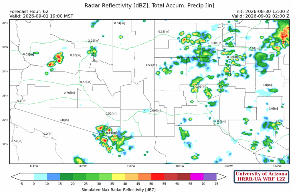
Only isolated thunderstorms will develop along the international border and northwest Arizona on Tuesday as the monsoon winds down and moisture dries out.
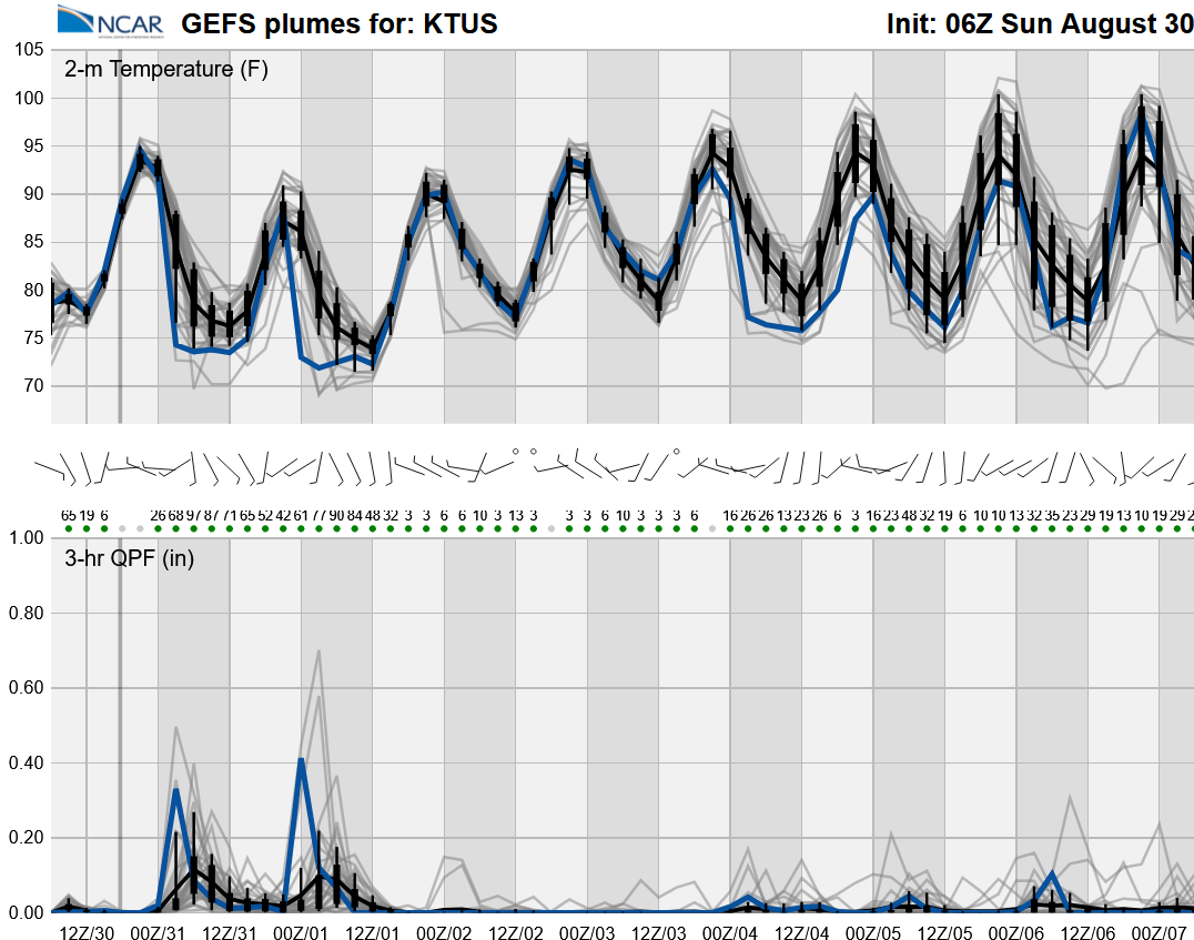
A drop in monsoon thunderstorm activity begins Tuesday and will continue into the weekend unless tropical systems push more moisture into the area.
Discussion written by Pat Holbrook and Patrick Bunn