

Summary
Moisture from the tropics and the remnants of Tropical Storm Iselle are increasing humidity across southern and southwest Arizona. Surface observations show a surge of moisture moving up the Gulf of California, increasing the chance of thunderstorms in the region today. Forecasts predict thunderstorms developing in southeast Arizona and on the Mogollon Rim. Storms that initiate in SE Arizona will spread northwest into Pinal and Maricopa counties, with the most significant rainfall expected over the mountain areas of central Pima.
Over the next few days, conditions remain favorable for afternoon and evening storms, particularly in Pinal, eastern Maricopa, and Tucson, with gusty winds and heavy rain likely. Activity is expected to remain high through the weekend before gradually decreasing next week.
Yesterday’s Weather
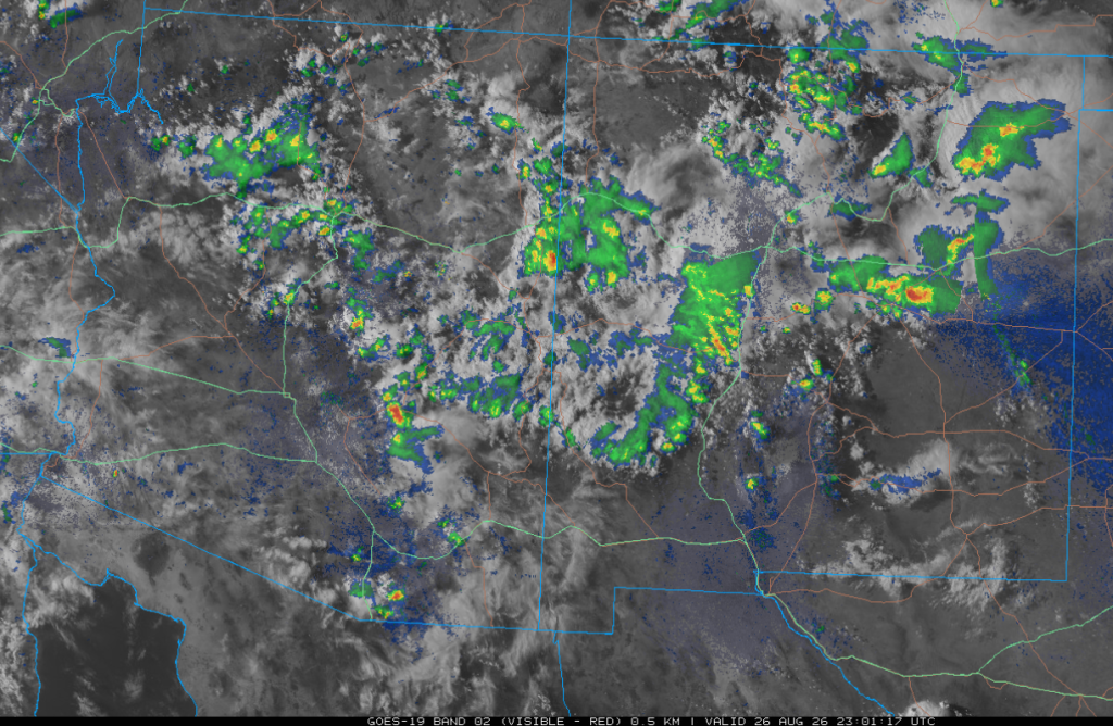
Yesterday’s visible satellite imagery combined with radar data shows the extent of thunderstorm activity, with most storms near the mountains producing much more cirrus cloud cover than surface rain in Arizona. In New Mexico, the storms were strongest in the northeast and eastern portion of the state. Many of the clouds in Arizona are from former Tropical Storm Iselle. As Iselle moved north, westerly winds stripped the storm of mid- and high-level moisture. Over the next few days, the moisture will move across the region.
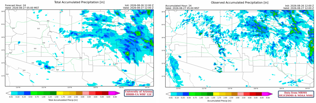
The HRRR-UA WRF 12Z 24-hour accumulated precipitation forecast (left) and corresponding observed precipitation from MRMS (right) are shown below. There were a few more storms observed in eastern Pinal County than forecast, and too many were forecast in south-central Pima County. Otherwise, the forecast was in good agreement with observed precipitation.
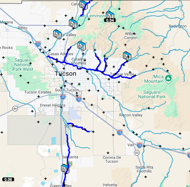
The isolated thunderstorms hit a few rain gauges in eastern Pima County. Santa Cruz County had a few more storms, with one rain gauge receiving 0.16 inches.
Analysis
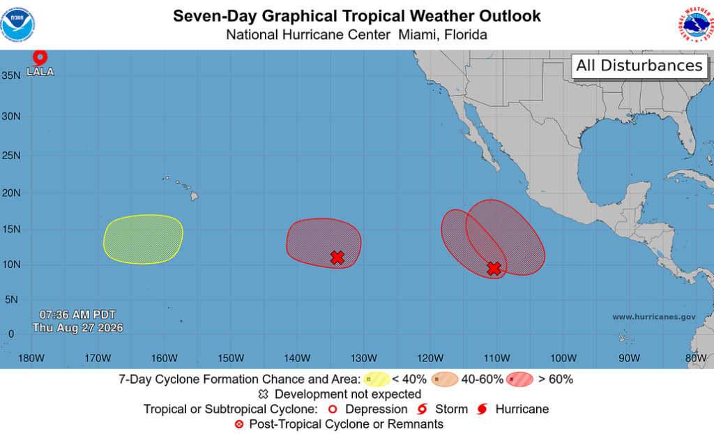
The National Hurricane Center (NHC) tropical weather outlook is below. The tropics are a source of late-monsoon moisture, and any tropical systems that get close to the southern tip of Baja would push moisture into Arizona. No tropical systems are in position yet.
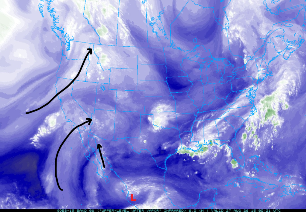
The upper-level water vapor image below shows the jet stream moving from northern California to northern Idaho. The source of moisture for the southwest part of the United States is the flow related to Iselle, pushing mid- and high-level moisture into the region, and moisture moving up the Gulf of California. This could be a Gulf Surge in the making or a synoptic push of low-level moisture. The Guaymas sounding further below shows the increase in low-level moisture yesterday morning. Either way, it should increase low-level moisture across portions of Arizona over the next few days.
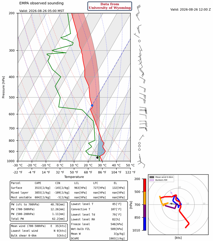
Below is the observed sounding for Guaymas yesterday morning, showing the push of moisture up the Gulf of California. The moisture has now pushed into southwest Arizona today. The tremendous amount of Convective Available Potential Energy (CAPE) yesterday could not overcome the Convective Inhibition (CIN) since the surface didn’t reach the convective temperature.
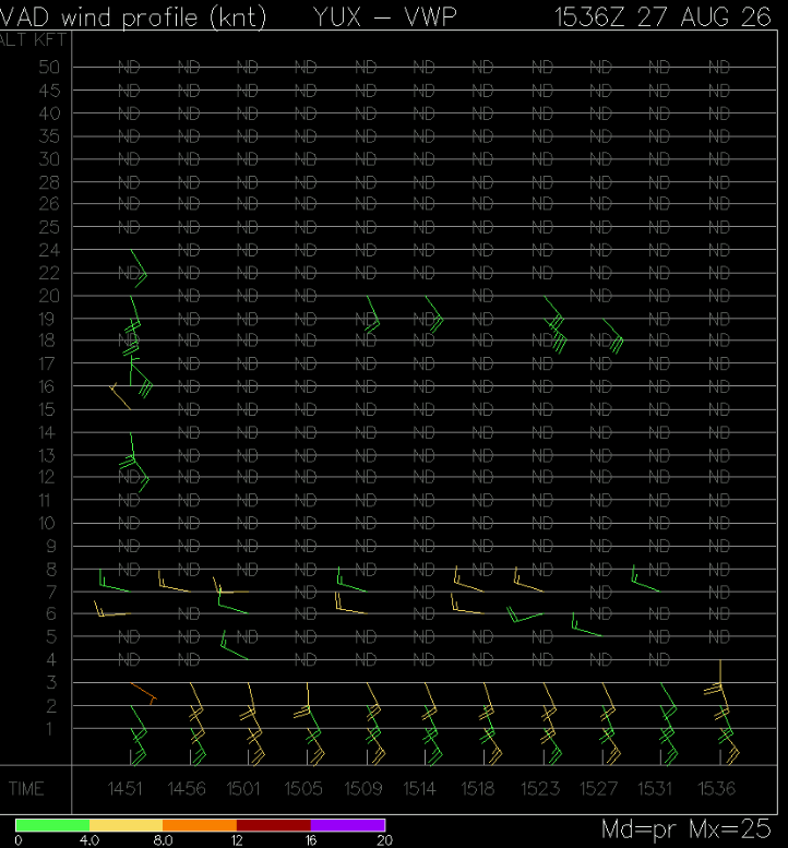
The Velocity Azimuth Display wind profile from Yuma shows the Gulf Surge, or synoptic push of moisture, with a depth of 3,000 feet (1 km).
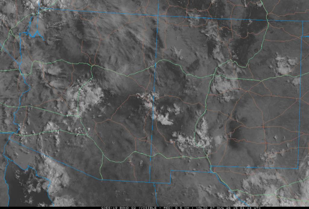
The 8:00 am visible satellite picture shows a mixture of clouds with high cirrus in the northern two-thirds of Arizona and mid-level clouds in the southwest.
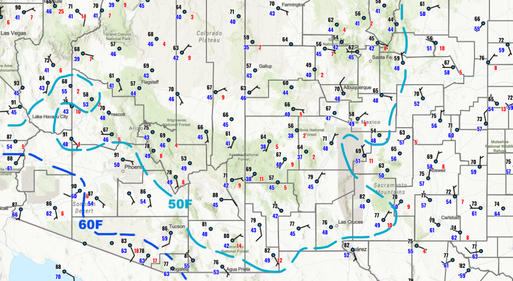
Surface dewpoint temperatures show increased moisture across southern and southwest Arizona, driven by the Gulf Surge/synoptic push of moisture into the state. The increased moisture will provide more fuel for thunderstorms. Moisture has also increased in eastern New Mexico in the wake of the cold front that swept south down the front range of the Rocky Mountains. Northern Arizona and New Mexico are still dry, but the moisture in Arizona should spread into these areas over the next few days.
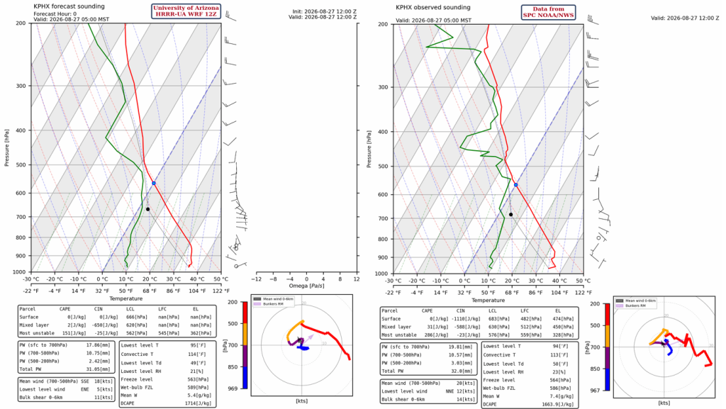
The HRRR-UA WRF 12Z initialization (left) and observed (right) sounding for Phoenix at 5 am are shown below. The moisture above 400 mb, and possibly near 490 mb, is from the remnants of Iselle. The moisture from southwest Arizona has not reached Phoenix at the time of the balloon launch. There is unlikely to be enough precipitable water for significant thunderstorm development, although afternoon temperatures may cool a few degrees from the increased clouds.
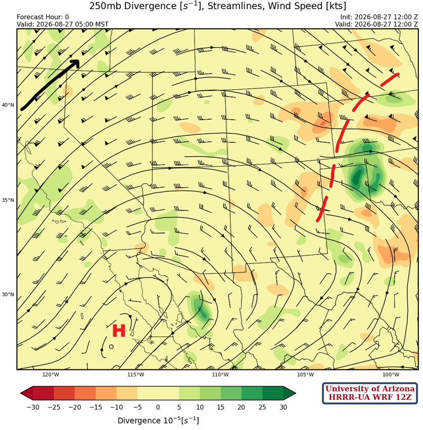
At 250mb, the polar jet is in the Pacific Northwest, and a trough is on the east side of the ridge dropping into Kansas (red dashed). The subtropical ridge is centered near the western tip of the Baja Peninsula. The Tropical Upper Tropospheric Trough (TUTT) low is further south and west than is indicated, but in about the same position as yesterday.
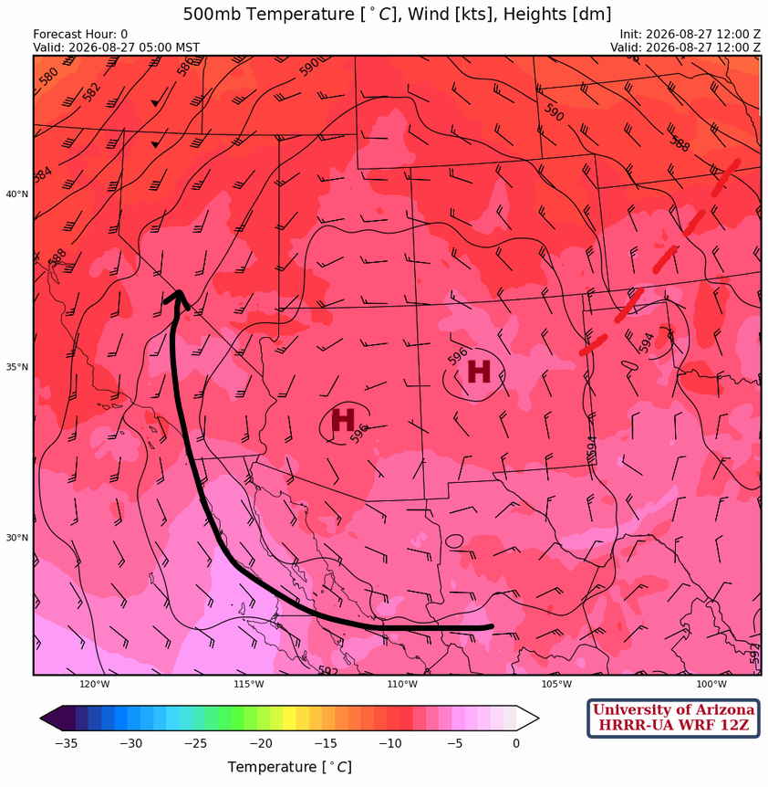
At 500mb, the subtropical ridge is centered over west-central New Mexico and is associated with a broad anticyclonic (clockwise) flow, and the trough dropping into Kansas is also visible (red dashed).
The monsoon ridge is near the Four Corners at 700 mb, with a broad easterly flow over northern Arizona. A couple of easterly waves are indicated from southwest Cochise County south into Mexico and another in Big Bend, Texas.

Today
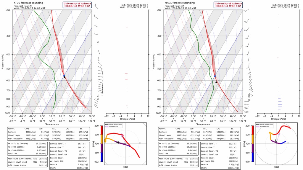
The forecast sounding for Tucson at 2 pm this afternoon (left) shows enough CAPE to produce storms after overcoming the small amount of CIN. To the west, the Gila Bend sounding (right) will be right on the edge of the surge of moisture, and it’s questionable whether it can use the surge moisture today. Thunderstorms may move into the area, jumping from mountain range to mountain range on outflows.
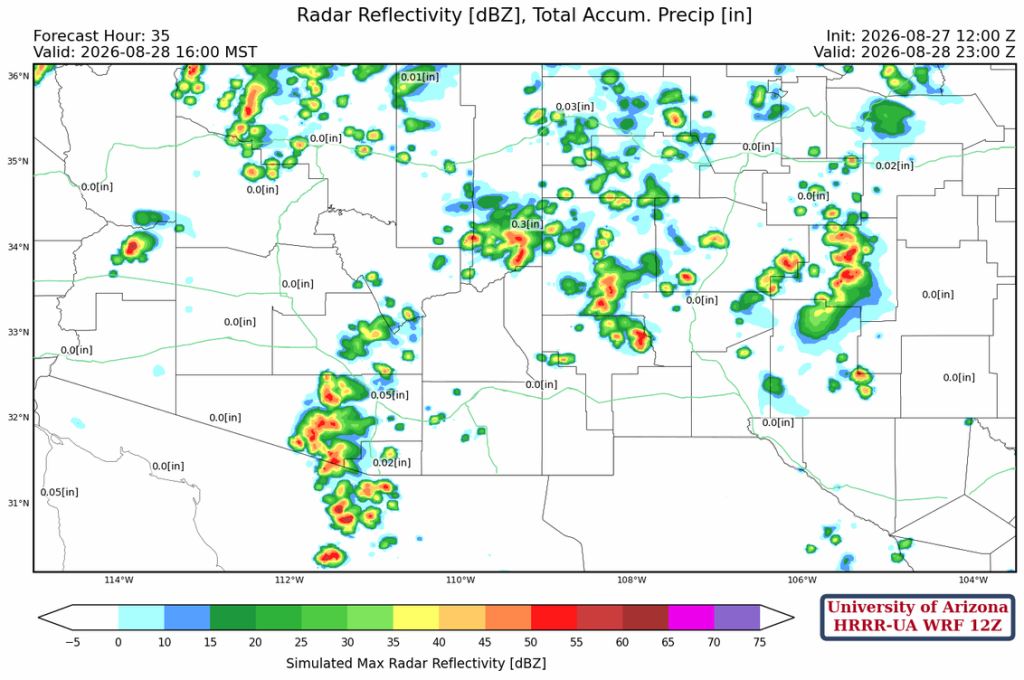
Thunderstorms form around 2 pm in southeast Arizona, but don’t move into the Tucson area until 4 to 5 pm. Other thunderstorms will develop across southeast Arizona east into southern New Mexico.
Tomorrow
Tomorrow’s forecast depends on what happens today, but since today’s activity is not predicted to extend too far west into the deserts, the atmosphere should be able to generate storms tomorrow afternoon and evening.
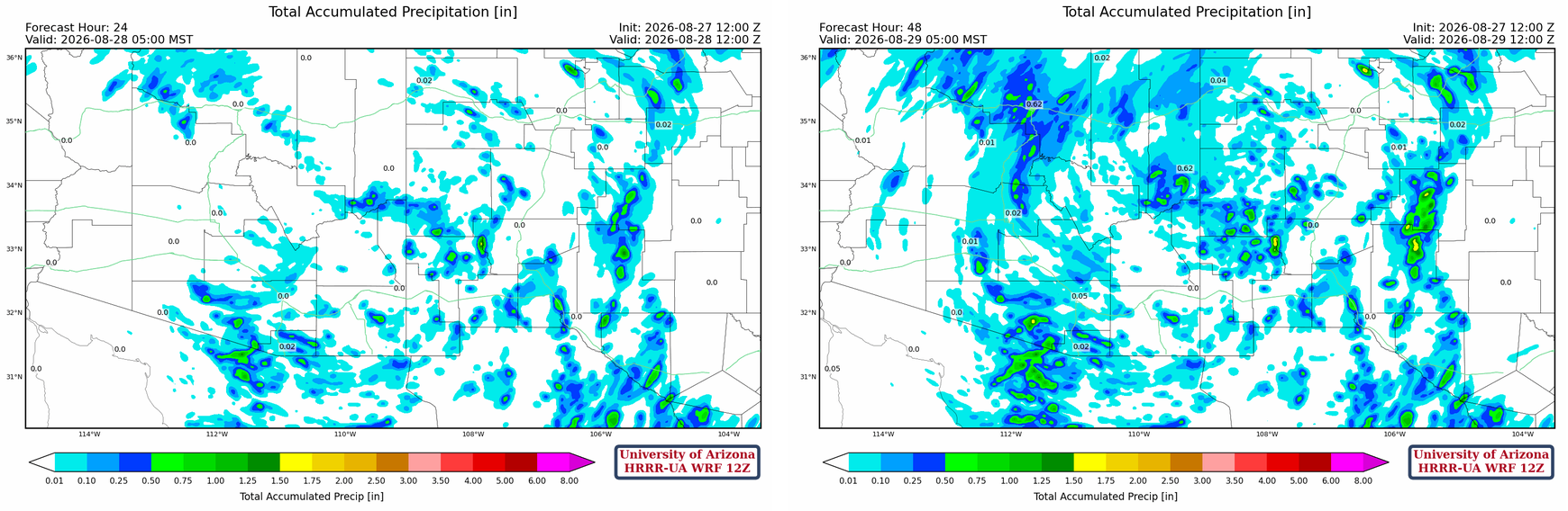
The 24-hour total precipitation forecast shows the greatest accumulations over the mountains in Pima and Santa Cruz counties (>0.5″) and less in the valley locations (0.25″ or less). Tomorrow shows additional accumulations in those areas and more on the Mogollon Rim and in the mountains in central New Mexico.
Outlook
Pinal and eastern Maricopa County appear favored for thunderstorms Saturday night, with strong gusty winds and potential for heavy rain. Tucson will also see afternoon storms with a potential for heavy rain.
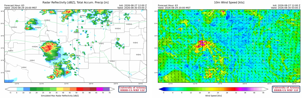
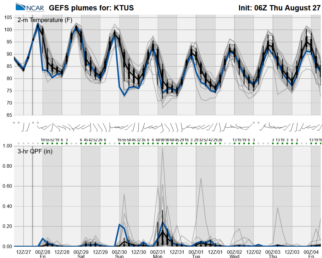
Long-range global model forecasts show a very active period into the weekend and Monday, followed by a slow tail-off of activity next week.
Discussion written by Pat Holbrook and Patrick Bunn