

Summary
A Gulf Surge has brought increased moisture and higher dewpoints back to Arizona. Morning observations indicate mostly clear skies, and weather balloon observations show increased lower-boundary-layer moisture from the surge and plenty of Convective Available Potential Energy (CAPE) if the Convective Inhibition (CIN) can be overcome by outflows.
Today, strong thunderstorm development is possible, particularly in southern Pima and Santa Cruz counties and the Mogollon Rim area. Forecasts show the main threat is strong winds, blowing dust, and possible heavy rain, especially where outflow boundaries collide. Outflows are expected to move into the Tucson and Phoenix metro areas by the evening. While the valleys may see less rain than mountainous areas, conditions remain favorable for continued storm activity through the week, though thunderstorm coverage is expected to decrease by Friday.
Yesterday’s Weather
Typical of a Gulf Surge, the moisture surge into southwest Arizona stalled during the afternoon, but began again overnight. Atypical of the surge is that it also moved up the valleys that extend north/south from central and western Pima County. The visible satellite and lightning data show thunderstorms in the mountains from Pine, east to Show Low, then eastward into New Mexico. Other thunderstorms were south of the international border from Douglas to Lukeville. It was hot, with the town of Quartzsite topping out at 121°F.
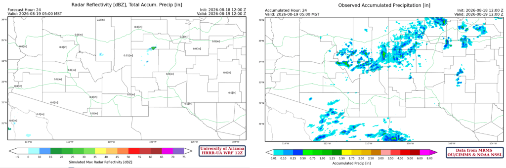
Neither the Maricopa nor Pima County Flood Alert gauges reported rainfall yesterday. South of the border, 0.03″ was reported at San Isidro, which is a few miles east of El Coyote, and 0.01” at Sells on the Tohono O’odham Nation. The HRRR-UA WRF 12Z 24-hour accumulated precipitation forecast (left) and corresponding observed precipitation from MRMS (right) are shown below. Overall, the forecast precipitation was in good agreement with the observed data.
Analysis
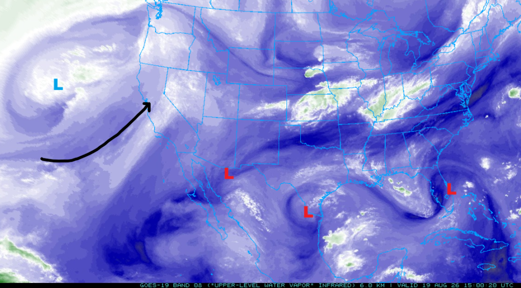
The upper-level water vapor satellite image shows three TUTT lows. One is in northwest Mexico south of Douglas, another near Brownsville, Texas, and a third over central Florida. The polar low has moved northeast, and the jet stream enters the California coast near San Francisco and extends north to Oregon.
What the difference a Gulf Surge can make, with 60°F and 70°F surface dewpoints pushing back into Arizona this morning. The 60°F dewpoint temperatures extend from the Phoenix metro area south to Tucson and Nogales then west into far southeast California.

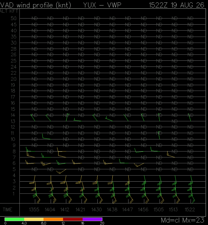
The Gulf Surge as seen by the VAD Wind Profile at the Yuma radar this morning.
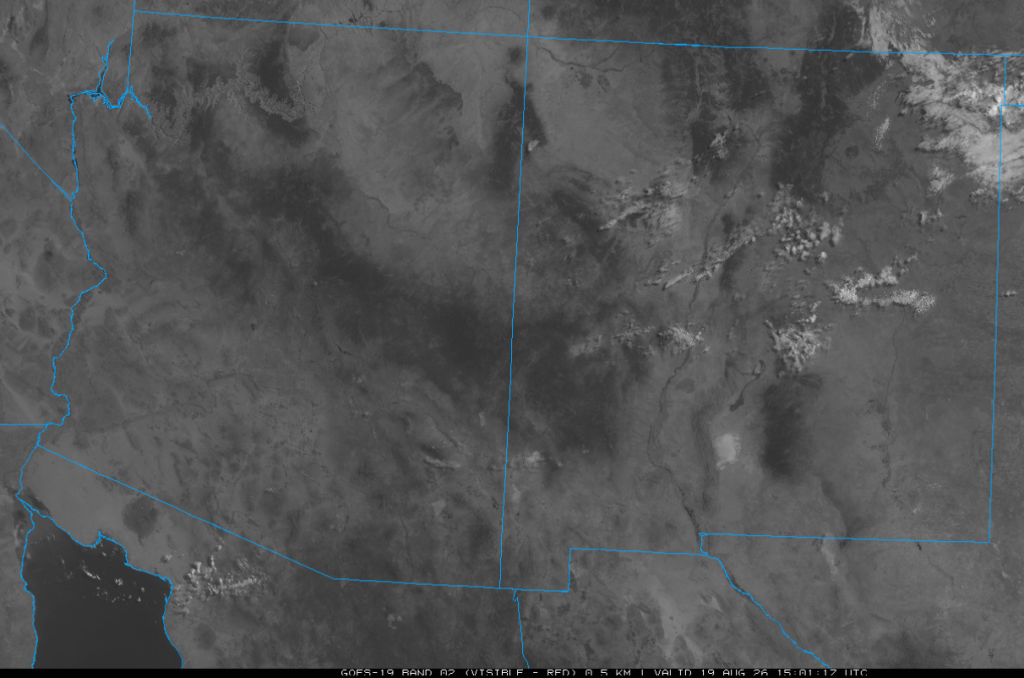
The visible satellite image at 8 am shows only a few clouds across the two-state region.
The HRRR-UA WRF 12Z initialization (left) and observed (right) sounding for Phoenix at 5 am are shown below. The Gulf Surge moisture was captured well below 850 mb. Mid-level warming at 400 mb is less pronounced today than yesterday, so storms should be able to rise to the equilibrium level around 50,000 feet (over 200 mb).

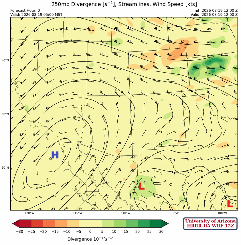
At 250mb, the high-pressure center is southwest of San Diego, with TUTT lows in north-central Mexico and another near Brownsville.
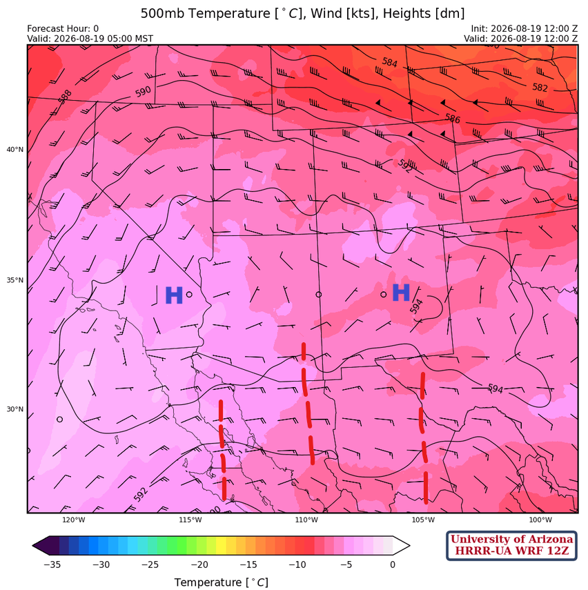
At 500mb, the monsoon ridge is east/west oriented from New Mexico across central Arizona to eastern California. Several short-wave troughs are rotating west underneath the ridge.
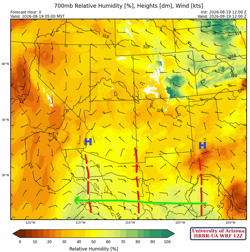
At 700mb, the monsoon ridge has two centers, one in southwest Arizona and the other north of Midland, Texas. The three short-wave troughs are moving west, and the second one may impact Arizona this afternoon and evening by enhancing thunderstorm movement and intensity.
Today
Both the forecast soundings for today for Phoenix at 6:30 pm (left) and Tucson at 5:30 pm (right) suggest thunderstorm development this afternoon is possible if outflow boundaries can overcome the Convective Inhibition in the valleys, which is predicted to be -70 to -80 [J/kg]. There’s over 1000 [J/kg] of Convective Available Potential Energy if this is the case.

Thunderstorms will develop across Santa Cruz and Pima counties this afternoon from 3 to 5 pm, while other storms develop in the White Mountains and Mogollon Rim. These two sets of storms will produce strong outflows moving into Tucson in the evening, 6 to 9 pm, increasing the chance of additional thunderstorm development in Tucson. The main threat from the storms is strong gusty winds up to 50 mph or more with blowing dust. Heavy rain can’t be ruled out depending on where the storms form and/or where a collision of outflow boundaries occurs. In Phoenix, thunderstorms will approach the valley during the evening hours with strong winds up to 45 mph, and therefore a haboob is possible. As in Tucson, heavy rain can occur depending on colliding outflows, causing additional thunderstorm development not in the forecast.
Tomorrow
Tomorrow’s forecast is like today’s, and much of what happens in the valleys will depend on how much the atmosphere is worked over by today’s activity. The forecast still has storms moving into the valleys with the same potential for strong winds and heavy rain. It’s not that we can’t get two up days in a row in the valleys; it is just rare.
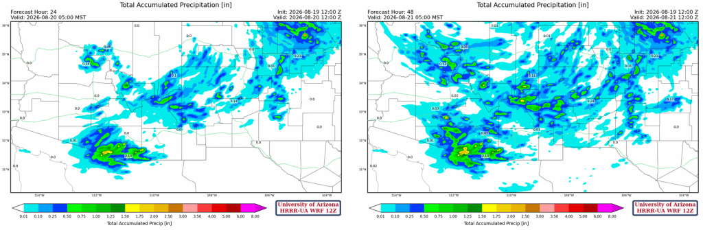
The total precipitation forecast for the next 24 hours (left) and the next 48 hours (right) shows that the Phoenix to Tucson valleys don’t get as much rain as compared to the mountains.
Outlook
The forecast for Friday shows a slow winding down of thunderstorms in strength and areal coverage, with storms mainly confined to the mountains.
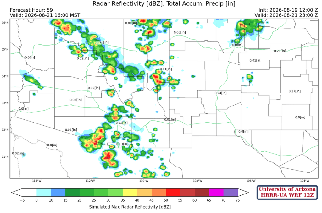
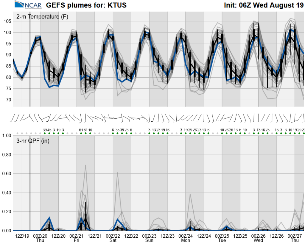
Long-range global model forecasts show the monsoon continuing through next week.
Discussion written by Pat Holbrook and Patrick Bunn