

Summary
Upper-level water vapor imagery shows a polar low near Los Angeles and a Tropical Upper Tropospheric Trough (TUTT) low near Texas, both affecting regional weather. Although surface dewpoints recovered well overnight, they are decreasing in Arizona and western New Mexico, with dry air expected to mix in during the afternoon. Daily highs are expected to increase into this week, bringing extreme heat warnings.
Forecast initialization and observed soundings for Phoenix showed a temperature inversion at 400mb that may limit thunderstorm development, though some isolated storms are possible, mainly in mountainous areas. The strongest storms and most precipitation are forecast for central and northeastern New Mexico, with only brief, light storms expected in southeast Arizona. Monsoon moisture will push into eastern Arizona tomorrow, bringing heavier rainfall to the White Mountains and north-central New Mexico, while southeast Arizona will still see only isolated activity. Longer-term forecasts suggest that as moisture returns later in the week, temperatures could drop again and rain chances could increase into the weekend.
Yesterday’s Weather
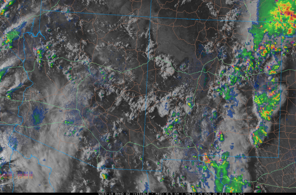
Thunderstorms were few and far between in Arizona and western New Mexico, as shown in the late-afternoon combined visible satellite, mosaic radar, and lightning data. The storms in California and northwest Arizona were related to the frontal zone associated with the west coast trough. The storms in eastern New Mexico, Colorado, and Kansas are where monsoon moisture is interacting with a trough dropping southeast from Colorado.
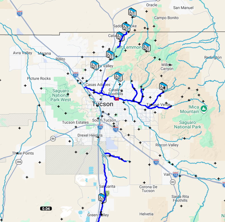
The Pima County Flood Control gauges only caught precipitation at one gauge.
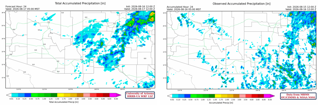
The HRRR-UA WRF 12Z 24-hour accumulated precipitation forecast (left) and corresponding observed precipitation from MRMS (right) are shown below. The forecast looks pretty good with this weather pattern, though synoptic features tend to be easier to predict.
Analysis
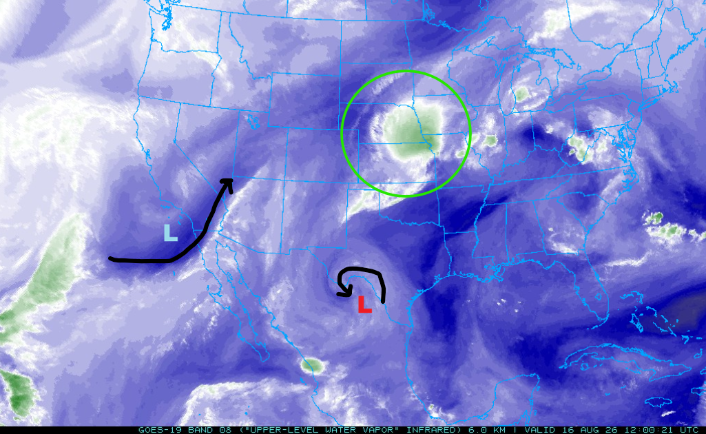
The upper-level water vapor satellite imagery taken at 5 am this morning shows the polar low (light blue “L”) just north of Los Angeles and the Tropical Upper Tropospheric Trough (TUTT) low near the Texas Big Bend (red “L”). The TUTT low is further north and east than forecast on Friday. The cirrus clouds just to the west of the Mesoscale Convective System (MCS, green circle) in Kansas are called striated bands and indicate moderate to severe turbulence at flight level.
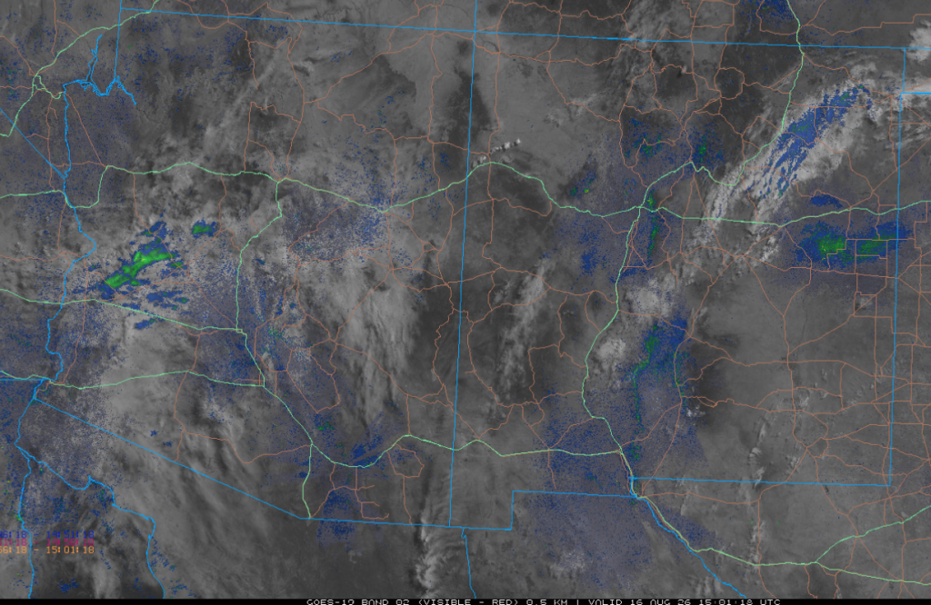
The visible satellite overlaid with composite radar from 8 am shows some scattered showers in western Arizona with scattered clouds across the rest of the region.
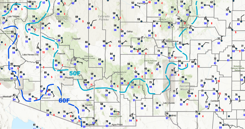
Surface dewpoint temperatures continue to decrease in Arizona and the western half of New Mexico. The 60°F dewpoints will dry out by afternoon due to vertical mixing with dry air aloft.
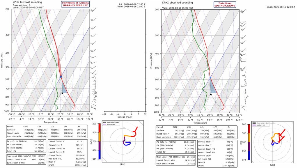
The HRRR-UA WRF 12Z initialization sounding (below, left) and observed sounding (below, right) from Phoenix at 5 am have almost the same precipitable water values, 38 and 36 mm, respectively. The observed sounding shows a temperature inversion near 400mb, while the initialization sounding smooths it out. The top of any thunderstorms that form today will be close to the 400mb inversion.
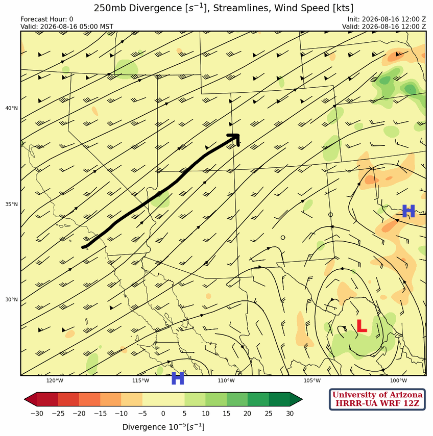
At 250mb, the monsoon high is split into two centers: the first is in north central Texas, and the second is over the Baja Peninsula. Between the two ridges is the TUTT near the Big Bend of Texas. The TUTT will provide favorable upper-level divergence over southeast Arizona this afternoon.
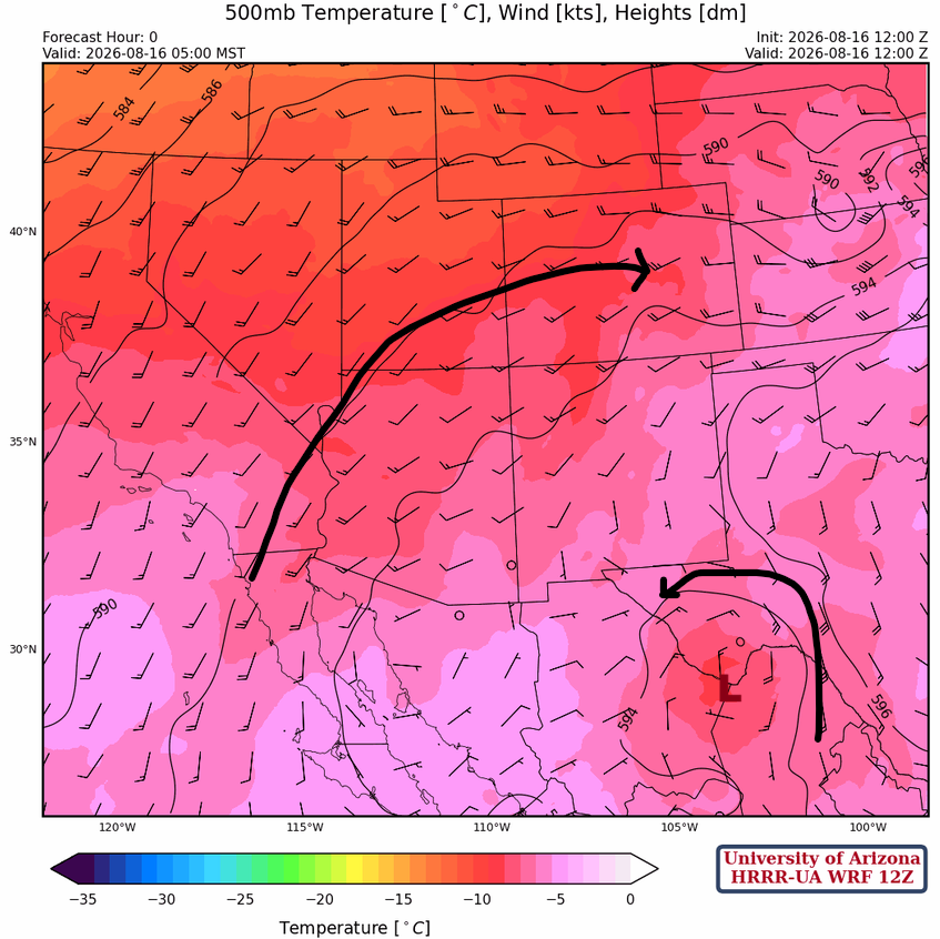
Broad anticyclonic flow (clockwise) is over the intermountain region of the United States at 500 mb. The monsoon ridge is over northeast Texas, and the TUTT low at this level is over the Big Bend of Texas.
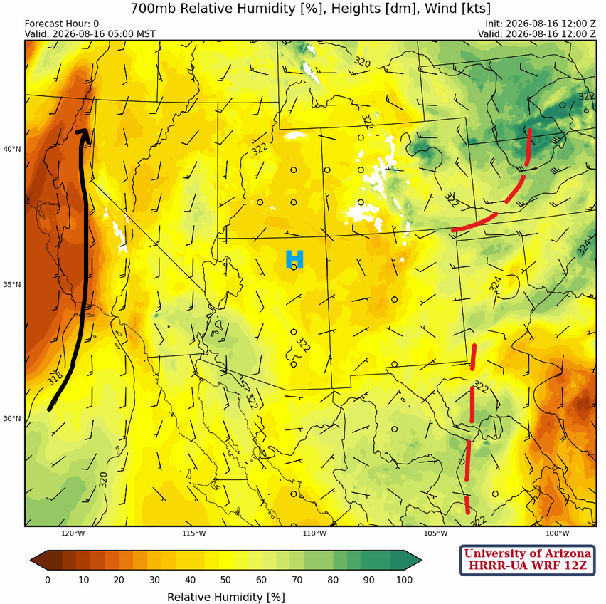
At 700mb, the short-wave trough over Kansas and Nebraska is associated with the MCS in the same area. The TUTT low is a north-to-south trough in West Texas and is moving slowly westward. The monsoon high is centered around the Four Corners.
Today
Although the forecasts indicate there is some amount of Convective Available Potential Energy (CAPE), only isolated storms are possible in and near the mountains.
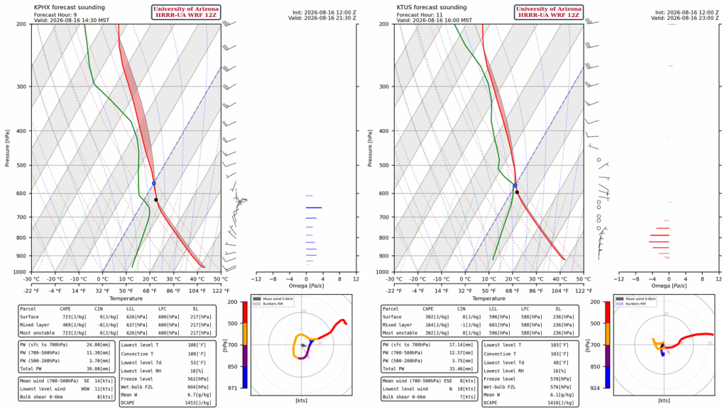
Late afternoon and evening thunderstorms will be more concentrated across central New Mexico, west central New Mexico, and the White Mountains. Isolated thunderstorms may form in Cochise and Santa Cruz counties but will be short-lived with very little rainfall.
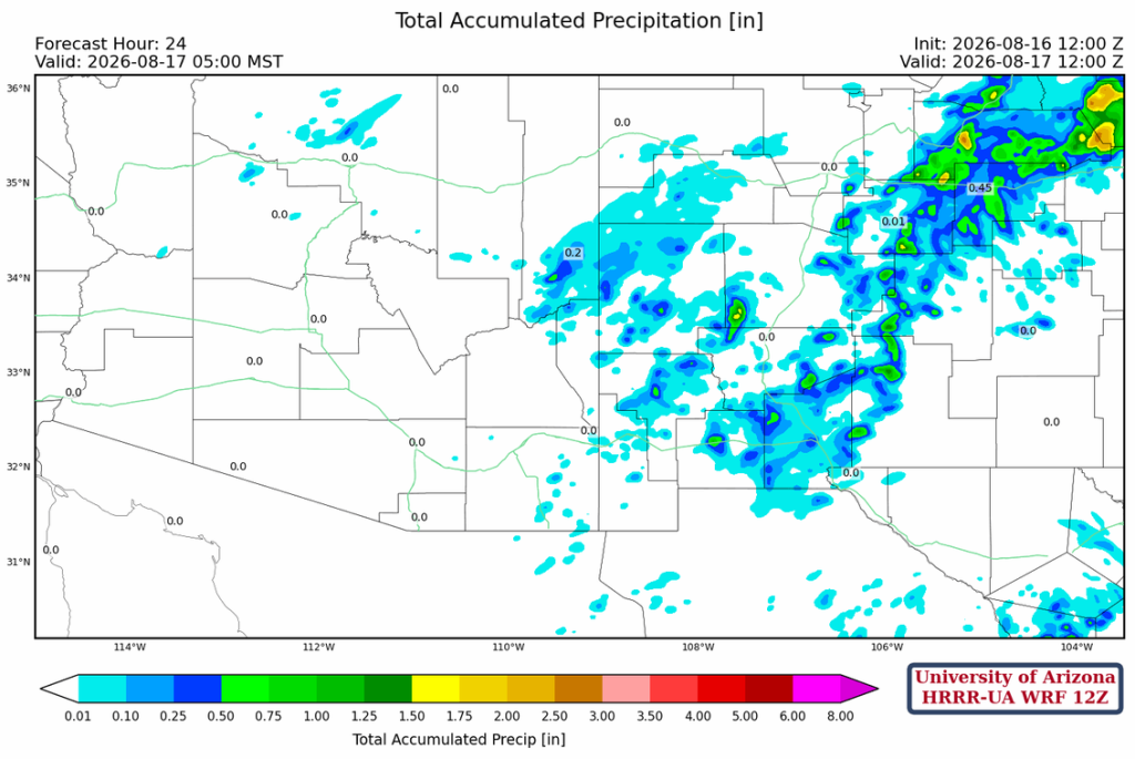
Total precipitation forecast through the next 24 hours shows the most precipitation in northeast New Mexico.
Tomorrow
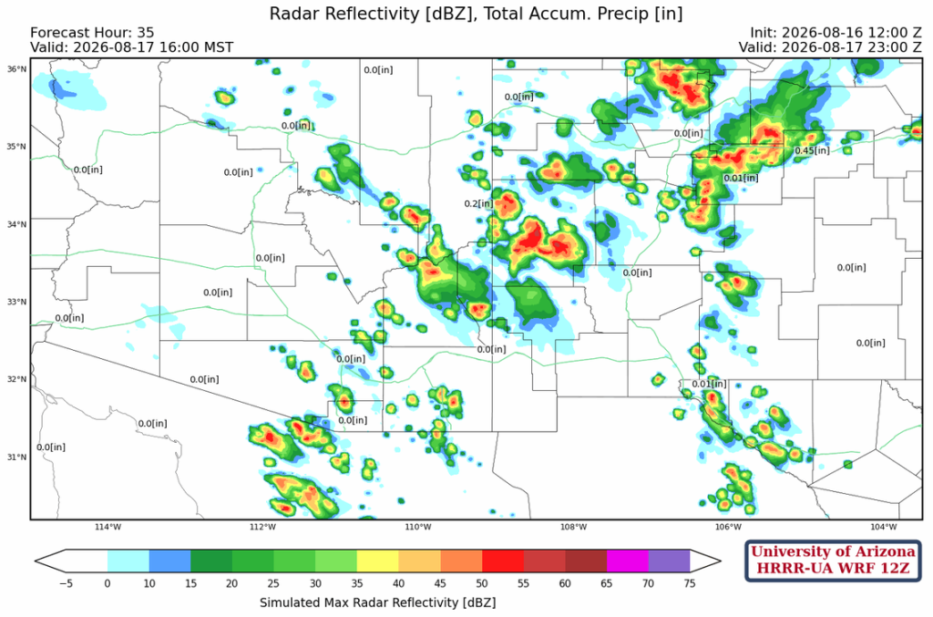
Monsoon moisture shifts west into eastern Arizona tomorrow. The heaviest rain is forecast in the White Mountains and north-central New Mexico. Southeast Arizona has isolated thunderstorms over the mountains.
Outlook
On Tuesday, thunderstorms decrease in New Mexico and increase in northern Arizona. Some isolated storms are predicted in southeast Arizona.

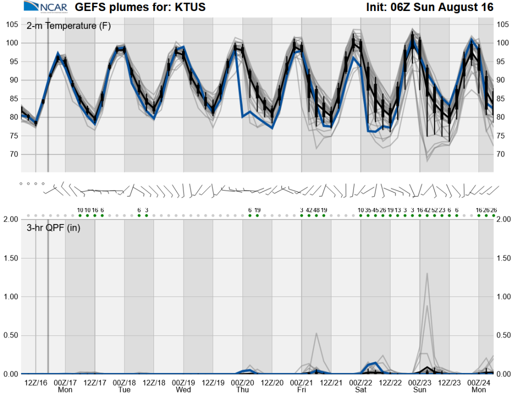
Long-range global model forecasts show that, as moisture returns later in the week, it will bring variability in both temperatures (especially lows) and precipitation into next weekend.
Discussion written by Pat Holbrook and Patrick Bunn