

Summary
Surface moisture levels have decreased across Arizona and New Mexico, with 2-meter dewpoints dropping due to vertical mixing of dry air down and a lack of Gulf Surge moisture to replenish. The 60°F dewpoint line has shifted south to the international border. Upper-level weather patterns indicate a short-wave trough moving south and a high-pressure ridge positioned over the Four Corners at 500mb, bringing strong easterly winds that limit thunderstorm development despite cool temperatures aloft.
Today, only isolated thunderstorms are expected, mainly in northern Arizona. However, moisture is forecast to increase overnight due to a mesoscale convective system (MCS) in Mexico, likely boosting thunderstorm activity tomorrow.
Looking further ahead, conditions early next week appear increasingly favorable for thunderstorms, especially in mountainous regions, with long-range models predicting an upswing in activity starting Monday.
Yesterday’s Weather
Activity dropped off in Arizona with storms restricted to over and near the mountains. In New Mexico, storms were aided by an upper-level low centered near Lubbock, TX. In Mexico, scattered thunderstorms were along and west of the spine of the Sierra Madre mountains, but no organized MCS was noted as the TUTT low influencing flow in northern Mexico has moved further west into the Pacific Ocean.
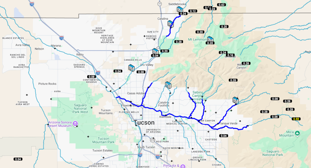
An isolated thunderstorm moved southwest from central Cochise County into northeast Pima County, producing wind gusts over 40 mph. The storm weakened before reaching the Tucson metro area. Most of the rain was over and near the Catalina and Rincon Mountains. Around the rest of Arizona, precipitation was mainly over the mountains with very few storms at any valley locations.
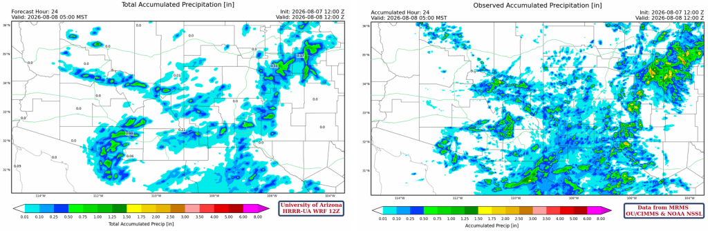
The HRRR-UA WRF 12Z 24-hour accumulated precipitation forecast (left) and corresponding observed precipitation from MRMS (right) are shown below. Two precipitation areas the forecast missed were the afternoon thunderstorms in central Pima County and the continuing problem in northern Mexico south of Douglas.
Analysis
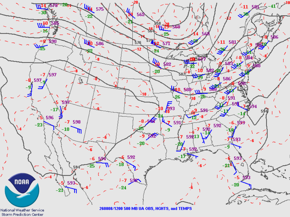
The Storm Prediction Center upper air map for 12Z (5 am) this morning shows the lack of upper air observations in the western United States. There are more observations available at 00Z, but by the time they are used to start numerical weather prediction models and forecast output is available, it is too late for those forecasts to be useful and actionable. This problem will continue until the NWS increases the upper air soundings across the United States.
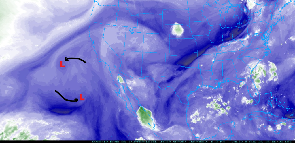
The water vapor satellite image at 8 am this morning shows two Tropical Upper Tropospheric Trough (TUTT) lows and their motion since yesterday. The southern one is weakening and will probably be absorbed by the northern one.
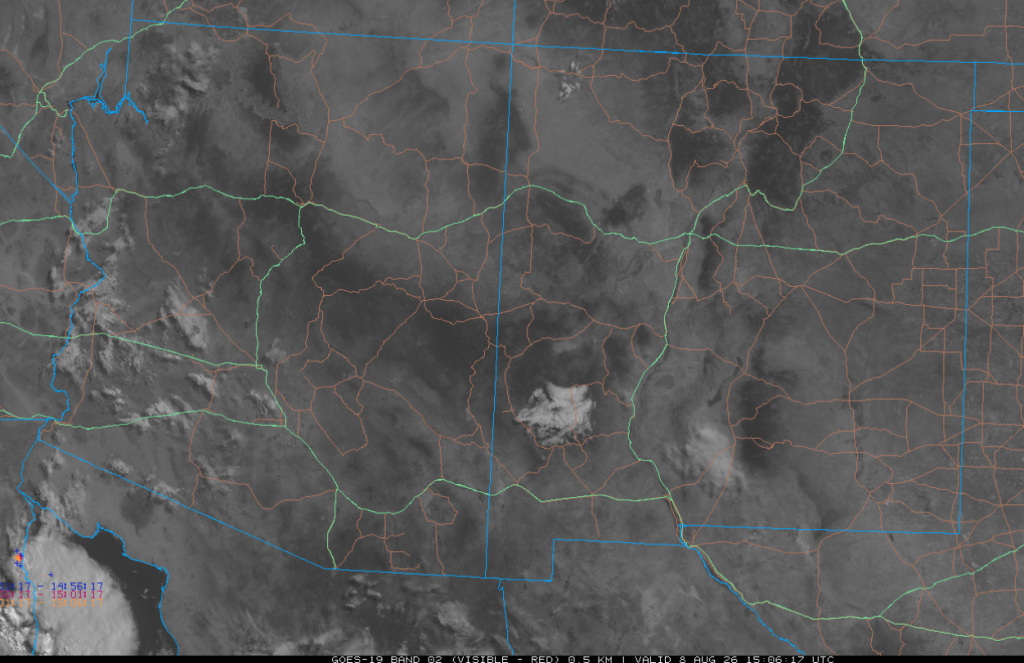
The visible satellite image from 8 am shows a few showers in southwest and central Arizona and in the northern Gulf of California. Otherwise, it was mostly clear across the region.
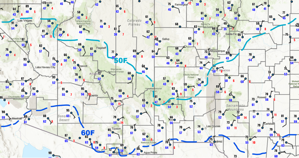
There has been an overall decrease in moisture across both states, with the 40°F dewpoint temperatures in the northern portion of Arizona and New Mexico. Vertical mixing is the culprit as the dry air aloft is mixed down to the surface. Without the Gulf Surge moisture for replacement, dewpoint temperatures dropped. The 60°F dewpoint temperature line has moved south to the international border.
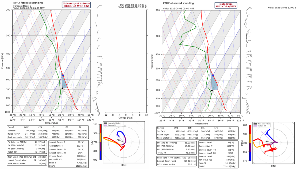
The observed SkewT from the Phoenix weather balloon launch at 5 am shows a slightly stronger inversion just above 700 mb than indicated by the model initialization, but otherwise the observation and model initialization look to be a good match. Perhaps too much precipitable water given the dewpoint temperature drops since yesterday; 42mm (1.65”).
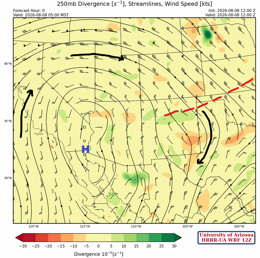
At 250 mb, a short-wave trough is dropping southward on the east side of the subtropical high-pressure ridge, with northerly winds in New Mexico and eastern Arizona. The TUTT low is further west in the Pacific today and is creating southerly flow between it and the west side of the monsoon ridge centered over Las Vegas.
At 500 mb, the monsoon high-pressure ridge finally made it to the Four Corners. A strong easterly wind is in southern New Mexico and Arizona, which tends to limit vertical growth of thunderstorms, though temperatures aloft remain cool.
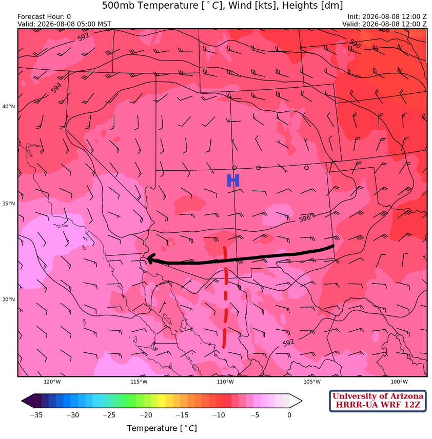
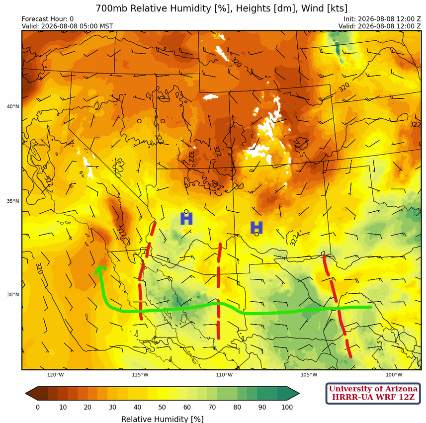
At 700 mb, there are three short waves about 24 hours apart, moving west, with decent monsoon moisture flow south of the ridge centers in AZ/NM.
Today
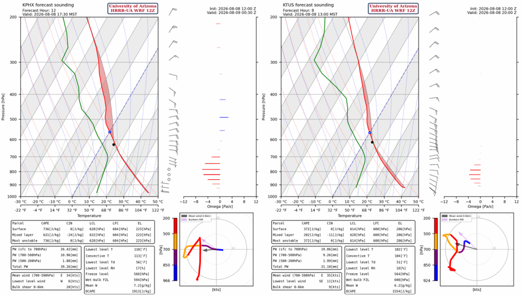
Neither the Phoenix forecast sounding at 5:30 pm (left), nor Tucson at 1 pm (right), suggest we are going to get thunderstorms today. Phoenix seems like it has a better chance since precipitable water remains high, but in Tucson it has dropped down to 31 mm. The only positive is the stronger east winds are more capable of pushing thunderstorms off the mountains.
The 12Z HRRR-UA WRF shows only isolated thunderstorms across Arizona, with a few stronger storms in the western portion of the Mogollon Rim.
Tomorrow
The forecast shows increased moisture overnight from an MCS forming in Mexico this evening. It only increases precipitable water by about 5 mm, but that will increase the overall thunderstorm activity tomorrow afternoon. It would not be surprising if an MCS forms down in central and western Pima County and moves down into northwest Mexico east of Puerto Penasco. If this happens, storms may move into Phoenix from the east.
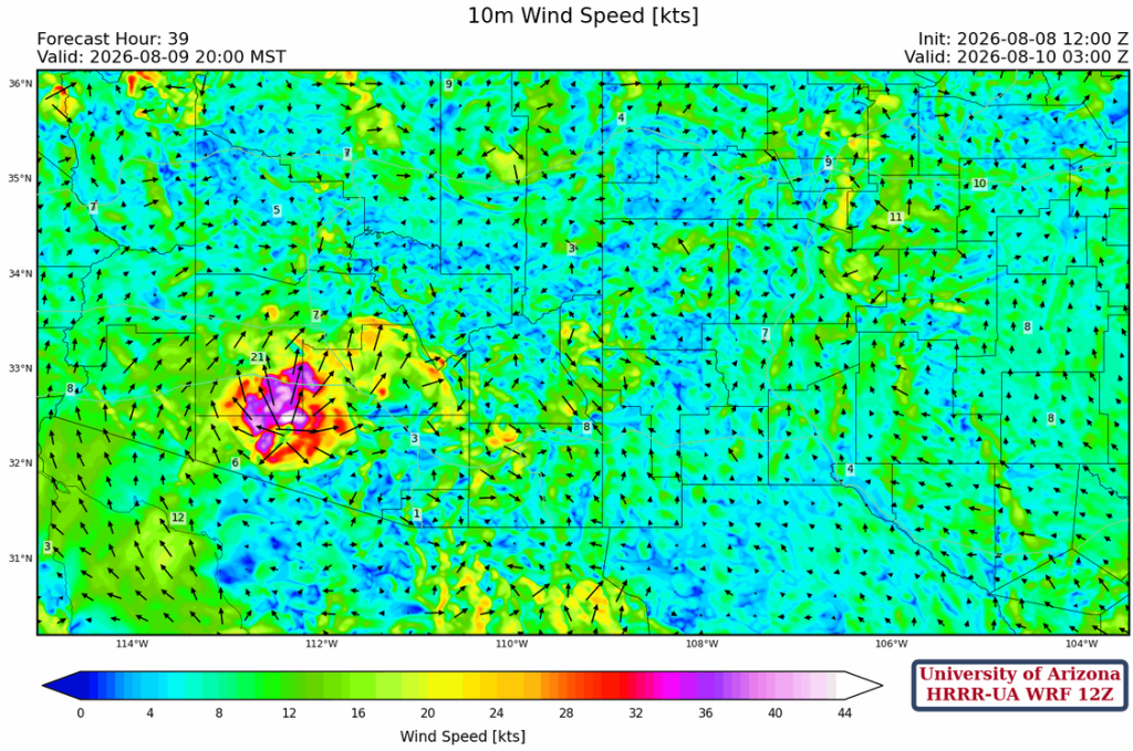
By 8 pm, thunderstorms produce a strong outflow in southwest Maricopa County.
Outlook
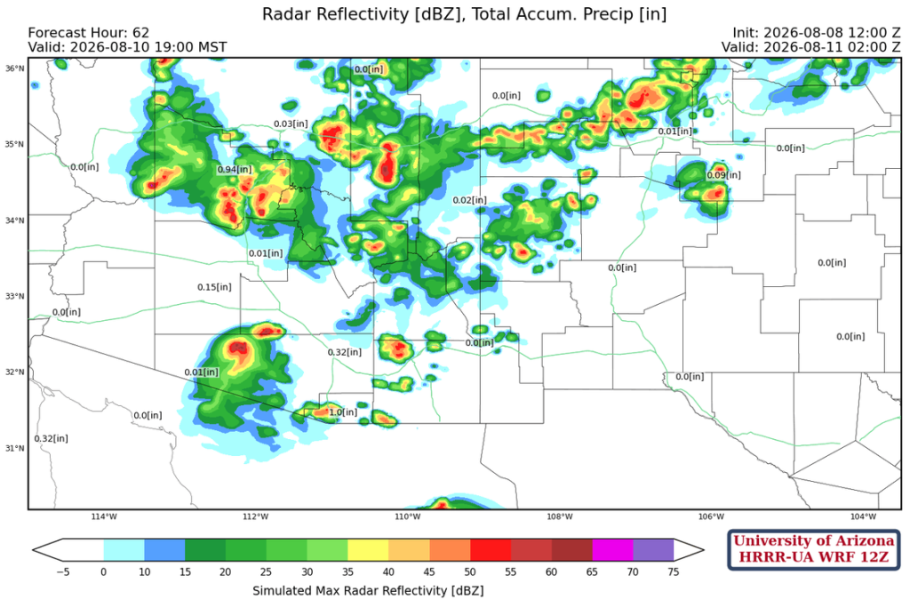
The upper-level flow on Monday looks very favorable for thunderstorms, but the forecast keeps the storms on the mountains since Sunday’s storms cool the valleys.
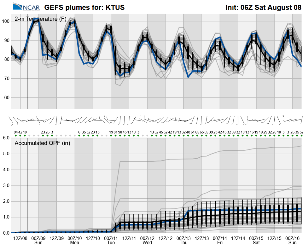
The long-range global model ensemble forecasts have been very consistent with an upswing in activity beginning Monday.
Discussion written by Pat Holbrook and Patrick Bunn