

Summary
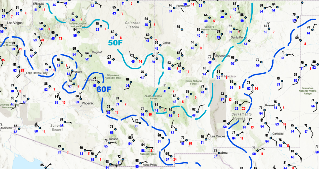
Surface moisture remains elevated over southern Arizona due to the Gulf Surge and outflow from storms in Mexico, with higher dewpoints reaching into Nevada. Ambient surface temperatures are cooler, but there has been little overall change in moisture distribution. The monsoon high-pressure ridge has shifted slightly eastward, while low pressure from the MCS in Mexico lingers over the northern Gulf of California.
Despite moisture in the region, convective inhibition (CIN) will most likely prevent thunderstorms from reaching the valleys today, keeping areas like Phoenix and Tucson dry, though storms will develop in the mountains. Tomorrow, precipitation is expected to decrease further, with storms likely remaining in the mountain foothills rather than reaching metro areas. However, an easterly wave may bring more widespread storms to Arizona and New Mexico on Saturday, before a return to a subdued monsoon pattern next week.
Yesterday’s Weather
The visible satellite and lightning data animation shows thunderstorms on the Mogollon Rim looking interesting at 6 pm, but there was not enough southwest push to get the storms into Phoenix. The storms in southeast Arizona were isolated, producing some severe wind gusts and blowing dust, while activity in northern Mexico was the main weather maker for southeast Arizona.
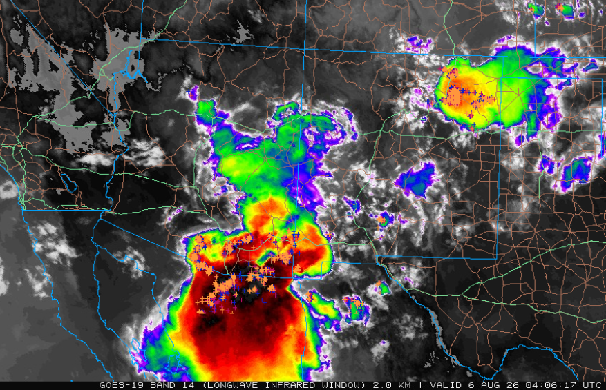
By 9 pm, the infrared satellite and lightning picture show the explosion of storms across southeast Arizona. About 45 minutes later, Pat was chasing his trash cans down the road that were being pushed by an estimated 70 mph wind gust. The storms still did not move too far northwest, with only sprinkles in Marana. Just like the night before, the gust and dust from the storms moved up I-10, reaching Phoenix around 1 am, where the airport recorded 49 mph wind gusts along with a trace of rain.
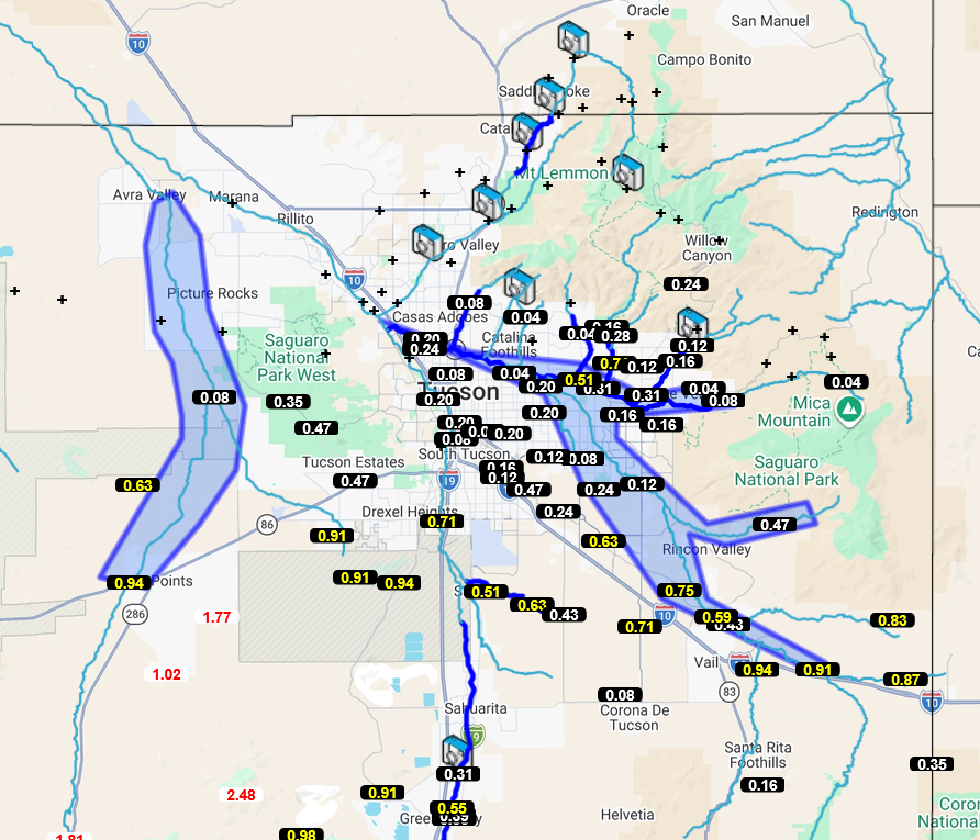
Below is the Pima County Alert map showing the precipitation totals and flood advisories in blue shading. The Brawley Wash at Three Points peaked at 12.59 feet overnight.
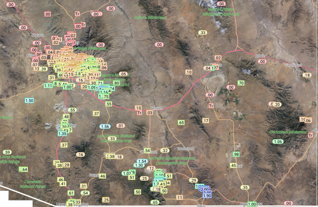
The Rainlog data below shows the heaviest rain in southeast Pima, Santa Cruz, and the southern half of Cochise County.
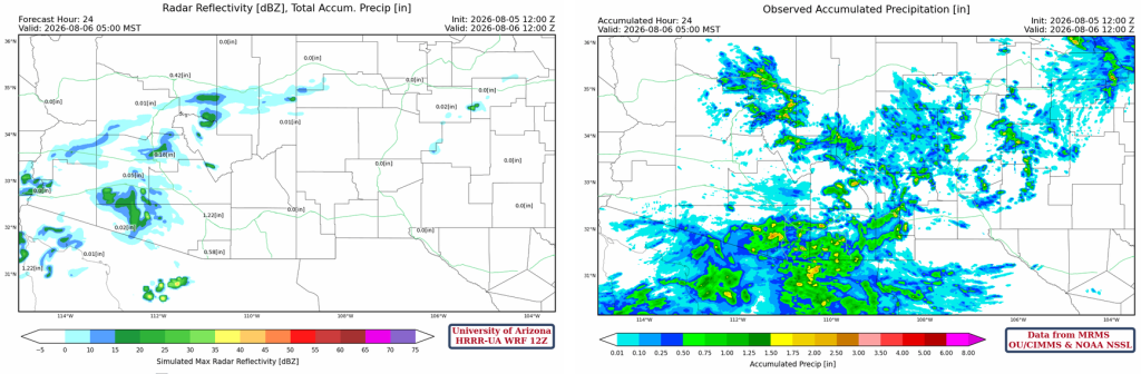
The HRRR-UA WRF 12Z 24-hour accumulated precipitation forecast (left) and corresponding observed precipitation from MRMS (right) are shown below. The forecast did not handle the MCS in Mexico; thus, there was a forecast underestimation of rainfall to the south of the international border and into southern Arizona. The storm that was forecast to move into the Phoenix area from the Mogollon Rim dissipated before reaching the metro area. Storms did not fire on the mountains surrounding Tucson as forecast, with only the MCS moving in from Mexico causing significant rain/severe weather in the Tucson region. This is technically another forecast bust and again highlights the forecast models’ misunderstanding of the vertical profile of the atmosphere in Tucson.
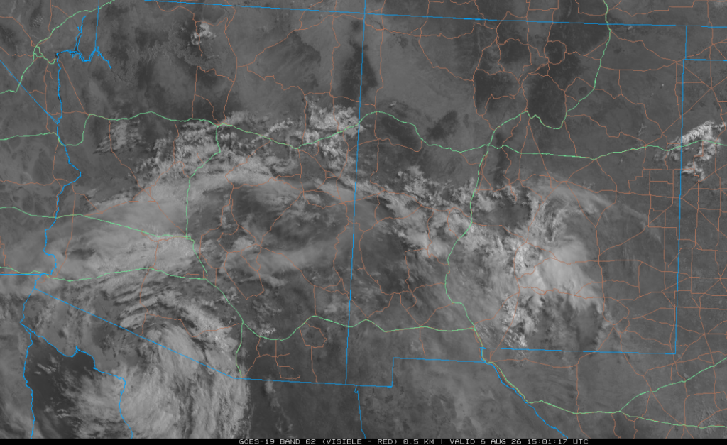
The visible satellite image from this morning at 8:30 am shows the remains of the MCS near Puerto Peñasco moving west. This image is very similar to the satellite picture from yesterday morning.
Analysis
The Gulf Surge and outflow from the MCS in Mexico are keeping surface moisture above 60°F over southern Arizona, and the higher dewpoints have moved up to Nevada. Only the Colorado Plateau and north-central New Mexico have dewpoints below 50°F. Otherwise, there has not been much change in moisture. Ambient temperatures are cooler due to the outflow from the southern Arizona storms.
The 12Z HRRR-UA WRF forecast initialization and the observed sounding from Phoenix at 5 am are similar today. The Convective Inhibition (CIN) is about the same as yesterday. The bulge of moisture between 750 mb and 900 mb was due to thunderstorm outflow from storms in Southern Arizona yesterday.

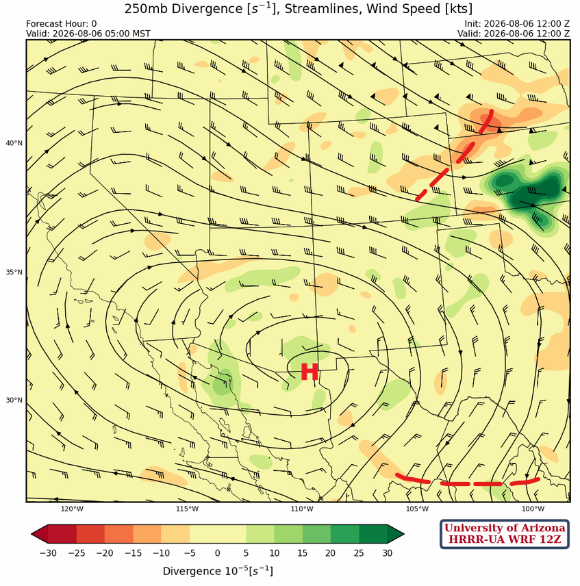
At 250mb, the monsoon high-pressure ridge has pushed a little further east and is now centered over Douglas. A short-wave trough is moving east into the Midwest, and another shortwave trough, well south of the Big Bend, is moving clockwise around the ridge.
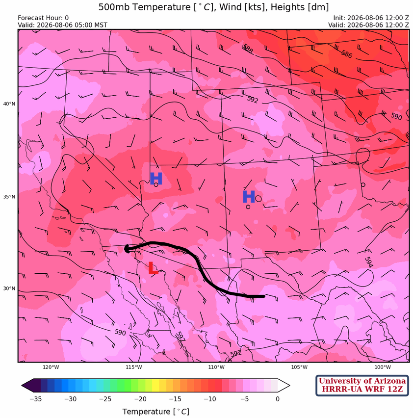
The low pressure associated with the MCS in Mexico yesterday is seen at the 500mb level over the northern Gulf of California, and it continues to move west. The monsoon ridge is elongated, and it extends from northwest Arizona to northwest New Mexico.
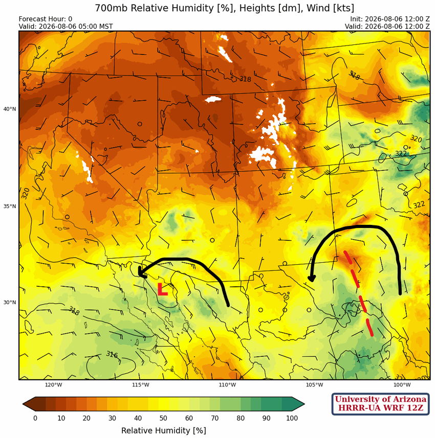
At 700 mb, the MCS is vertically aligned with the 500 mb and 250 mb centers, all in about the same location over Baja California. Another easterly wave is in west Texas and will move west and may affect Arizona weather on Saturday.
Today
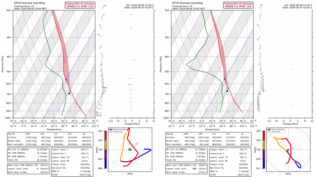
Both the Phoenix and Tucson forecast soundings for 7 pm have too much CIN to get thunderstorms into the valleys today, due to outflows cooling from last night’s storms.
The 12Z HRRR-UA WRF forecast radar shows thunderstorms form in the mountains by 6 pm. There is too much CIN in the valleys for storms to develop there, and winds aloft are pushing storms on the Mogollon Rim north and in storms forming in southeast Arizona northwest.
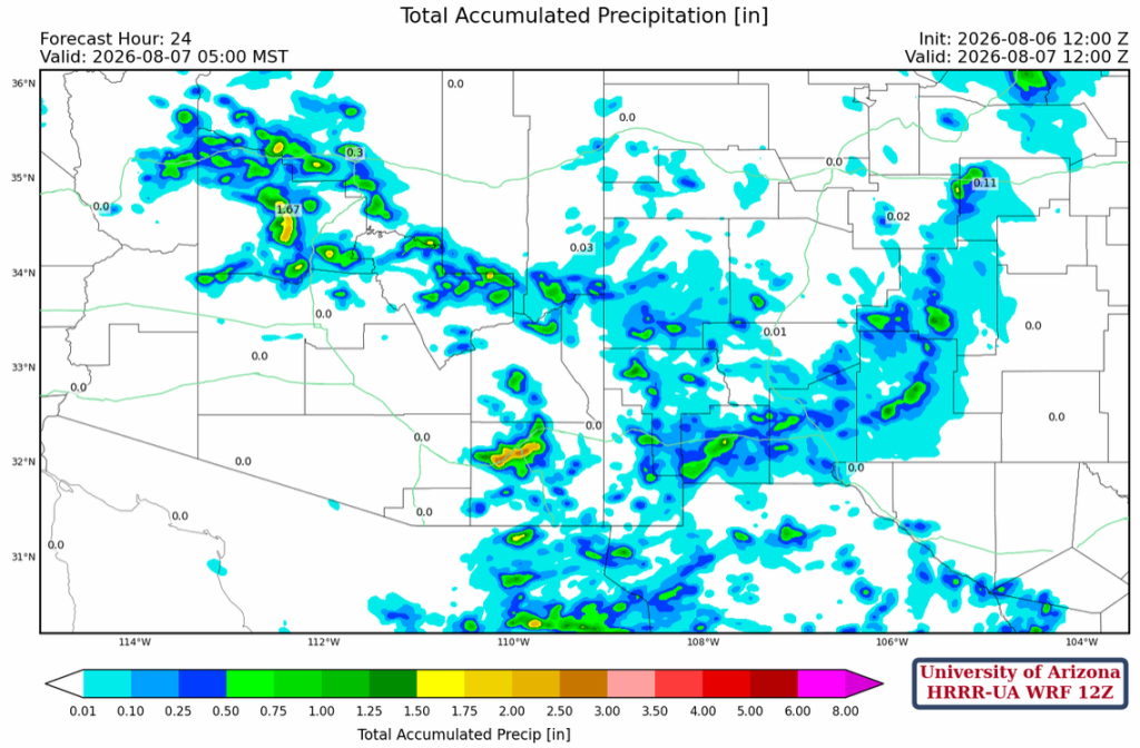
The forecast total precipitation through 5 am tomorrow shows the Phoenix/Tucson areas remain dry.
Tomorrow
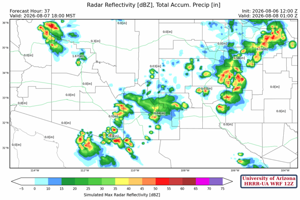
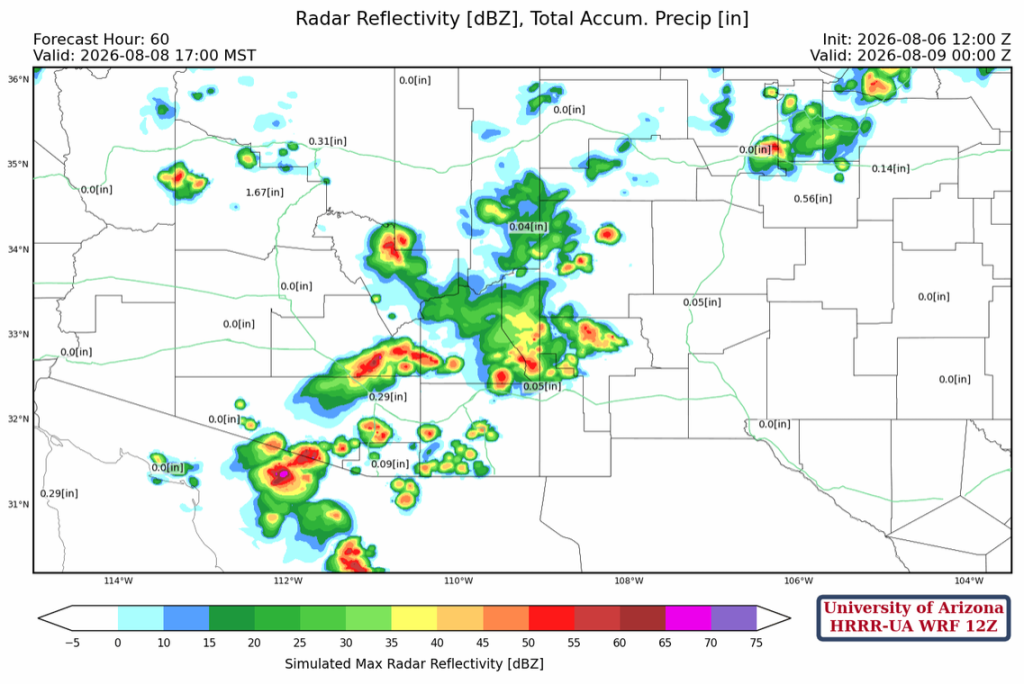
Tomorrow, there is an overall decrease in precipitation in Arizona. Although the forecast indicates storms move into Tucson, it’s more likely they will only reach the foothills of both the Catalina and Rincon mountains rather than the metro area.
Outlook
A few more storms are possible on Saturday due to the easterly wave that moves into AZ/NM from Texas. These storms have a better chance of moving into both the Phoenix and Tucson valleys.
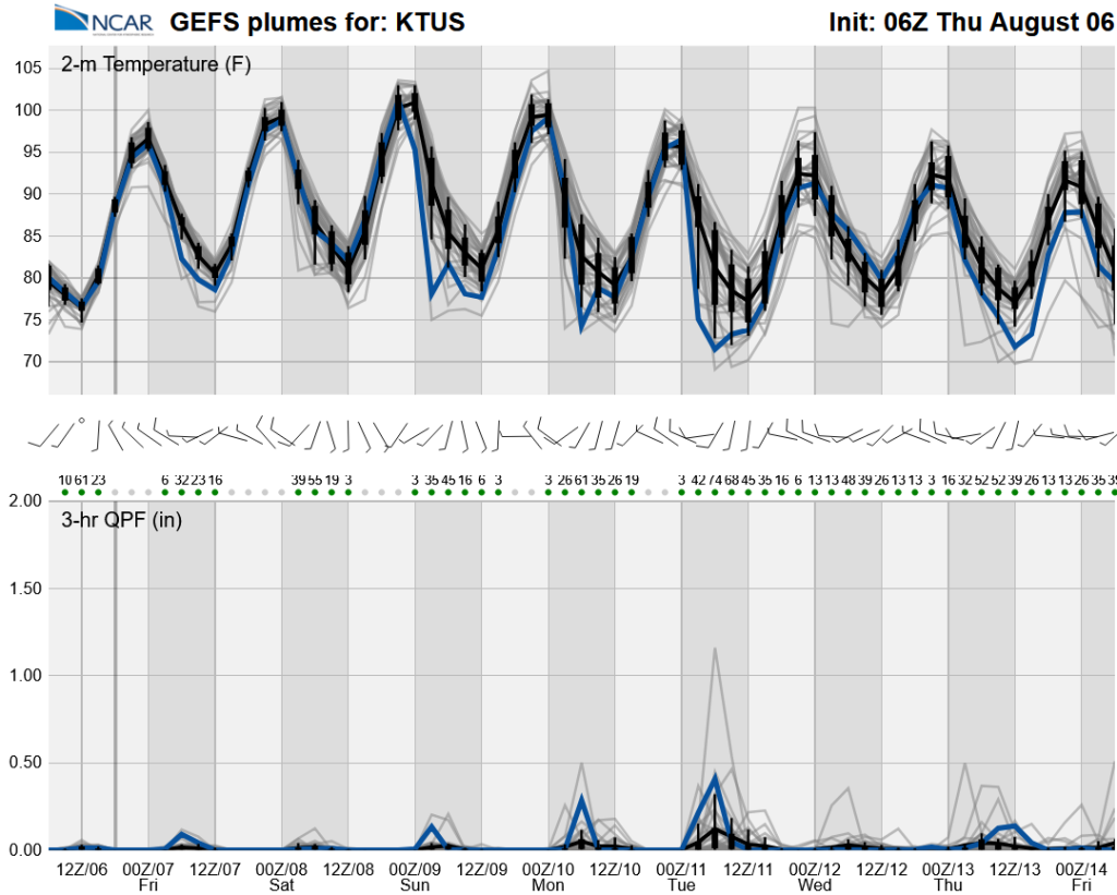
The long-range ensemble forecasts show we’re back to a low-grade monsoon until next week.
Discussion written by Pat Holbrook and Patrick Bunn