

Summary
The Tropical Upper Tropospheric Trough (TUTT) in southern California yesterday has moved north and dissipated. A new low has strengthened in eastern Arizona, aided by yesterday’s activity. Surface moisture remains high in parts of Arizona, leading to flash flood watches in areas of higher terrain northeast and southeast Arizona. Extreme heat warnings are in place in western Arizona.
Forecasts indicate that Phoenix is unlikely to see storms today due to high convective inhibition, while Tucson has a higher chance for slow-moving storms with heavy rain. Most precipitation is expected in mountainous areas (about 0.5″), with valleys staying relatively dry unless a storm propagates and continues to develop from the southeast.
Tomorrow, moisture and storm activity are predicted to decrease further, especially for Phoenix, while Tucson may still see scattered storms. By Thursday and into the weekend, monsoon activity is expected to lessen, with only isolated showers and a trend toward warmer temperatures. A possible return of moisture next week could bring renewed monsoon activity, but some down days are ahead.
Yesterday’s Weather
Thunderstorms developed in eastern and northern Arizona in the areas that cleared out from remnant showers and clouds that persisted into Monday morning. Heavy rain/flooding was reported at Payson with the thunderstorm circled in black. The thunderstorm and associated outflow moved towards Phoenix, and produced a wind gust of 68 mph at Phoenix Sky Harbor Airport, but only a trace of rain. After they moved from the mountains to the east, the thunderstorms ran out of Convective Available Potential Energy (CAPE), with new cells forming along the outflows and dying rather quickly.
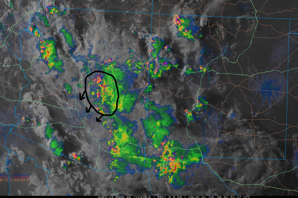
Storms moved into Tucson by 8 pm as shown by the observed radar reflectivity (below right). Wind gusts were near 40 mph with very little lightning, reflecting weak updrafts from the lack of CAPE.
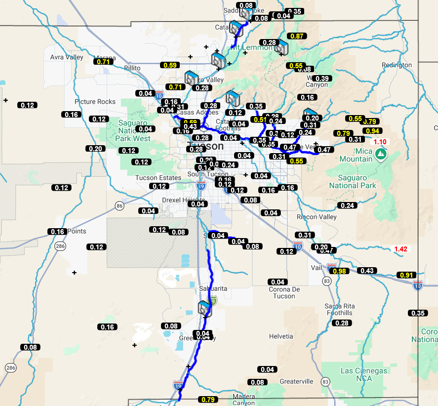
The Pima County Flood Control 24-hour precipitation amounts from yesterday are below. The heavy rain was in the mountains and foothills, with most valley locations receiving 0.25” or less.
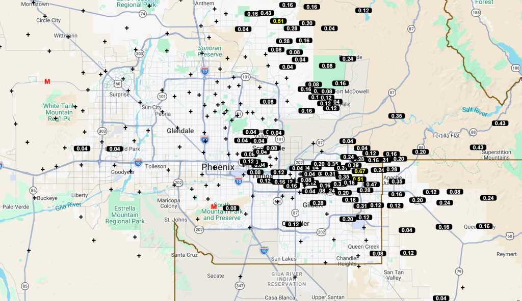
Similar to Tucson, the Maricopa County alert gauges had the greatest precipitation totals reported east of I-10 and I-17. Around 0.25”, generally, though some maximums of ~0.5”.
Analysis
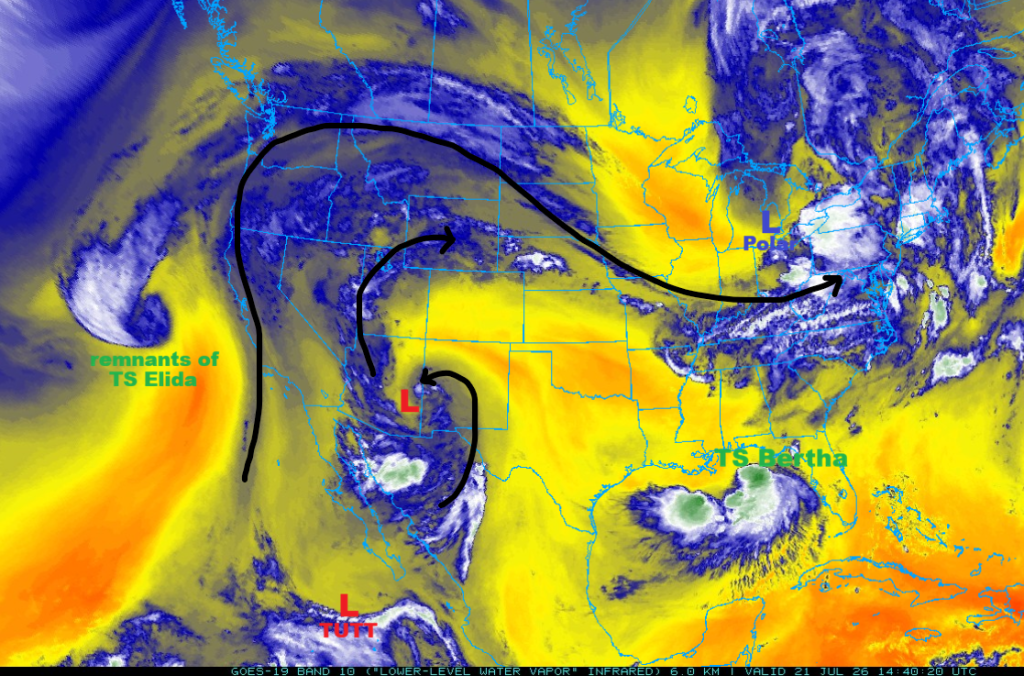
The Tropical Upper Tropospheric Trough (TUTT) over southern California yesterday has moved well to the north to northern Nevada and is no longer identifiable as a TUTT low. A new low has formed in eastern Arizona as a result of last night’s storm activity. The persistent TUTT to our south keeps wobbling around the southern tip of the Baja Peninsula. The polar low near the Great Lakes is continuing to move east, guided by the jet stream. Remnants of Elida continue to move north up the West Coast, and lastly, the tropical depression in the Gulf of Mexico is now Tropical Storm Bertha, which is moving slowly west off the coast of Florida.
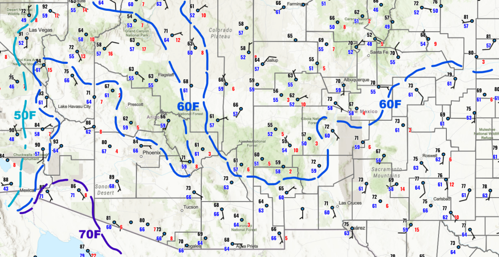
The surface is still very moist in the mountains of eastern Arizona, western New Mexico, and from the Mogollon Rim north to southern Utah. Flash flood watches are in place for higher terrain, Prescott northwest to the Colorado Plateau, and the easternmost counties: Gila, Greenlee, Graham, and Cochise. An extreme heat watch is in effect for the western part of Arizona into California.
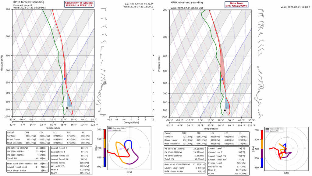
The HRRR-UA WRF 12Z initialization (left) and observed sounding (right) for Phoenix at 5 am are below. A little more CAPE on the observed sounding versus forecast initialization, but not enough to affect the overall forecast quality.
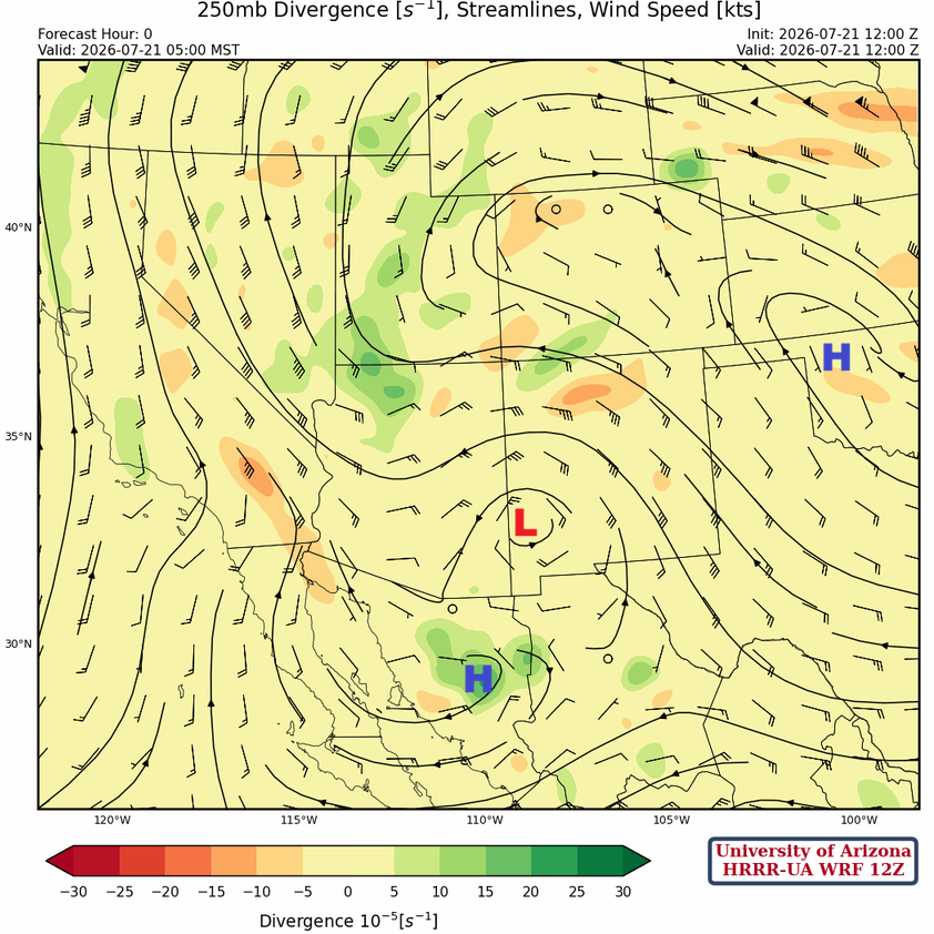
At 250mb, a new low is over southeast Arizona with a high to the south in Mexico, and the subtropical high-pressure that was in Colorado yesterday has shifted to Oklahoma, in the wake of the polar low near the Great Lakes.
At 500mb, the low near Douglas is a reflection of the 300mb low in the same area. This low may have originated from the cold air aloft associated with the polar low that caused all the flooding in Texas, which has now taken on more tropical characteristics.

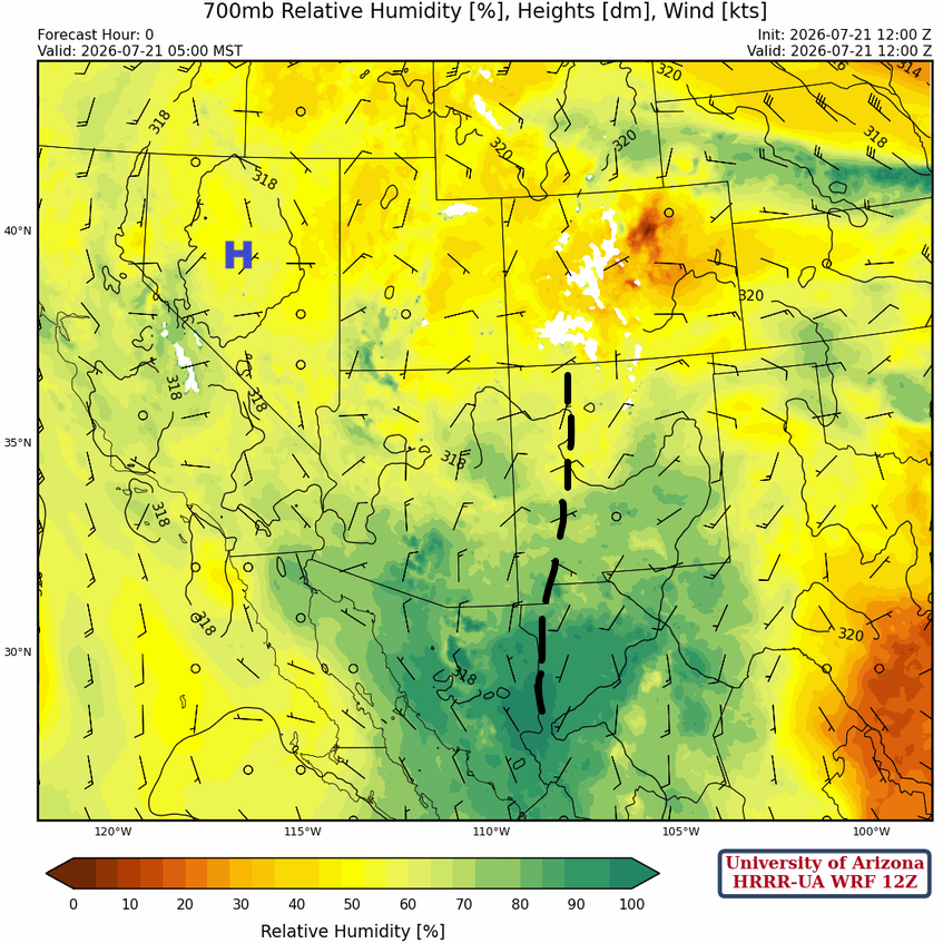
At 700mb, a trough in western New Mexico that extends down to east of Douglas reflects the upper lows at 300mb and 500mb and has similar characteristics of an easterly wave except that it has not moved much in the last day.
Today
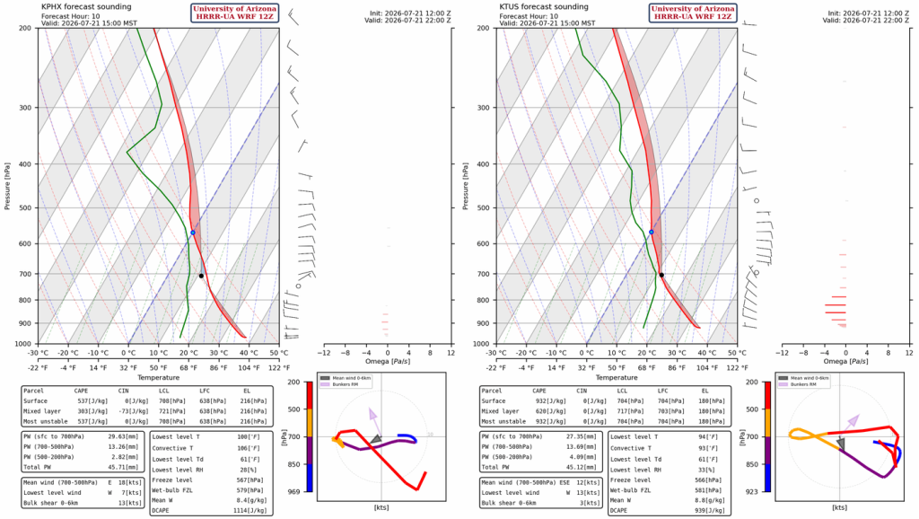
There is a fair amount of Convective Inhibition (CIN) on the forecast sounding for Phoenix this afternoon at 3 pm, stemming from the outflow boundaries from yesterday’s activity that moved through the area. There will probably not be enough Convective Available Potential Energy (CAPE) to overcome the CIN and initiate thunderstorms in the valley. For Tucson, there’s more CAPE available 600 [J/kg] and no CIN. So, given the 0-6 km wind flow, slow-moving storms with heavy rain are possible.
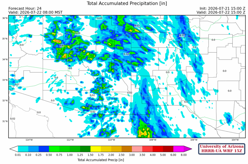
HRRR-UA WRF 15Z forecast radar shows storms forming this afternoon and evening from Tucson to Nogales, and north and northwest of Phoenix in the mountains on the Colorado Plateau and Mogollon Rim. Some storms will also form east of Phoenix, but will not move into the valleys. In Pima County, storms will initiate on the Catalinas, Rincons, and Mt Graham slightly earlier today between 3 and 5 pm. Storm propagation is west-northwest, so storms could miss the valley unless the storms from the Rincons continue developing as they move off the mountain.
The HRRR-UA WRF 15Z 24-hour accumulations are greater than 0.5″ in the mountains near Tucson, but less than 0.25″ in the valley. Phoenix will remain dry, and the most intense activity is in northern Arizona between Prescott and Flagstaff, where 0.5″ to 1.5″ is predicted depending on elevation.
Tomorrow
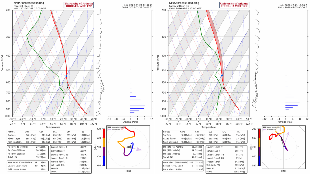
Precipitable water values drop at both Phoenix and Tucson, and winds above the boundary layer are from the southeast and south. This is not a favorable sounding for activity in Phoenix, but scattered afternoon and evening thunderstorms are possible for Tucson.
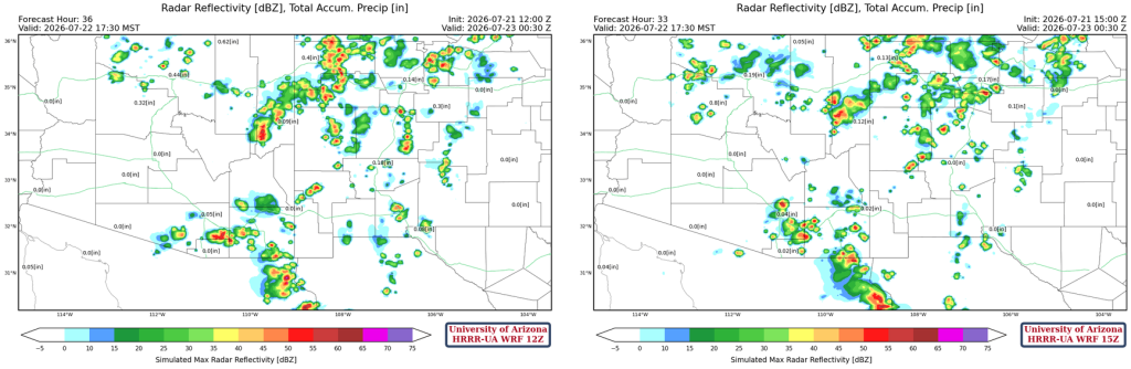
Both the 12Z and 15Z HRRR-UA WRF forecasts have less precipitation for New Mexico and Arizona on Wednesday.
Outlook
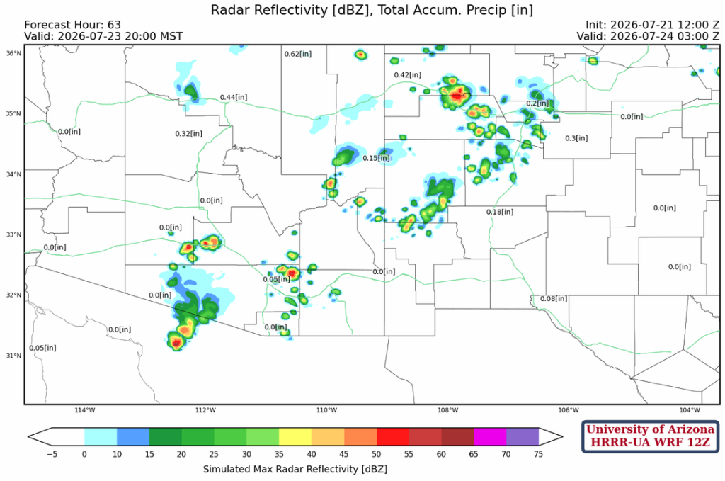
Even less activity on Thursday with only isolated showers and thunderstorms as shown below.
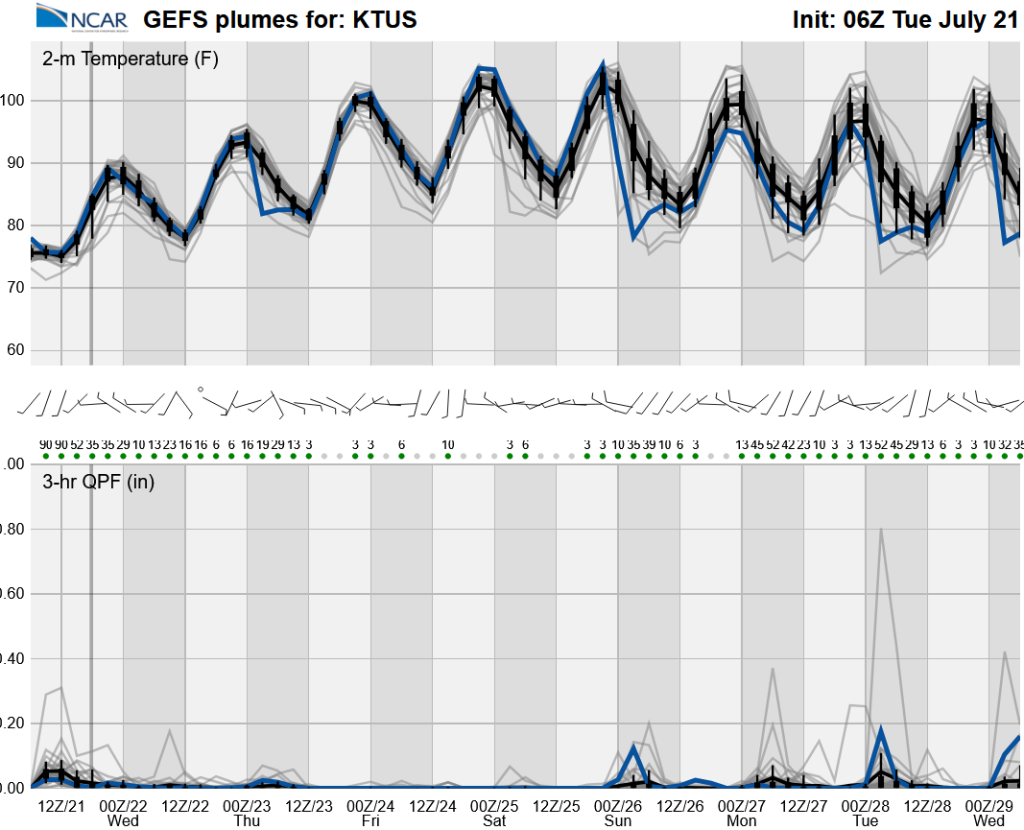
Global model ensemble forecasts (GEFS) show monsoon precipitation will reduce into the weekend and afternoon temperatures warm through Sunday. Moisture may return from Sunday into next week for a more active monsoon period.
Discussion written by Pat Holbrook and Patrick Bunn