

Summary
Moisture persists in eastern New Mexico as air moves from the Gulf of Mexico, while elevated dew points near Yuma reflect warm surface waters in the Gulf of California. Weather station observations indicate dry conditions in Arizona, with moisture spikes mainly in New Mexico. The monsoon ridge remains south, and a short-wave trough is moving through the western United States, bringing cold air aloft to the north.
Thunderstorms are expected to form in southeast New Mexico, producing localized rain and gusty winds, but overall precipitation is light and scattered. Tomorrow is forecast to be another day for Arizona, before a potential increase in moisture from the remnants of a tropical storm in the Pacific west of the Baja coast. Long-range outlooks suggest a gradual increase in moisture over the next week, but we’re cautious about this prediction, as monsoon moisture typically increases more quickly.
Yesterday’s Weather
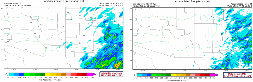
Except for eastern New Mexico, rain was scarce yesterday. The satellite image below shows a few clouds and maybe a shower over far southeast Arizona, along with a few smoke plumes from wildfires.
The 24-hour accumulated precipitation observations show nothing for Arizona, and accumulated totals up to 1 inch in parts of eastern New Mexico.
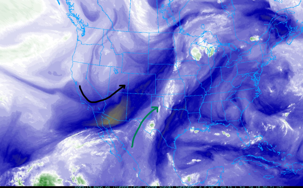
Not much change in the location of the polar jet (black) and monsoon moisture axis (green).
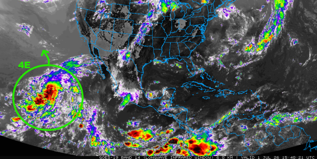
Tropical Depression 4E will move slowly northward in the Pacific, but before it dissipates completely, some mid-level moisture will move into Arizona from this system and may kick off some mountain-confined storms over the weekend.
Analysis
Significant moisture remains in eastern New Mexico due to surface advection from the Gulf of Mexico. The higher dewpoint temperature in the Yuma area and south reflects the high sea surface temperatures in the Gulf of California.

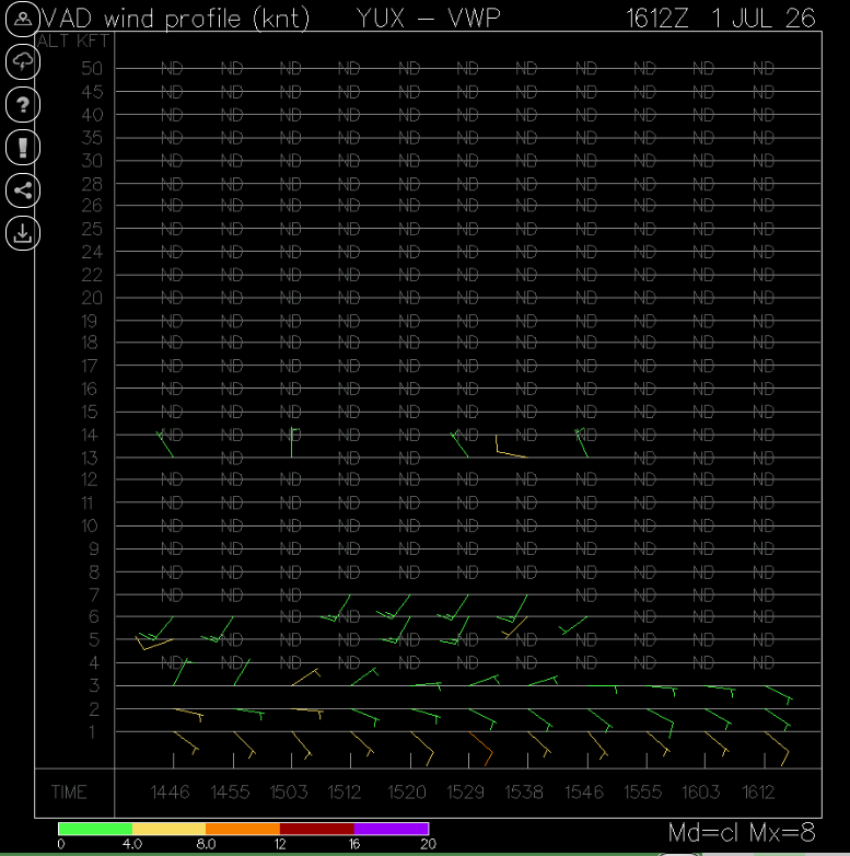
Below is a Velocity Azimuth Display wind profile (VWP) from the Yuma radar. VWP is a radar algorithm that estimates horizontal wind speed and direction at various altitudes above a radar site. The profile from Yuma shows low-level east winds in the layer below 2000 feet. There is no precipitation, just radar signals returned by bugs and dust. Once a gulf surge forms, the VWP will show the strength of the wind associated with the surge. Before the surge reaches Yuma, reflectivity will increase over the Gulf of California.
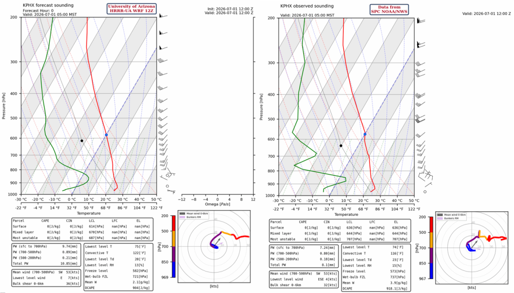
Except for a spike in moisture near 850 mb, the Phoenix sounding remains dry, while the tropopause has lowered to 180 mb. Westerlies still dominate the flow. Total column precipitable water is just 8mm (0.3″).
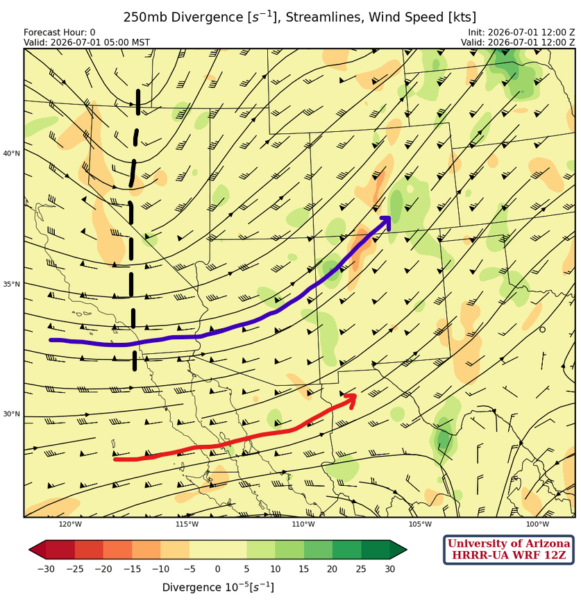
At 250 mb, the Monsoon ridge is still to the south, and the polar (blue) and subtropical (red) jets are as indicated. The short-wave trough from southeast Oregon and south into California is the second short-wave moving through the mean trough position (black dashed line).
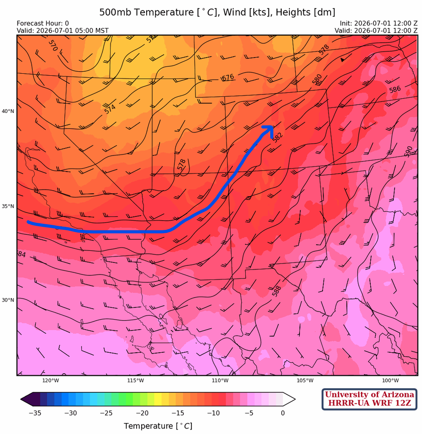
At 500 mb, there is very cold air aloft over southern Idaho and Montana, with a few stations reporting snow. The polar jet shown in blue is at the southernmost position it’s forecast to reach, as the monsoon ridge builds back northward.
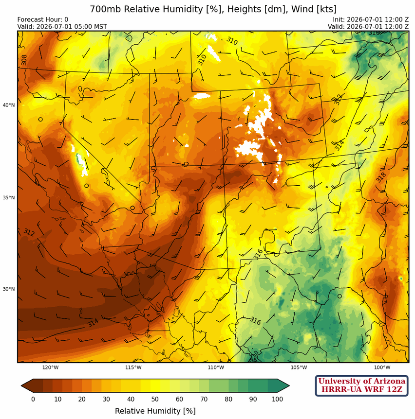
It’s still dry across Arizona at 700 mb, with similar moisture compared to yesterday in New Mexico.
Today
The HRRR-UA WRF 12Z forecast sounding for Carlsbad, NM, below indicates thunderstorms forming again today in southeast New Mexico with reasonable wind shear, 33 mm of precipitable water, and over 750 [J/kg] of CAPE. Forecasts for microburst winds are in the 35kt range, based on a Downward Convective Available Potential Energy of 1284 [J/kg].
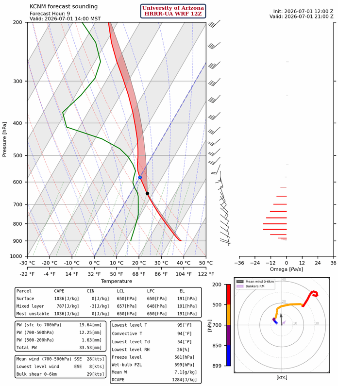
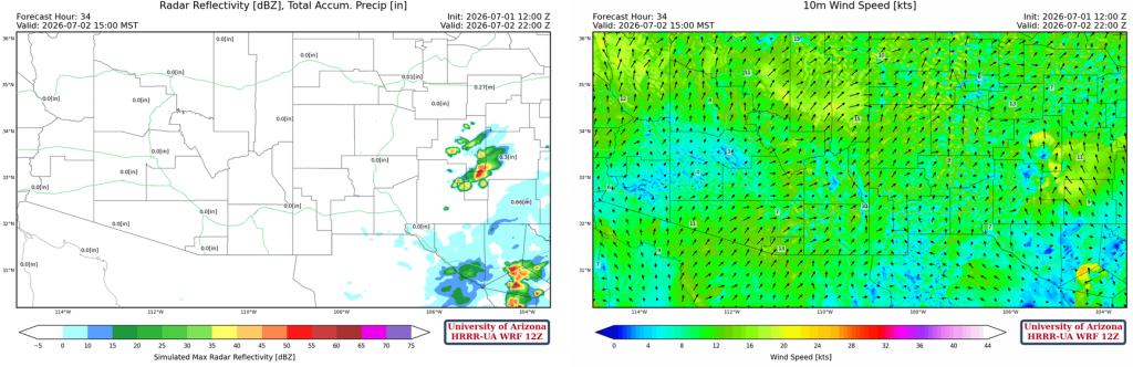
Precipitation in eastern New Mexico is neither heavy nor widespread, but some storms may produce up to 0.75” of rain.
Tomorrow
Tomorrow may be the day with the least precipitation we will see until the end of the monsoon. The good news is that things are forecast to change.
Outlook
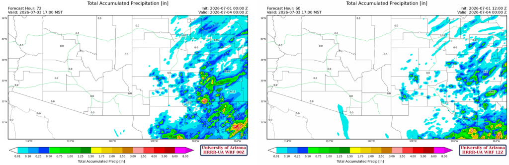
The 12Z and 00Z HRRR-UA WRF radar forecasts valid for 5 pm Friday are shown below. The precipitation in New Mexico is generally consistent over time and across locations. The Arizona precipitation forecast is inconsistent. Each model is having trouble with mid-level moisture from tropical depression 4E, which is understandable given the lack of upper-air observations in the Pacific Ocean.
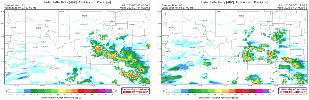
At least both model runs agree that little or no rain will reach the surface, so Friday looks like a day of mid-level clouds producing virga.
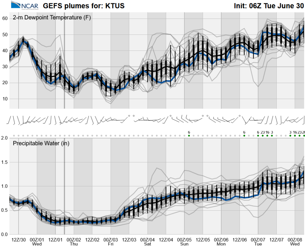
Ensemble forecasts of 2-meter dewpoint temperature and precipitable water are below from the GEFS long-range global model. They show a gradual ramp-up to the monsoon, which raises skepticism in the forecast, since it usually occurs over just a few days.
Discussion written by Pat Holbrook and Patrick Bunn