

Summary
Surface moisture is mostly limited to eastern New Mexico, with dry conditions prevailing elsewhere in the region. Red flag warnings remain in effect for parts of northern Arizona, western New Mexico, eastern Utah, and Colorado’s mountains due to dry air and gusty winds. Weather balloon observations and model forecasts indicate very low precipitable water in Arizona, resulting in limited thunderstorm activity and mostly dry weather. Some light showers may occur in southeast Arizona, but without significant lightning risk.
Over the next few days, the polar and subtropical jet streams are expected to weaken and shift north, bringing slightly warmer air to Arizona. Thunderstorm activity will gradually move into New Mexico, with a slight increase in moisture forecast by July 4th, potentially bringing isolated storms to the mountains in eastern Arizona. However, widespread storms are unlikely until at least the middle of next week if moisture levels rise.
Yesterday’s Weather
The satellite image below, from yesterday afternoon, shows a mix of meteorological features, including smoke plumes over Utah, Colorado, and Arizona. A little further south are cloud streets. Long, parallel rows of cumulus clouds that stretch across the sky in alignment with the direction of the low-level wind flow. The cumulus clouds represent upward vertical motion with sinking air between each cloud street. Finally, thunderstorm activity is noted from south of El Paso into far southeast New Mexico and West Texas
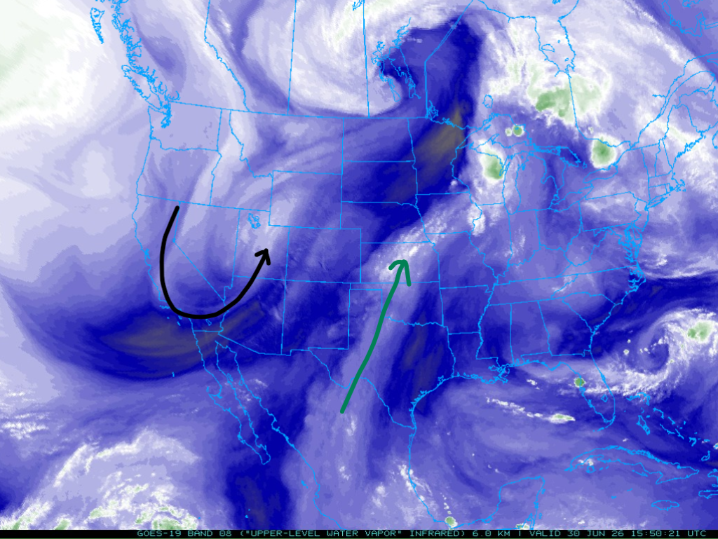
The polar jet stream has dipped farther south into northwest Arizona, as shown in the water vapor satellite imagery below. The monsoon flow has shifted well east into Texas. The flow associated with the polar jet stream has become latitudinal (north to south) versus meridional (west to east). This type of pattern allows short wave troughs to move through the mean trough position without any significant change in the location of the trough.
Analysis
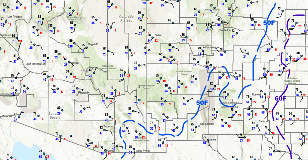
Any significant surface moisture is confined to eastern New Mexico. Red flag warnings continue for parts of northern Arizona and western New Mexico, as well as eastern Utah and most of the mountainous areas of Colorado.
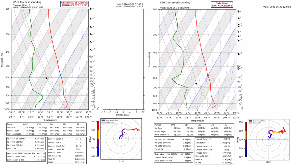
The Phoenix sounding shows only 0.3” (8mm) of precipitable water due to the dry air brought in by the westerly winds aloft. The HRRR-UA WRF 12Z initialization matches the observations well.
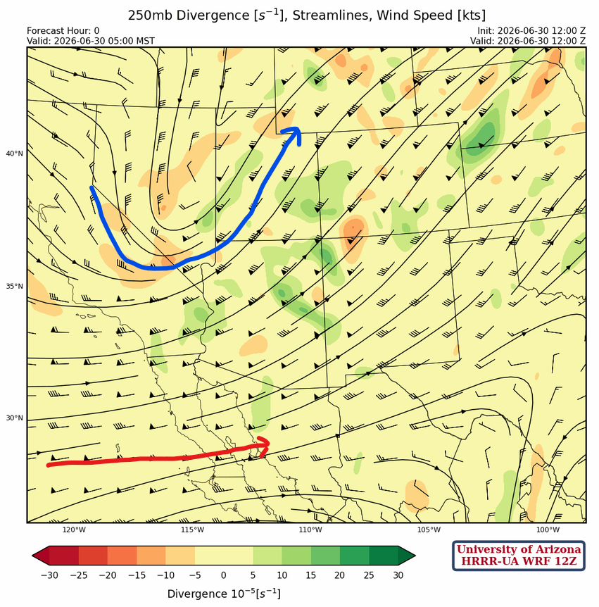
The position of the polar jet (blue) and subtropical jet (red) at 250 mb is annotated below. Over the next few days, both jets will shift northward with the polar jet weakening. The subtropical jet will be associated with a broad area of sinking and warming air, as is typical.
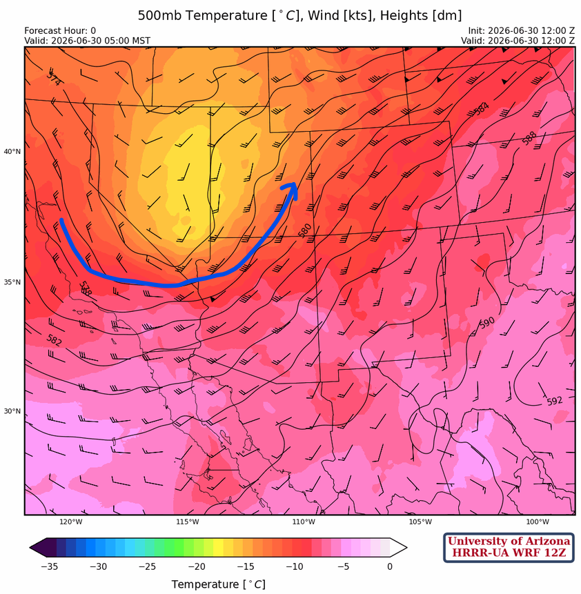
At 500mb, the coldest air aloft associated with the polar jet is around –15° C in eastern Nevada. Warmer air is moving into Arizona thanks to westerly winds beneath the trough and general atmospheric subsidence.
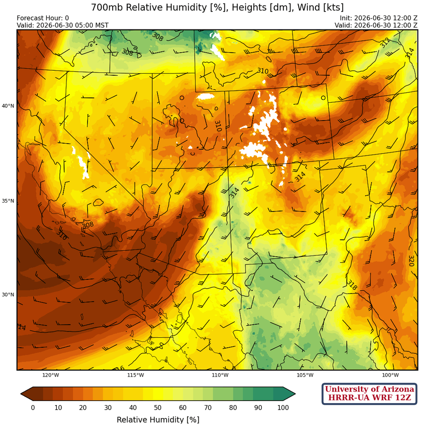
Moisture remains in far eastern Arizona, extending down and east of the Sierra Madre mountains in Mexico at 700mb. Dry air continues to move into the western half of Arizona.
Today
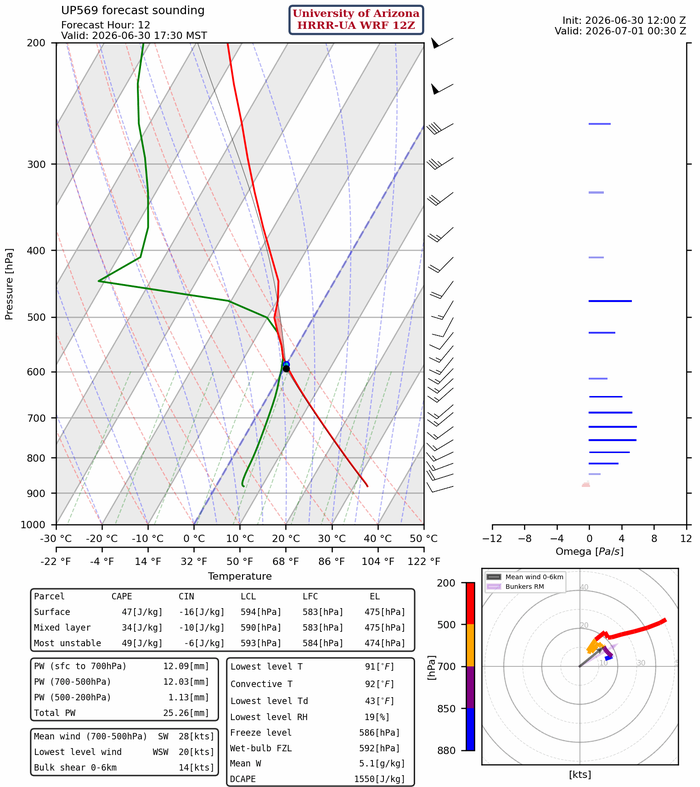
The HRRR-UA WRF 12Z skewT forecast below is for San Simon at 5:30 pm. Cloud streets will likely form in southeast Arizona again today, and there may be just enough moisture for some light showers in this area, but no graupel (small hail aloft). Without graupel, there won’t be any lightning.
The simulated radar reflectivity forecast shows showers in Cochise County and thunderstorms associated with the best moisture, generally east and north of El Paso. Although the red flag warning remains in effect for eastern Arizona and western New Mexico, winds aloft are weakening, and the warning will expire this evening.
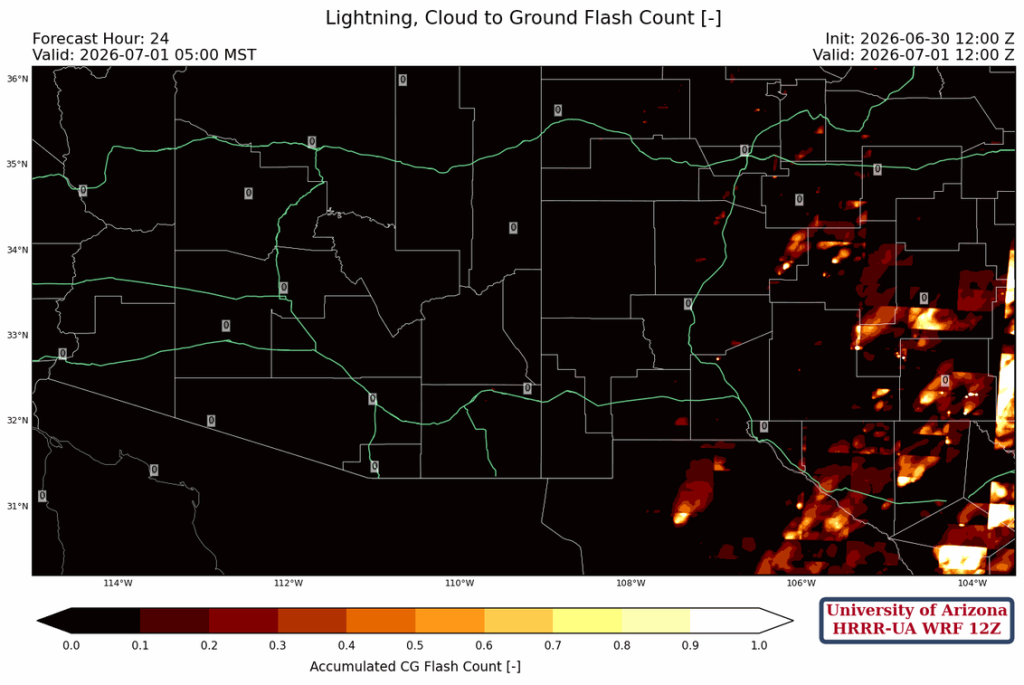
The HRRR-UA WRF 12Z forecast below is for the accumulated number of lightning strikes through to tomorrow morning at 5 am.
Tomorrow
Most of the thunderstorm activity shifts eastward into New Mexico, and surface winds are slowing, though still somewhat elevated in higher terrain.
Outlook
On Thursday, some isolated storms will form in New Mexico, but elsewhere it will be dry. The dewpoint temperatures across Arizona are extremely low, while eastern New Mexico gets moisture from the Gulf of Mexico.
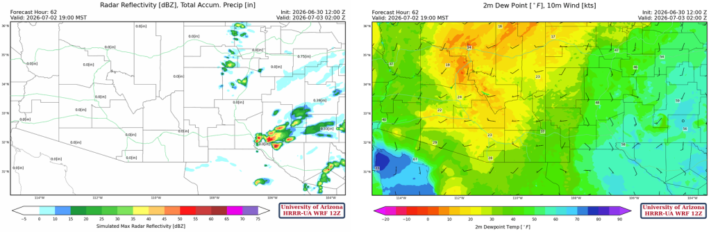
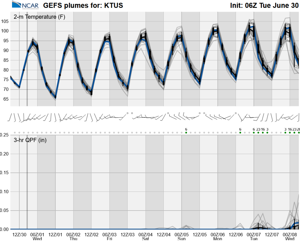
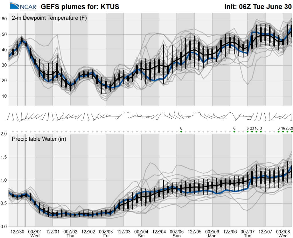
The ensemble forecasts below show a bump in precipitable water to about 0.75″ by July 4th. This may be enough for storms in the mountains of eastern Arizona, but not the valleys. To get storms more widespread, we will probably have to wait until the middle of next week if precipitable water values continue to increase.
Discussion written by Pat Holbrook and Patrick Bunn