
Yesterday’s Weather
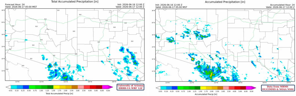
The 24-hour total precipitation from the HRRR-UA WRF 12Z forecast and the corresponding MRMS observations are shown below. The forecast did a decent job in southern Arizona, but missed the storms in the Mogollon Rim and in western Arizona south of I-10. Despite convection initiating in the model in these locations, the precipitation accumulations were missed. The amount of precipitation in the storms near Sells was underestimated, too.
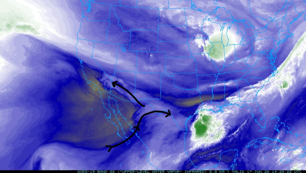
The visible satellite images are shown below with GLM lightning strikes overlaid. With strong westerlies aloft, the anvils were blown east of the actual storm, whereas the lightning strikes indicate the location of the actual rain. The storms ended by 10 pm.
Analysis
The moisture axis has shifted even farther east, with a secondary moisture axis extending from southeast Arizona into California.
Low-level moisture is across the low-desert areas from Tucson and Phoenix southwest to Yuma, and this should be where storms form today, as shown by the observed 2-meter dewpoint temperature below.

The Phoenix sounding (below right) is similar to yesterday’s, except for additional moisture below 750 mb. The 500 mb temperature remains at -10 °C, and the cold air aloft, combined with increased low-level moisture, will support thunderstorm development. The HRRR-UA WRF 12Z initialization has some issues: 3 mm less precipitable water than observed and cooler/drier near-surface ambient/dewpoint temperatures, though that doesn’t seem to impede the development of significant convective available potential energy (CAPE) later in the simulation.

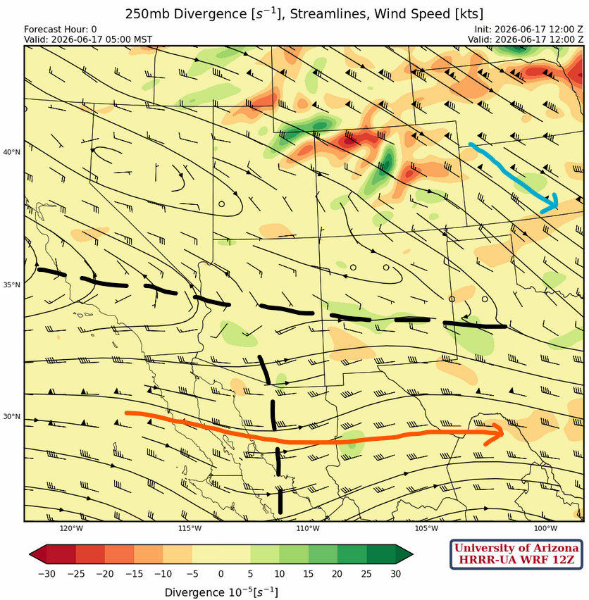
At 250mb, the trough in Arizona is in about the same position as yesterday, with the polar jet shifting to the northeast. The subtropical jet had only minor changes in development, and the trough continues to move slowly east into northwest Mexico.
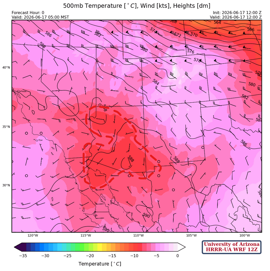
At 500 mb, the polar jet extends from Wyoming to Nebraska, and a ridge may be forming over southwest Mexico. The -10°C temperatures over Arizona, as marked in red dashes below, should indicate where the thunderstorms will occur today. The bases of the storms will be slightly lower today, at around 12,000 feet. Yesterday, a storm formed over the Rincon Mountains, and the rain it produced evaporated before reaching the ground. With lower cloud bases and more moisture, the risk of strong microbursts is high today!
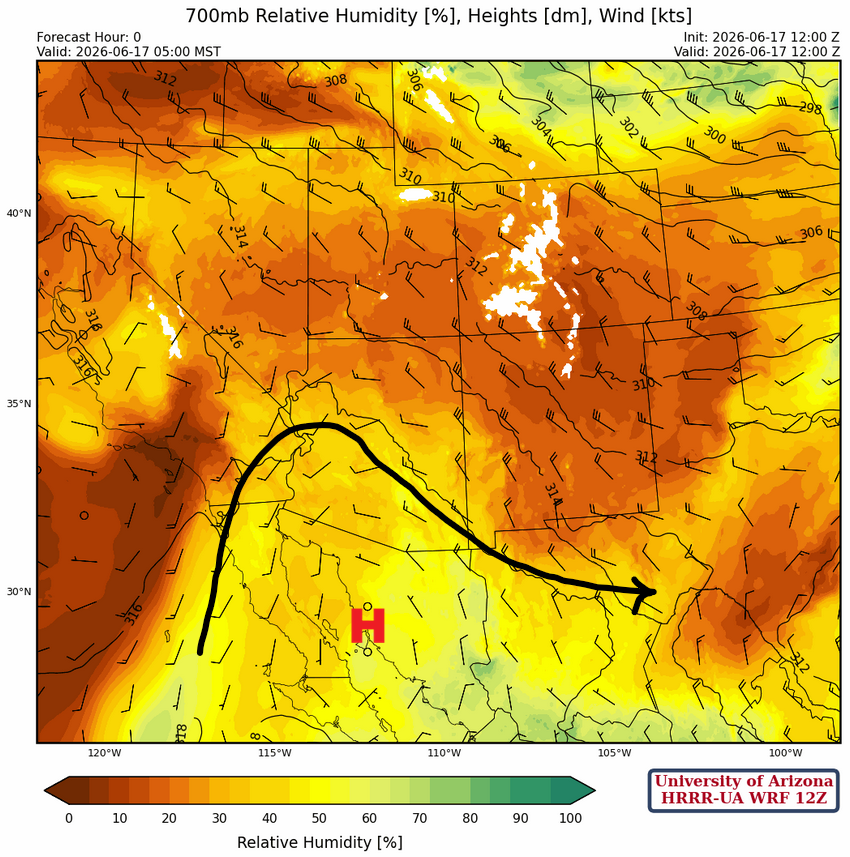
At 700 mb, a ridge is over northwest Mexico, with moisture moving into Arizona and dry air moving into New Mexico.
Today
Both forecast soundings for Phoenix (left) and Tucson (right) show an unstable atmosphere this afternoon, with maximum mixed-layer Convective Available Potential Energy values of >800 [J/kg] and >500 [J/kg], respectively. Both locations are forecast to exceed their respective convective surface temperatures: 106°F in Phoenix and 98°F in Tucson. Thunderstorms that form will move eastward, given the uniform vertical wind profiles shown below.

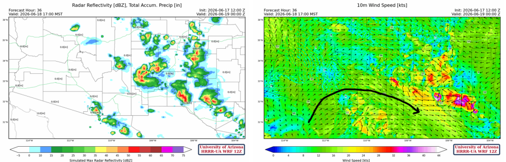
Convection starts on the Mogollon Rim by noon, but thunderstorms in the valley form only around 4 pm, with peak activity around 7 pm. The strongest storms will stay east of I-10/I-19 in Pima, Santa Cruz, and Pinal counties. Although storms are not forecast in Maricopa County, it can’t be ruled out given the primed forecast sounding above.
2-meter dewpoint temperatures and 10-meter winds indicate surface moisture is coming in from the Gulf of California, and strong outflow gusts are possible in southeastern Arizona from 4 pm onward.
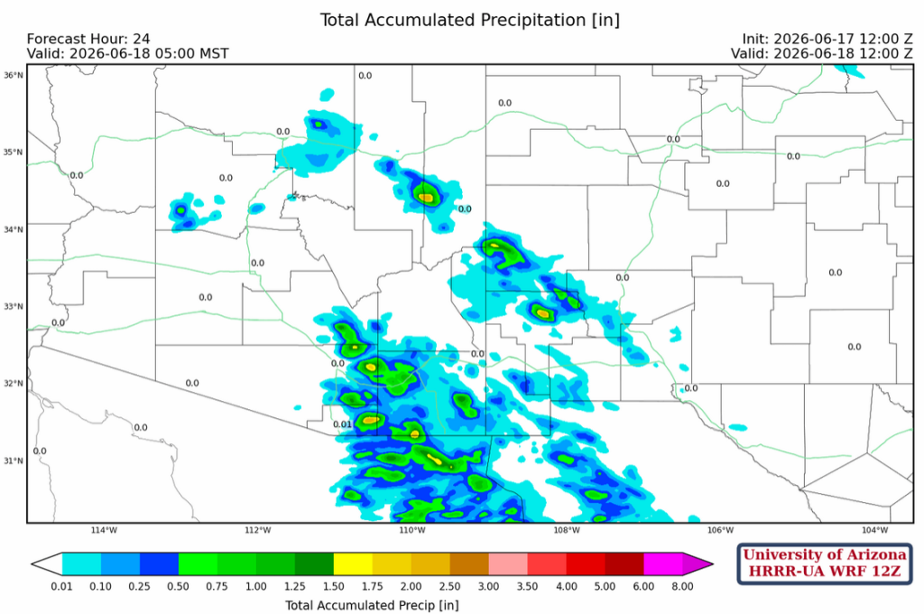
Below is the 24-hour precipitation forecast with some totals above 1.5 inches in the mountains.
Tomorrow
The westerlies push the low-level moisture into New Mexico tomorrow, with an overall decrease of storms in Arizona.
The forecast dew point temperatures drop into the 40°Fs by tomorrow afternoon in southern Arizona and New Mexico.

Outlook
By Friday, the ensemble forecast from global forecast models shows that the tropical moisture is gone for now… possibly returning in July around Independence Day. Why such a long break? An El Niño pattern should theoretically cause a delayed monsoon onset, given a shift toward strengthening tropical westerlies rather than the monsoon circulation, which has a southerly wind component bringing moisture from Mexico. The faux monsoon we have seen over the last few days was driven by tropical moisture advected into the area by the westerlies, not a true monsoon circulation.
Without monsoon moisture, this is what happens…
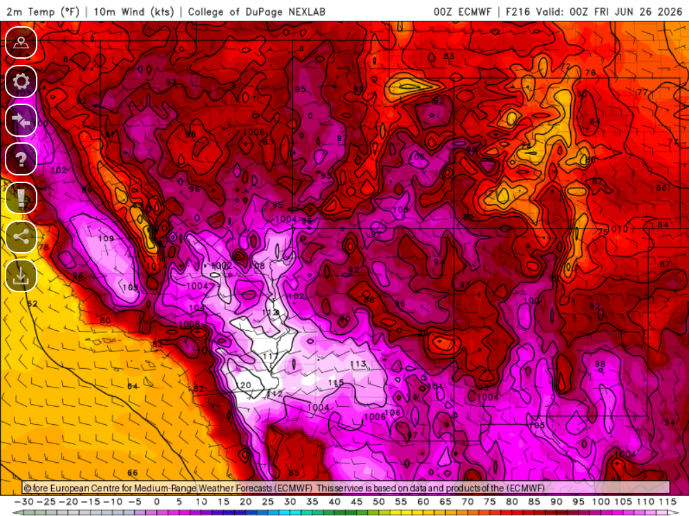
The forecast temperatures are valid for next Friday, June 26th, with Phoenix at around 115°F, Tucson at 106°F, and Yuma at 112°F. Long-range forecasts show some cooling after that, but warming up again by July 4th.
Discussion written by Pat Holbrook and Patrick Bunn