

Summary
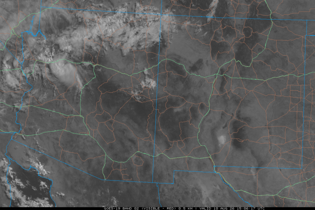
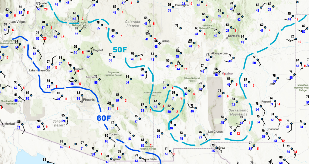
The subtropical high-pressure monsoon ridge at 500 mb is centered over northwest New Mexico, and temperatures at this level over western New Mexico and southeastern Arizona are cool enough to support thunderstorms. Surface dewpoints remain high, and despite boundary layer cooling from last night’s activity, convective temperatures are expected to be reached today in SE Arizona. Visible satellite imagery shows that while northwest Arizona has lingering clouds from recent storms, most of the region remains clear, and dry air persists in New Mexico. The National Weather Service has issued a flash flood watch for parts of southern Arizona.
Forecasts indicate that thunderstorms will develop in eastern Pima and Santa Cruz counties this afternoon and move northwest, though they look relatively unorganized in the simulated radar reflectivity forecast. Another round of stronger, more organized storms moves into the Tucson area by 9 pm and continues northwest toward Phoenix. The greatest precipitation totals are expected in the mountains west of Tucson in central Pima County. Tomorrow’s activity is predicted to be extremely similar in its pattern and movement, though with more intense rainfall and greater 24-hour accumulations.
By midweek, a trough from the polar jet will shift wind patterns and reduce monsoon moisture, with longer-range forecasts suggesting a return of the monsoon ridge after August 20th.
Yesterday’s Weather
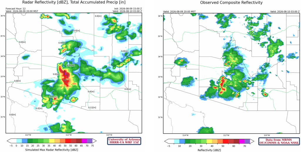
Yesterday evening, severe storms developed in central and western Pima County and then moved north into Maricopa County. Below is the HRRR-UA WRF forecast at 12Z (left) and corresponding radar observations at 8 pm last night.
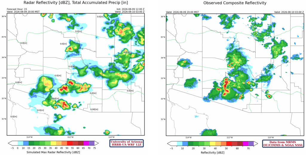
The 15Z forecast appears to have a better handle on the situation, though the forecast was certainly not perfect. The precipitation forecast for western Pinal County developed further west, and then the Phoenix and Gila Bend storms merged as the outflow boundaries collided.
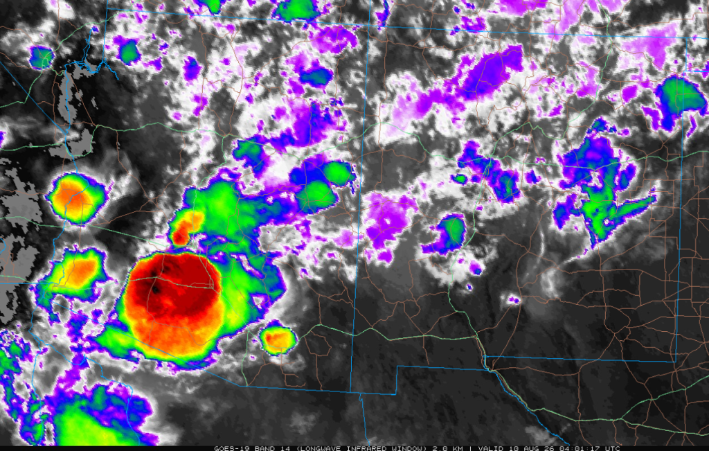
The infrared satellite image from 9 pm shows the huge storm near Gila Bend and the much smaller one in Phoenix.
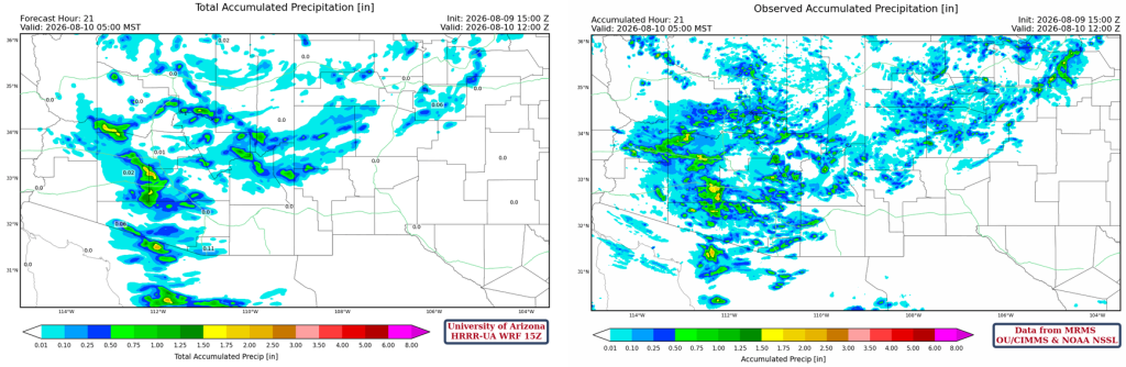
The HRRR-UA WRF 12Z 24-hour accumulated precipitation forecast (left) and corresponding observed precipitation from MRMS (right) are shown below. The area in the green box was missed by the 12Z forecast, as well as isolated storms along the Colorado River.
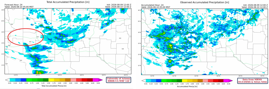
The HRRR-UA WRF 15Z accumulated precipitation, for the same time period, was better than 12Z.
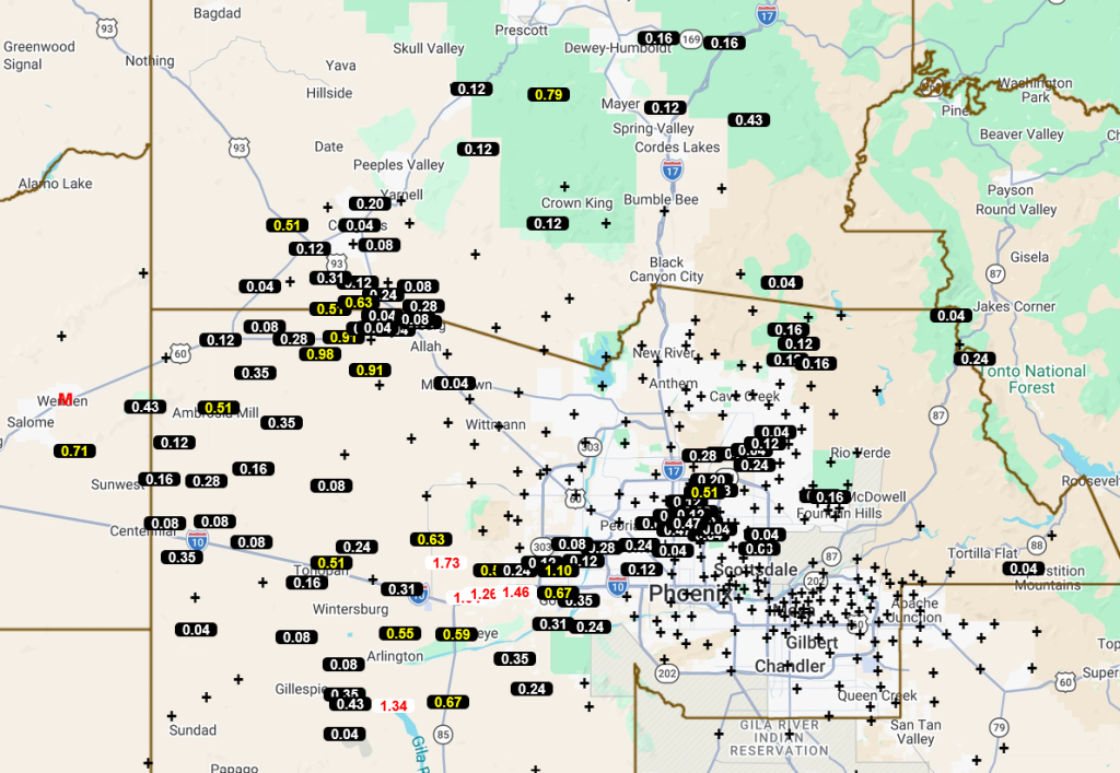
The Maricopa and Pima County Flood Control Alert rain gauge data is below. A storm formed in northeast Phoenix and moved southwest to Buckeye. Not all areas of Phoenix enjoyed the rain, and the heaviest rain did not fall until the storm passed Loop 303.
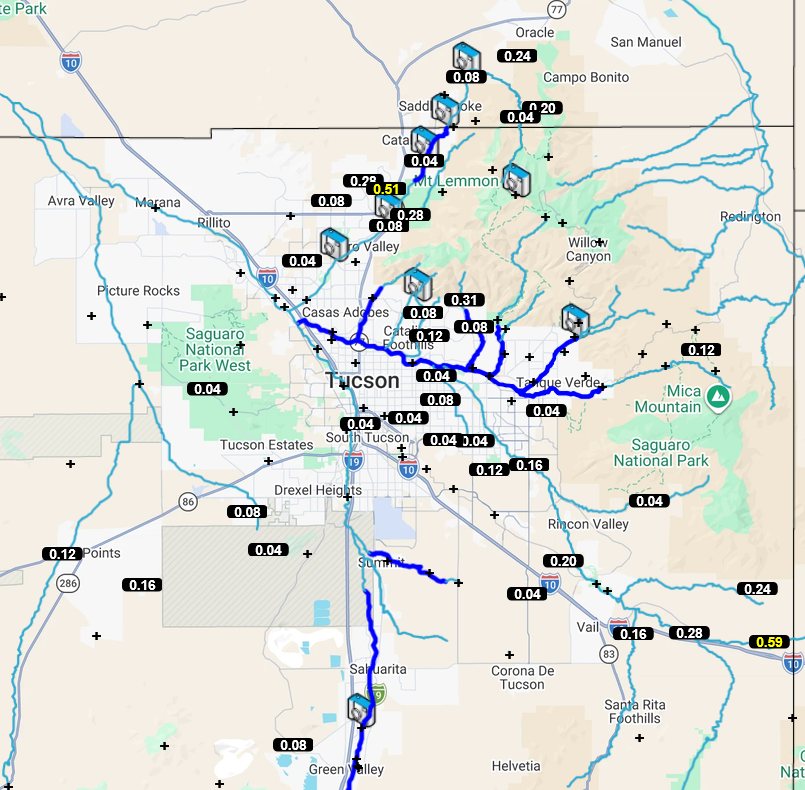
The Tucson area missed out on any significant heavy precipitation.
The location of the strongest storm points to the reason why the forecasts had trouble with the additional storm development: the Gulf Surge moisture. No weather balloon was launched in Yuma at 5 am, but the Yuma Doppler Radar Velocity Azimuth Display Wind Profile did show the surge yesterday morning.
Analysis
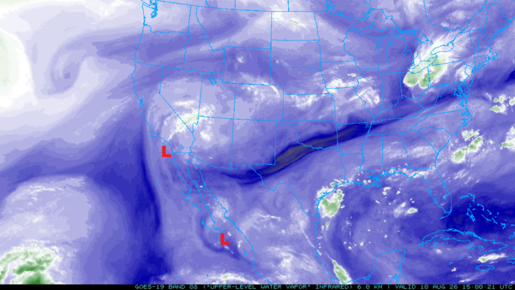
The Tropical Upper Tropospheric Trough (TUTT) over the Gulf of California may have aided the storms in Arizona, although it appears to be weakening as it moves slowly north now off the coast of San Diego. Another TUTT is moving northwest from the southern tip of the Baja Peninsula.
The visible satellite image from 8:20 am shows clouds from last night’s storm in northwest Arizona. Otherwise, mostly clear skies are over the rest of the region.
There is not much change from yesterday, with dry air in New Mexico and moisture in the southern half of Arizona. The NWS has a flash flood watch for Pima, Santa Cruz, and southeast Pinal counties.
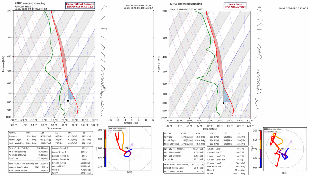
The 12Z HRRR-UA WRF forecast initialization (left) and the observed sounding from Phoenix at 5 am (right) are similar today. Both have boundary layer cooling from last night’s storms, though the heating needed to overcome this cool air is possible given today’s surface temperature forecasts.
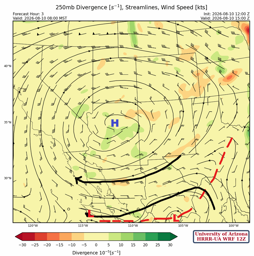
At 250mb, the TUTT near southern California isn’t visible on this analysis. Although there are two lows in Mexico annotated, only the TUTT over the Baja Peninsula is shown on the upper-level water vapor image shown earlier. The low over Chihuahua is a messy feature in the trough axis, not in the observational analysis. The TUTT over Baja is also located further south than what appears on the forecast initialization below.
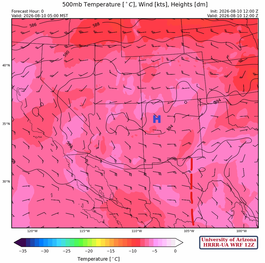
At 500mb, the monsoon high-pressure has moved a little to the south and is more elongated across northern Arizona and New Mexico. Temperatures aloft remain around –6°C, which is cool enough to support thunderstorms in Arizona again.
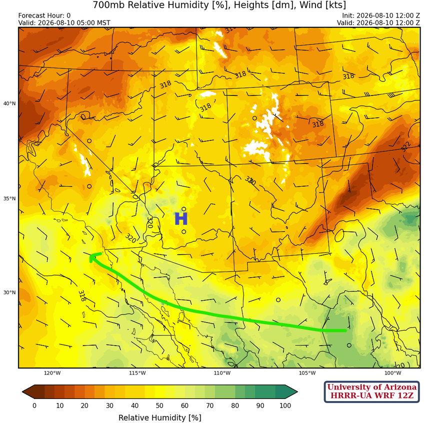
At 700 mb, the monsoon high has moved a little further north than yesterday, but the general circulation remains the same.
Today
The forecast sounding for Phoenix (left) has thunderstorm development around 7 pm this evening, while the Tucson sounding (right) shows thunderstorm development at 3 pm.
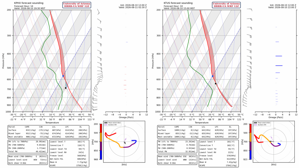
Thunderstorms will form this afternoon in eastern Pima and Santa Cruz counties and move west into central Pima County in the evening hours. Additional thunderstorms will be dropping southwest from Graham and northwest Cochise counties into Tucson around 8 pm this evening. These storms will then move northwest to the Casa Grande area by 10 pm and weaken as they move into Phoenix after midnight.
Tomorrow
Another round of thunderstorms is forecast tomorrow night in eastern Pima, eastern Pinal, Santa Cruz, and western Graham counties. The storms will move west and weaken as the Convective Available Potential Energy (CAPE) in the low desert will have been drained from the previous two days of storms.
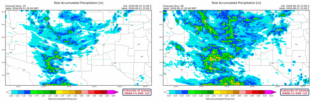
The 24-hour accumulated precipitation forecast (left) shows storms around the Tucson area, but mostly in the mountains to the west of Tucson in central Pima County, though a slight misplacement in the forecast could see the metro area getting rainfall after sunset from the additional development of storms coming from the northeast. The 48 hour accumulation forecast (right), adds rain to the mountains to the east of Tucson and the metro area. We’ll need to check tomorrow’s forecast for consistency to understand how much the metro area is likely to get.
Outlook
A trough associated with the polar jet stream will be moving into California Wednesday. This will change the wind flow in Arizona from the easterlies in place now to south- and southwesterlies. The forecast for Wednesday evening (left) and early Thursday morning (right). The storms in northern Arizona are due to the trough moving in from the West Coast, as are the overnight storms in southeast Arizona.
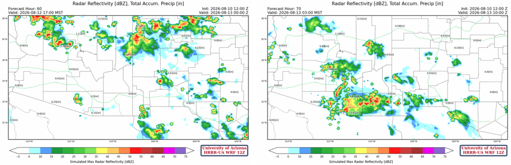
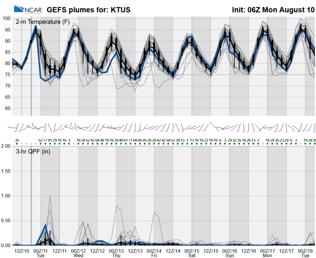
The west coast trough will cut off monsoon moisture by the end of the week. Longer-range global model forecasts indicate the monsoon ridge will return around August 20th or later.
Discussion written by Pat Holbrook and Patrick Bunn