
Summary
Moisture is gradually moving east across Arizona, leading to drier conditions as westerly winds bring in dry air from the west. While some showers are happening in Northern Arizona, most rain evaporates before reaching the ground except in mountainous areas, where slightly more precipitation is possible.
UA WRF model forecast and observed soundings indicate that moisture is decreasing, especially at lower levels, and the potential for storms is limited mainly to higher terrain today. By tomorrow, storm chances drop further as the moisture shifts east, with only isolated storms expected in New Mexico. Strong winds, low humidity, and dry conditions are increasing fire weather risks across Arizona into the weekend. Looking ahead, forecasts show little rainfall is likely through early July, with only eastern Arizona possibly seeing some monsoon accumulations, according to the ECMWF model.
Yesterday’s Weather
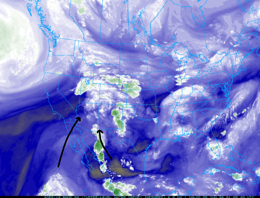
Moisture continues to move into Arizona along two axes, shown below. The one depicted further west is pulling moisture from the tropical eastern Pacific northward into western Arizona, Nevada, and Utah. Storms dropped up to a half inch of rain in Northern Arizona at the Grand Canyon, westward to Las Vegas. The second moisture axis extends from the Sierra Madre mountains in Mexico northward into southeast Arizona.
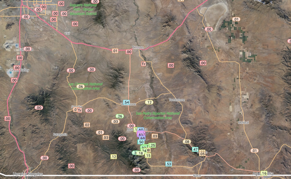
The thunderstorms associated with moisture flow from the Sierra Madre produced some locally heavy rain near Sierra Vista, as shown on the Rainlog plot below.
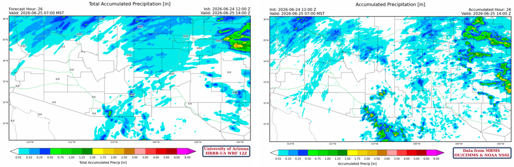
An isolated thunderstorm developed near Gila Bend and produced light rain and lightning into the northwest Phoenix metro area. The HRRR-UA WRF 12Z forecast (below, left) missed this small feature and also some activity on the Cochise/Graham county line, and the easternmost part of New Mexico.
Analysis
Moisture is slowly moving eastward and out of the state as westerlies aloft are bringing in dry air from far western Arizona. Visible satellite and radar show the moisture axis from Yuma northeast to Flagstaff and east to northern New Mexico. The Phoenix sounding (shown later) has the base of these showers above 12k. Therefore, away from the mountains, the rain from these showers must fall through a dry atmosphere, meaning only a few hundredths reach the ground. In the mountains, there’s less distance for drops to fall, so they could receive between one and two tenths.
Compared to yesterday, the 50°F surface dew point line has shifted farther east in Arizona, and moisture has also decreased in New Mexico.

Although the observed weather balloon sounding from Phoenix at 5 am (below, right) shows more moisture than yesterday, mixing with the dry air below 550 mb will reduce the precipitable water. The HRRR-UA WRF 12Z forecast initialization is good in terms of the wind and moisture profile, a little too much precipitable water, 2mm over the observed 36mm.

At 250mb, the Pacific Northwest trough will drop southeast over the next few days, and the mostly zonal (west to east) flow will become southwest to northeast by the weekend. The center of the monsoon ridge is in about the same position as yesterday, but it will get pushed eastward as the trough approaches. The trough will remain over the western region of the country, though next weekend.

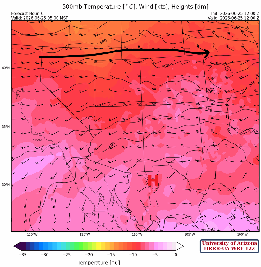
At 500mb, the Polar jet stream has dropped into the Pacific Northwest and is pushing the monsoon ridge southward into Mexico.
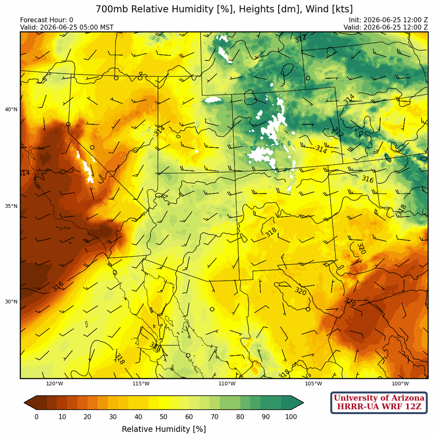
At 700 mb, the moisture flowing into Arizona is primarily from the southwest and is associated with the axes shown earlier, leading to clouds and showers in Arizona.
Today
The Phoenix sounding (below left) and the Tucson sounding (below right) show potential for storms, but anything that forms will have a dry atmosphere below to make it difficult for rain to reach the ground. The Tucson sounding doesn’t show any potential for storms, but they will not be too far away to the southeast in Cochise County.

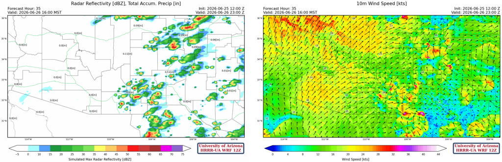
The12Z HRRR-UA WRF forecast simulated radar reflectivity and winds for this afternoon are shown below. Storms today will form in the eastern third of the state, extend into New Mexico, and propagate eastward. Some stronger winds are associated with the storms in New Mexico.
Tomorrow
Neither the Phoenix nor the Tucson forecast soundings show any potential for storms as the moisture axis shifts eastward.

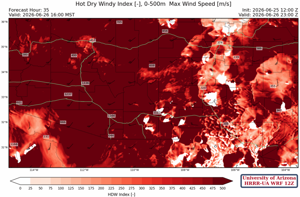
Precipitation is almost out of Arizona by tomorrow, and only a few microbursts are expected in New Mexico. Surface winds increase ahead of the Pacific trough across Arizona, with gusts over 40 mph in northern Arizona. Add in the low relative humidity, and fire weather warnings have been issued for most of Arizona into the weekend.
The forecast for the Hot-Dry-Windy index, a fire weather prediction index, is off the scale.
Outlook
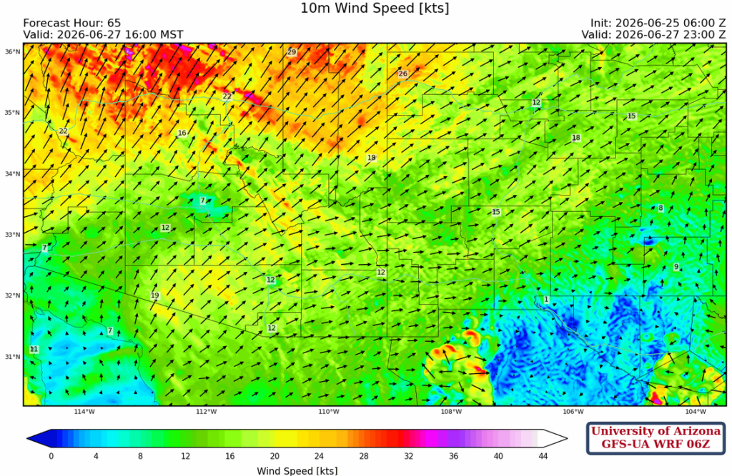
The strong winds continue on Saturday with wind gusts probably exceeding 60 mph in northwest Arizona.
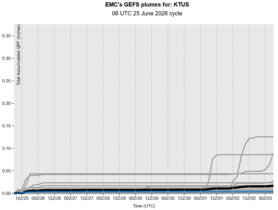
We are going to be dry until July, according to the long-range GEFS ensemble forecast below.
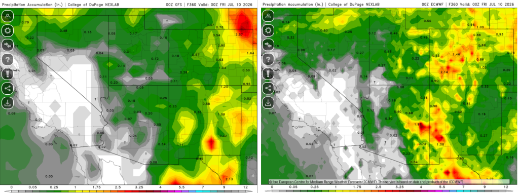
The total accumulated precipitation from the GFS (left) and ECMWF (right) through July 10th is shown below. Only the EMCWF shows a decent monsoon rainfall, and only in eastern Arizona.
Discussion written by Pat Holbrook and Patrick Bunn